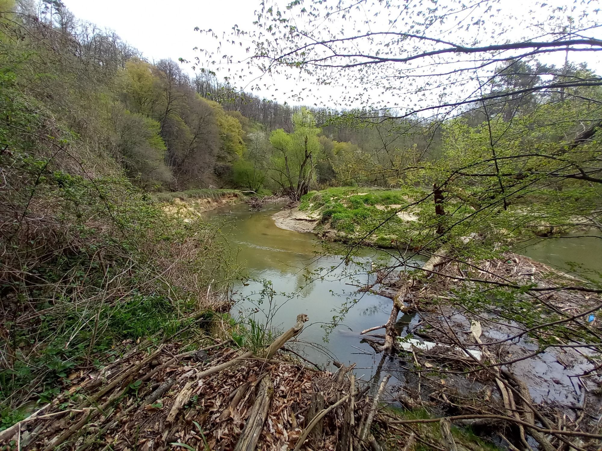
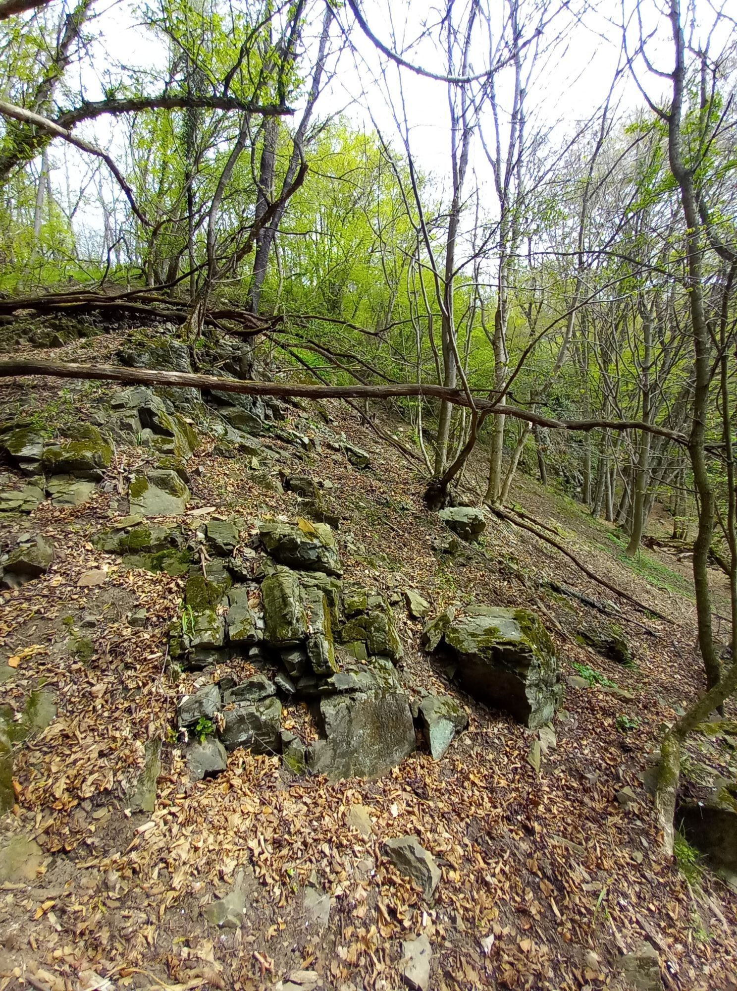
Szombathely - Szent György-templom - Szent Miklós-templom - Szentháromság templom
mittel
Hol diese Tour auf dein Handy
Szombathely - Szent György-templom - Szent Miklós-templom - Szentháromság templom
mittel
Wanderung
43,40
km
QR-Code scannen und Navigation in der bergfex App beginnen

Wandern & Tracking


Szombathely - Szent György-templom - Szent Miklós-templom - Szentháromság templom
mittel
Distanz
43,40
km
Dauer
11:03
h
Aufstieg
368
hm
Seehöhe
219 -
371
m
Track-Download
Szombathely - Szent György-templom - Szent Miklós-templom - Szentháromság templom
mittel
Wanderung
43,40
km
Wegverlauf
Szentháromság templom
(225 m)
Andachtsstätte
0,0 km
Groß Mucken
(240 m)
Dorf
7,4 km
Szent György-templom
(260 m)
Andachtsstätte
8,3 km
Kőkereszt kápolnában
(280 m)
Andachtsstätte
14,8 km
Szent Miklós-templom
(258 m)
Andachtsstätte
15,7 km
Großdorf
(235 m)
Dorf
25,2 km
Szentháromság templom
(225 m)
Andachtsstätte
43,4 km
Wegverlauf
Szombathely - Szent György-templom - Szent Miklós-templom - Szentháromság templom
mittel
Wanderung
43,40
km
Szentháromság templom
(225 m)
Andachtsstätte
0,0 km
Steinamanger
(216 m)
Stadt
0,0 km
Dienling
(245 m)
Dorf
4,2 km
Krisztina-kilátó
(302 m)
Aussichtspunkt
6,9 km
Groß Mucken
(240 m)
Dorf
7,4 km
Muzsla-forrás
(240 m)
Quelle
8,1 km
Szent György-templom
(260 m)
Andachtsstätte
8,3 km
Kőkereszt kápolnában
(280 m)
Andachtsstätte
14,8 km
Oberschilding
(260 m)
Dorf
15,5 km
Szent Miklós-templom
(258 m)
Andachtsstätte
15,7 km
Judit Buschenschank borozó
(251 m)
Restaurant
23,7 km
Großdorf
(235 m)
Dorf
25,2 km
Kelemenmajor
(250 m)
Siedlung
38,3 km
Steinamanger
(216 m)
Stadt
43,3 km
Szentháromság templom
(225 m)
Andachtsstätte
43,4 km
Noch keine Bewertungen
Beliebte Touren in der Nähe
- 3,9
S 23 Drei Weinberge-Rundweg
leichtWanderung 14,1 km - 4,4
Gipfelwandertour
schwerWanderung 20,6 km - 4,4
Eisenberg, Csaterberg, Georgssee
schwerWanderung 13,2 km - 3,2
Rundweg (3) Pinkadurchbruch - Wandern in der Weinidylle
mittelWanderung 11,2 km - 5,0
Wandern in der Weinidylle: Rundweg (2) Eisenberg
leichtWanderung 4,34 km - 3,2
Günser Gebirge: Rechnitz - Geschriebenstein
leichtWanderung 7,71 km - 3,5
Rundweg (9) Kohfidisch - Csaterberg - Wandern in der Weinidylle
leichtWanderung 6,61 km - 4,0
See, Vogelparadies & Ödes Schloss Rechnitz
leichtWanderung 7,09 km - 5,0
Weingebirgstour
leichtWanderung 7,78 km - 4,3
Georgssee & Csaterberg
mittelWanderung 12,2 km

Wandern & Tracking

Über 550.000 Tourenvorschläge, detailliertes Kartenmaterial und ein intuitiver Routenplaner machen die App zum Must-have für alle Naturbegeisterten.

Verpasse keine Angebote und Inspirationen für deinen nächsten Urlaub
Zum Newsletter anmelden
Fehler
Ein Fehler ist aufgetreten. Bitte versuche es erneut.Vielen Dank für deine Anmeldung
Deine E-Mail-Adresse wurde in den Verteiler eingetragen.
Touren in ganz Europa
Österreich Schweiz Deutschland Italien Slowenien Frankreich Niederlande Belgien Polen Liechtenstein Tschechien Slowakei Spanien Kroatien Bosnien und Herzegowina Luxemburg Andorra Portugal Island Vereinigtes Königreich Irland Griechenland Albanien Nordmazedonien Malta Norwegen Montenegro Moldau Kosovo Ungarn San Marino Rumänien Estland Lettland Belarus Zypern Litauen Serbien Bulgarien Monaco Dänemark Schweden Finnland