Le roc du Montalet
schwer
Navigieren
Navigieren
Hol diese Tour auf dein Handy
Le roc du Montalet
schwer
Wanderung
18,03
km
QR-Code scannen und Navigation in der bergfex App beginnen

Wandern & Tracking


Le roc du Montalet
schwer
Distanz
18,03
km
Dauer
05:30
h
Aufstieg
516
hm
Seehöhe
794 -
1.243
m
Track-Download
Le roc du Montalet
schwer
Wanderung
18,03
km
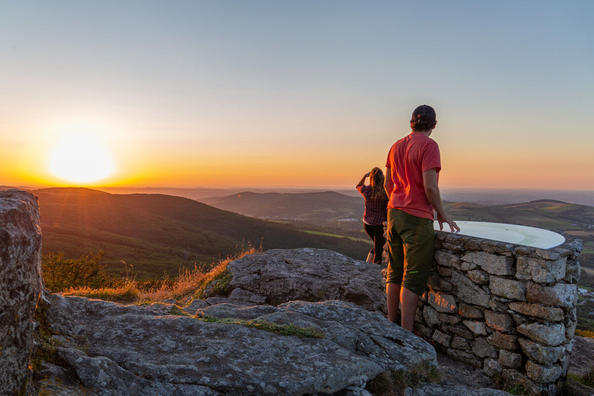
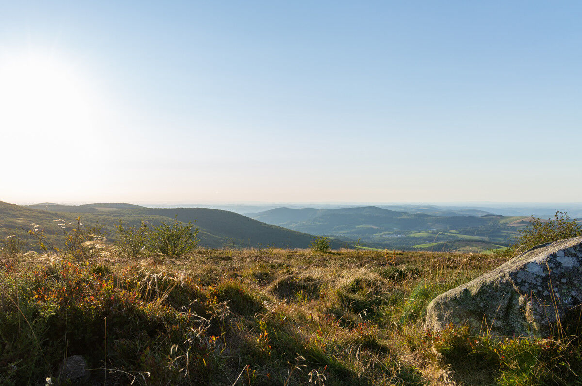
Inspiration at the summit...
A rocky peak, the Roc du Montalet (1,259 m) has always been a place for religious manifestations. First, there were the cults dedicated to divinities and natural phenomena,...
Beschreibung
Inspiration at the summit...
A rocky peak, the Roc du Montalet (1,259 m) has always been a place for religious manifestations. First, there were the cults dedicated to divinities and natural phenomena, the memory of which has been lost. Then, there were the pilgrimages of the Catholic church. In the 18th century, the local people, lacking opportunities for mountain entertainment, confused the first with the second. So much so that after serious abuses, around 1770, the bishop of Castres forbade all processions to Montalet! A new bishop re-established the pilgrimage in 1776, on the condition of not being on the paths after sunset, of separating men from women, and of erecting a cross at the summit. A statue of the Virgin has replaced it since 1882.
A rocky peak, the Roc du Montalet (1,259 m) has always been a place for religious manifestations. First, there were the cults dedicated to divinities and natural phenomena, the memory of which has been lost. Then, there were the pilgrimages of the Catholic church. In the 18th century, the local people, lacking opportunities for mountain entertainment, confused the first with the second. So much so that after serious abuses, around 1770, the bishop of Castres forbade all processions to Montalet! A new bishop re-established the pilgrimage in 1776, on the condition of not being on the paths after sunset, of separating men from women, and of erecting a cross at the summit. A statue of the Virgin has replaced it since 1882.
Wegverlauf
À la Maison
(805 m)
Restaurant
0,0 km
Lacaune
(798 m)
Dorf
0,1 km
Roc des Ecus
(1.074 m)
Gipfel
2,1 km
Pic de Montalet
(1.259 m)
Gipfel
8,6 km
Thioys
(874 m)
Siedlung
15,2 km
L'Élixir de Jouvence
(794 m)
Restaurant
17,7 km
Lacaune
(798 m)
Dorf
17,9 km
Wegverlauf
Le roc du Montalet
schwer
Wanderung
18,03
km
À la Maison
(805 m)
Restaurant
0,0 km
Lacaune
(798 m)
Dorf
0,1 km
Roc des Ecus
(1.074 m)
Gipfel
2,1 km
Plo des Parcs
(1.154 m)
Flur/Gelände
4,4 km
Pic de Montalet
(1.259 m)
Gipfel
8,6 km
Les Vidals
(919 m)
Siedlung
12,3 km
Thioys
(874 m)
Siedlung
15,2 km
L'Élixir de Jouvence
(794 m)
Restaurant
17,7 km
Lacaune
(798 m)
Dorf
17,9 km
À la Maison
(805 m)
Restaurant
18,0 km
Autor
Bereitgestellt von Tarn Tourisme
Die Tour Le roc du Montalet wird von outdooractive.com bereitgestellt.

Weginformationen
Wegverlauf
Point 1 : Derrière la statue de la Vierge, monter rue de la Murette ; 80 m après, tourner à gauche. À la patte d’oie, quitter le goudron par la droite. Continuer tout droit.
Point 2 : Prendre le petit sentier bordé de houx, à gauche. Traverser la route par un rapide gauche-droite. Gravir le sentier. Au croisement avec un chemin, poursuivre tout droit. Devant une propriété privée, le sentier bifurque et grimpe à droite.
Point 3 : Au roc des Écus, tourner sur la crête à gauche. Avancer tout droit. Descendre sur une large piste. S’y engager à main gauche. À la première patte d’oie en début de forêt, aller à gauche (séparation avec les GR® de Pays des Monts et Lacs en Haut-Languedoc et GR® de Pays des Hautes Terres d’Oc).
Point 4 : À la deuxième patte d’oie, bifurquer à gauche. Au carrefour, continuer tout droit.
Point 5 : Sur la route, tourner à gauche. À la patte d’oie, 200 m après, traverser le goudron pour grimper tout droit vers le sommet du Montalet.
Point 6 : Descendre un sentier étroit et abrupt, entre les hêtres tordus. Avancer tout droit sur la lande plate.
Point 7 : Devant la route, virer en épingle à gauche (jonction avec le GR® de Pays des Monts et Lacs en Haut-Languedoc jusqu’à Lacaune) et descendre à droite.
Point 8 : À la route, tourner à droite vers les Vidals. Au stop, prendre à gauche ; 350 m plus loin, virer dans un chemin à droite. Longer Gandilhou par la droite. Descendre le chemin toujours à main droite. En bas, suivre la courbe à gauche, puis poursuivre tout droit. Sur la route, prendre à droite. Au croisement, tourner à gauche vers le Thioys. Traverser le hameau.
Point 9 : 20 m après la première patte d’oie, monter le chemin entre les houx à gauche. Sur la route, tourner à droite ; 50 m plus loin, encore à droite. Dans la descente, virer deux fois à gauche à l’angle du premier hangar de gauche. Poursuivre tout droit. Aux premières maisons de Lacaune, laisser le chemin de gauche. Au croisement, tourner à droite, puis aussitôt à gauche. Face au tunnel, bifurquer à droite. Descendre jusqu’à la statue de la Vierge.
Noch keine Bewertungen
Beliebte Touren in der Nähe
- 4,0
WANDERUNG DER LAUZE
mittelWanderung 9,41 km AUTO-ROUTE - MONTS DE LACAUNE
leichtMotorrad 154,6 kmAUTOFREIZEITROUTE - DIE SEENROUTE
leichtMotorrad 129,1 kmDer Entdeckungspfad von Payrac
leichtWanderung 1,79 kmLe Mont Barre
leichtWanderung 6,21 kmFahrradroute - C4 Rund um den See von Laouzas mit dem Fahrrad
leichtRennrad 19,8 kmDu Laouzas au Montalet
schwerWanderung 15,4 kmWANDERUNG AUF DEM PREVERT-PFAD
leichtWanderung 4,95 kmWANDERUNG DURCH DAS OBERE AGOUT-TAL
mittelWanderung 17,0 kmTOURENFAHRT MIT DEM AUTO - SOMAIL-ESPINOUSE
leichtMotorrad 111,3 km
Wandern & Tracking

Über 550.000 Tourenvorschläge, detailliertes Kartenmaterial und ein intuitiver Routenplaner machen die App zum Must-have für alle Naturbegeisterten.

Verpasse keine Angebote und Inspirationen für deinen nächsten Urlaub
Zum Newsletter anmelden
Fehler
Ein Fehler ist aufgetreten. Bitte versuche es erneut.Vielen Dank für deine Anmeldung
Deine E-Mail-Adresse wurde in den Verteiler eingetragen.
Touren in ganz Europa
Österreich Schweiz Deutschland Italien Slowenien Frankreich Niederlande Belgien Polen Liechtenstein Tschechien Slowakei Spanien Kroatien Bosnien und Herzegowina Luxemburg Andorra Portugal Island Vereinigtes Königreich Irland Griechenland Albanien Nordmazedonien Malta Norwegen Montenegro Moldau Kosovo Ungarn San Marino Rumänien Estland Lettland Belarus Zypern Litauen Serbien Bulgarien Monaco Dänemark Schweden Finnland