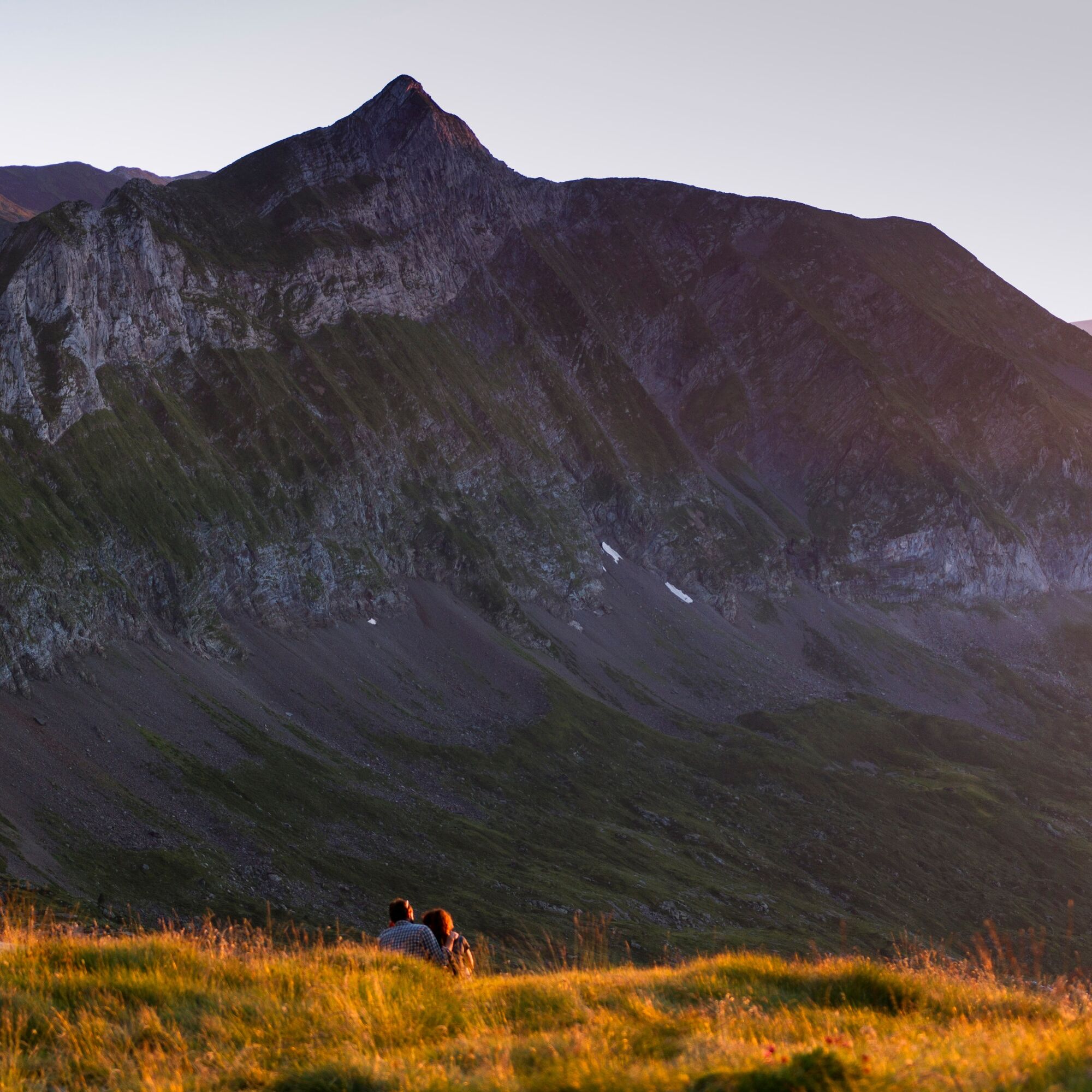
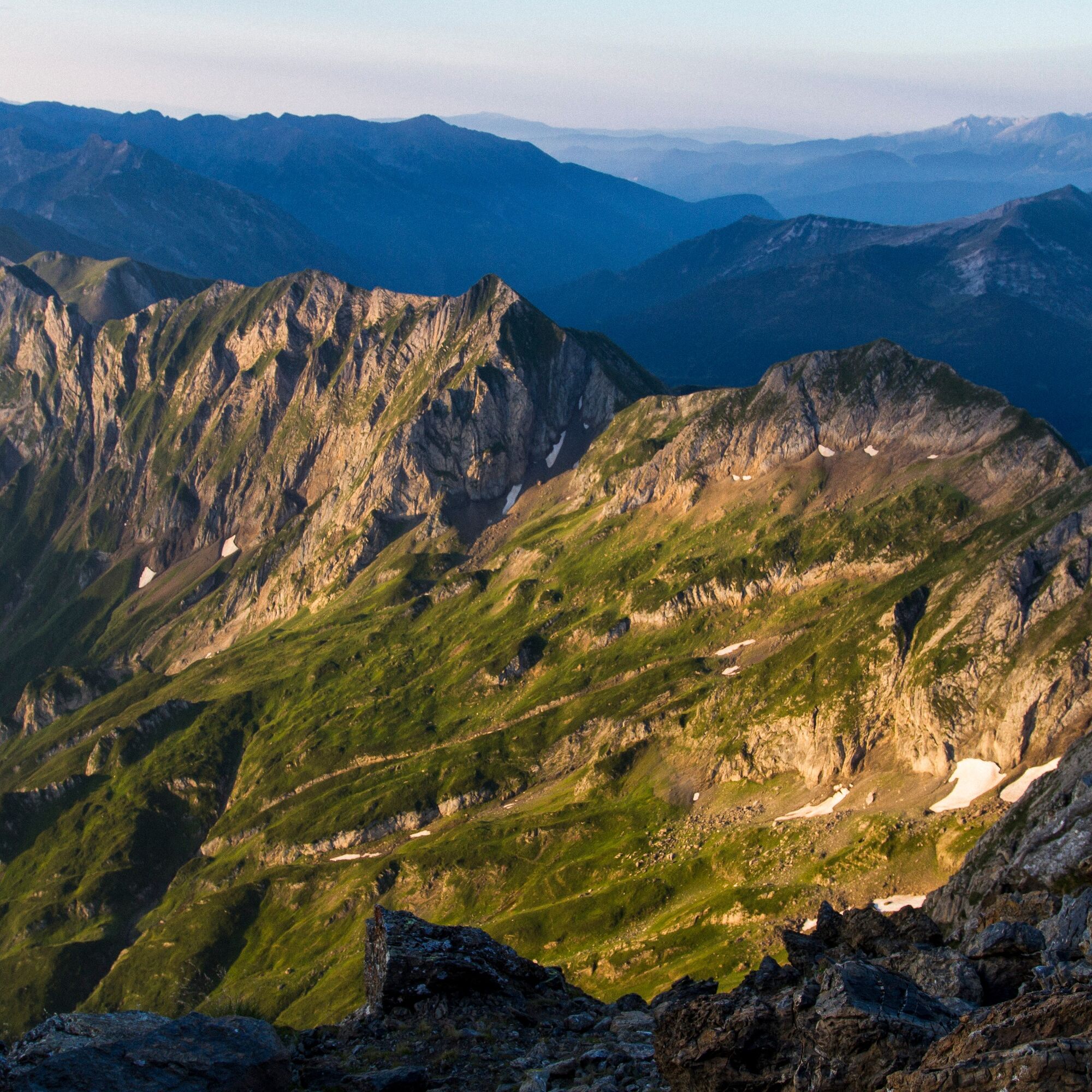
Mont Valier par l'étang de Milouga
schwer
Navigieren
Navigieren
Hol diese Tour auf dein Handy
Mont Valier par l'étang de Milouga
schwer
Wanderung
21,21
km
QR-Code scannen und Navigation in der bergfex App beginnen

Wandern & Tracking


Mont Valier par l'étang de Milouga
schwer
Distanz
21,21
km
Dauer
11:30
h
Aufstieg
2.040
hm
Seehöhe
940 -
2.811
m
Track-Download
Mont Valier par l'étang de Milouga
schwer
Wanderung
21,21
km
Wegverlauf
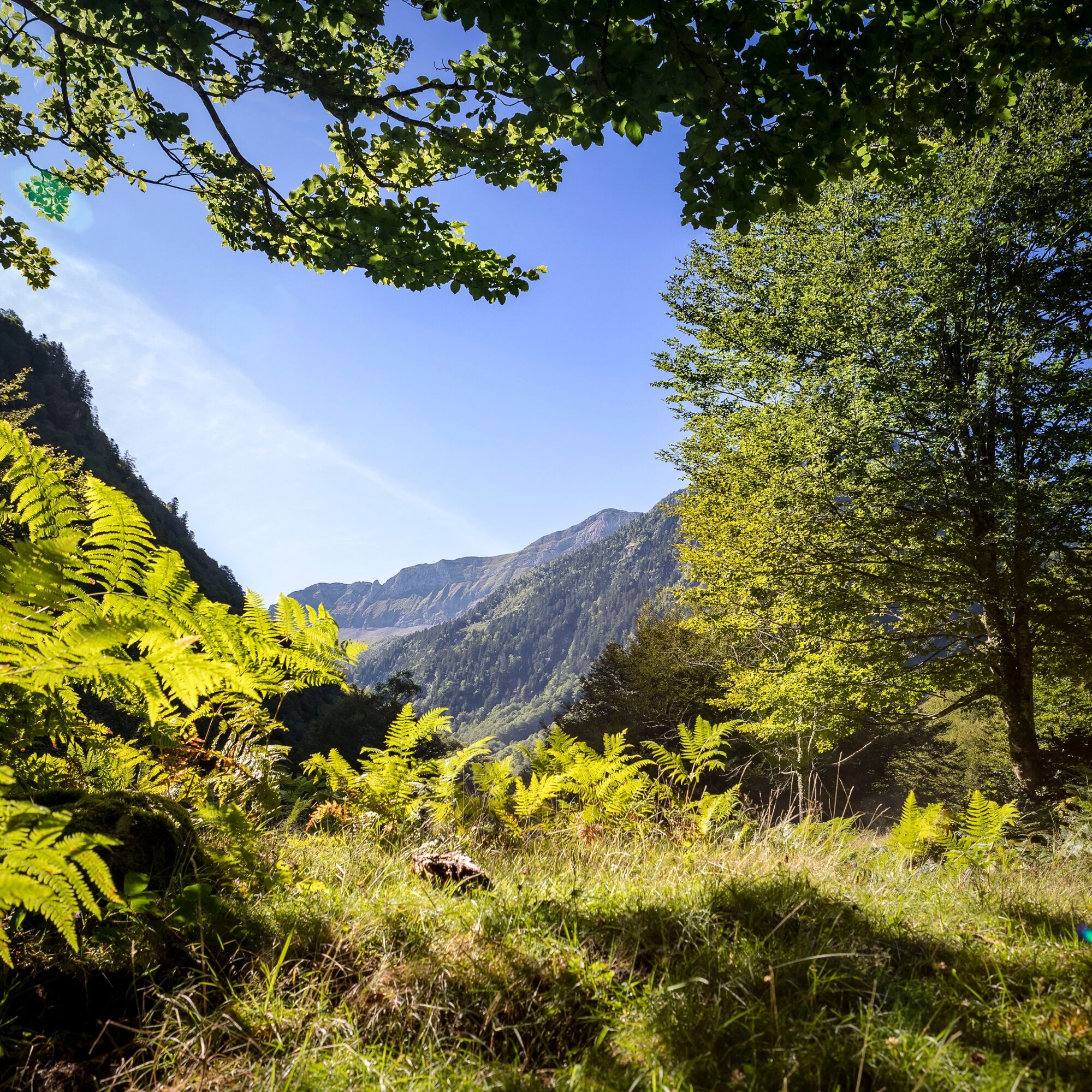
Réserve domaniale du Mont Vallier
(942 m)
Aussichtspunkt
0,0 km
La Maison du Valier
(943 m)
Restaurant
0,2 km
Cascade de Nérech
(1.410 m)
Wasserfall
3,6 km
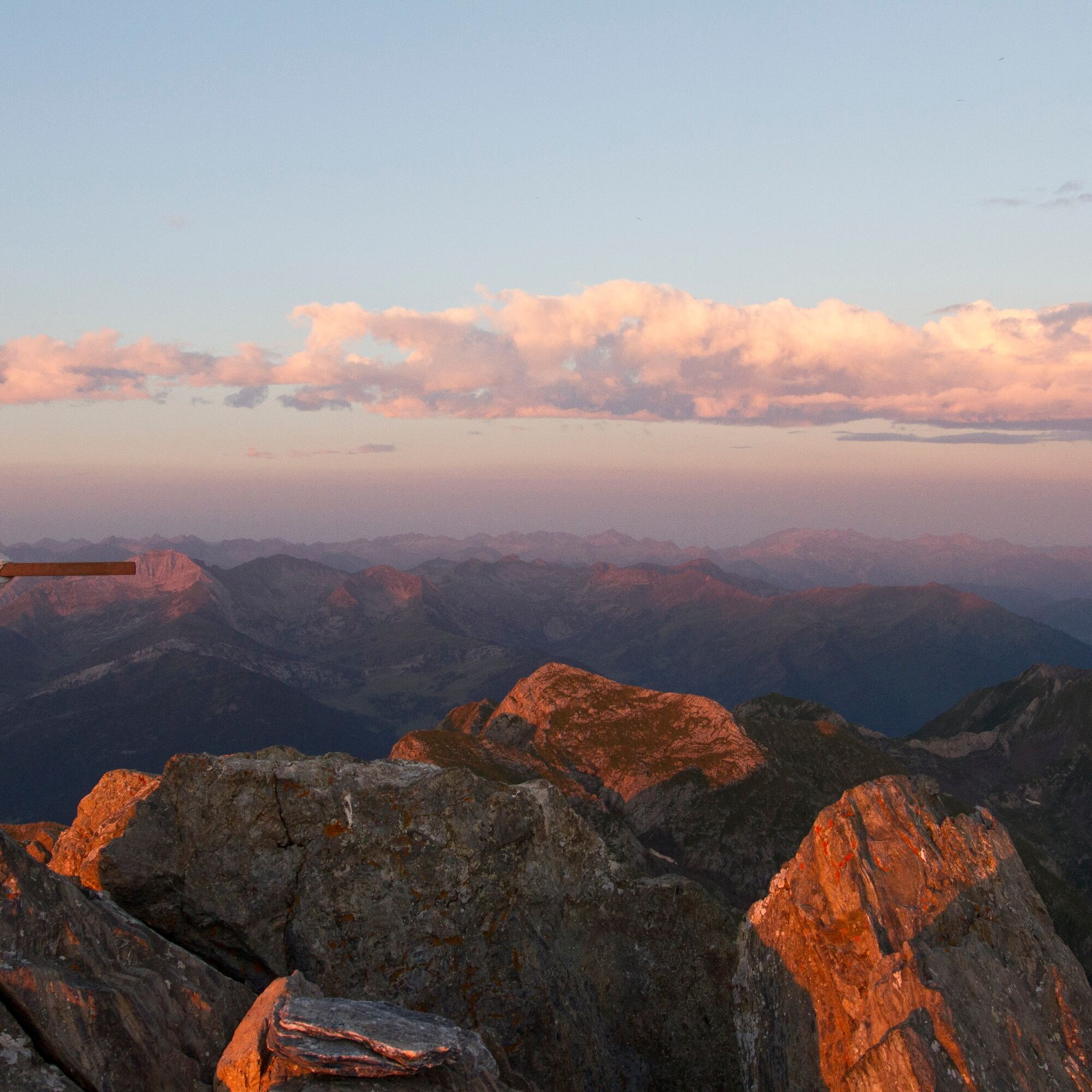
Refuge «Les Estagnous»
(2.248 m)
Schutzhütte
7,0 km
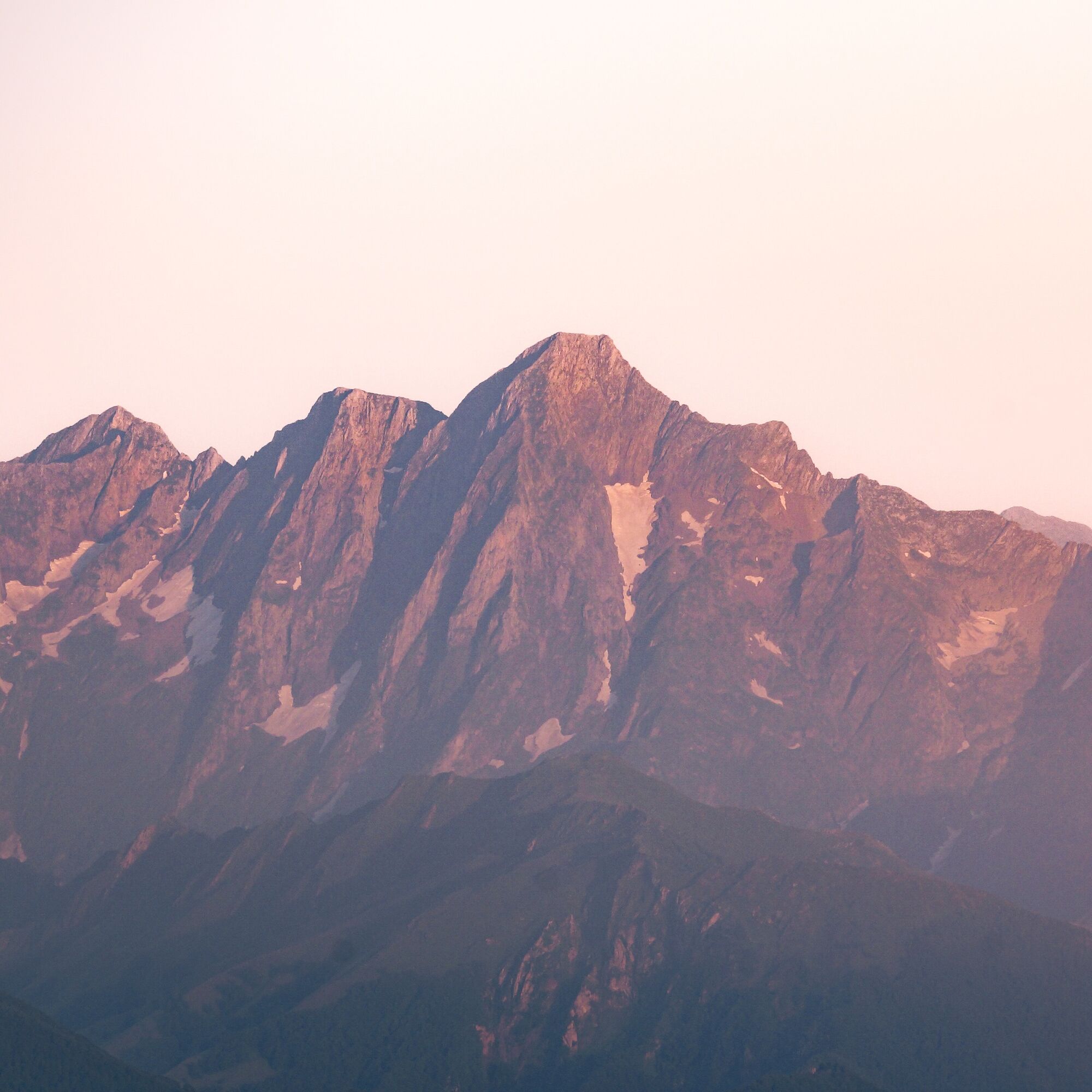
Mont Valier
(2.838 m)
Gipfel
8,9 km
Cabane du Taus
(1.893 m)
Schutzhütte (unbewirtschaftet)
14,9 km
Fontaine d'Aouen
(1.691 m)
Quelle
16,6 km
Wegverlauf
Mont Valier par l'étang de Milouga
schwer
Wanderung
21,21
km
Réserve domaniale du Mont Vallier
(942 m)
Aussichtspunkt
0,0 km
La Maison du Valier
(943 m)
Restaurant
0,2 km
Cascade de Nérech
(1.410 m)
Wasserfall
3,6 km
Cascade de la Lauze
(1.593 m)
Wasserfall
4,5 km
Cabane de Caussis
(1.836 m)
Schutzhütte (unbewirtschaftet)
5,5 km
Refuge «Les Estagnous»
(2.248 m)
Schutzhütte
7,0 km
Mont Valier
(2.838 m)
Gipfel
8,9 km
Refuge «Les Estagnous»
(2.248 m)
Schutzhütte
10,7 km
Cabane du Taus
(1.893 m)
Schutzhütte (unbewirtschaftet)
14,9 km
Fontaine d'Aouen
(1.691 m)
Quelle
16,6 km
La Maison du Valier
(943 m)
Restaurant
20,9 km
Autor
Bereitgestellt von Ariège Pyrénées Tourisme
Die Tour Mont Valier par l'étang de Milouga wird von outdooractive.com bereitgestellt.


Weginformationen
Wegverlauf
1/Departure from the Pla de la Lau car park 0h - 935 m Follow the GR10 down to the stream and to the right (signposted), leaving it quickly (do not cross the footbridge) to go straight ahead on the Port de la Girelle GRT (cross-border), signposted in red and white. A little further on, leave the Barlonguère route on the right and cross two footbridges on the left. Go up the right bank of the stream along the well-marked path that continues through the forest and ends near a rock shelter (la tutte de l'ours). The path splits and a footbridge allows you to follow the route on the other bank to reach the
2/Cascade de Nérech 1h40 - 1350 m Cross the footbridge and climb the switchbacks carved into the rock. Further on you come out into the meadow and continue as far as
3/La cabane de Caussis 3h - 1859 m At the fork in the path, take the path up on the left, still signposted in red and white (the path on the right takes 30 minutes to the Etang Rond). The climb is less steep and it won't be long before you reach the
4/Refuge des Estagnous 4h - 2246 m Leave the red and white markings and follow the well-marked yellow path (heading east-south-east). It quickly rises to a rocky spur that can be bypassed on the right. The climb is steep (snow-covered at the start of the season) towards the Col de Faustin. The route then becomes easy, deviates slightly from the ridge and quickly leads to the
5/Summit of Mont-Valier 5h30 - 2838 m The return journey takes the same route in the opposite direction to the refuge, behind which the yellow signposted trail climbs to the Col de Pécouch (2462 m) and descends through the Lauzés (a large granite plain that is best crossed without fog) to arrive at
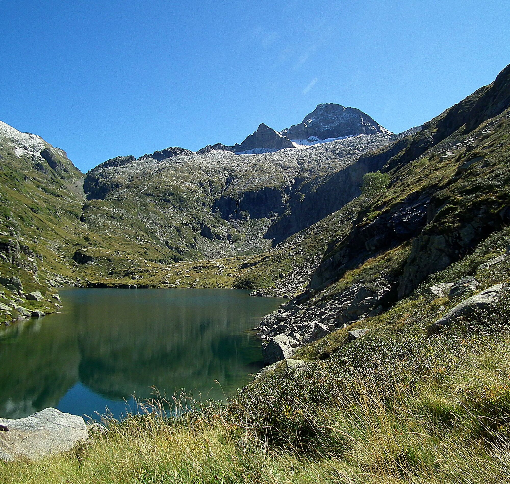
6/Milouga pond (1959 m). An almost flat crossing (always marked in yellow) takes you back to the
7/Taus hut (1890 m). From here a gentle climb joins the GR10 (red and white), which takes you to the Aouen hut and then a long descent to the Pla la Lau car park.
8/Parking du Pla de la Lau 11h30 935 m
2/Cascade de Nérech 1h40 - 1350 m Cross the footbridge and climb the switchbacks carved into the rock. Further on you come out into the meadow and continue as far as
3/La cabane de Caussis 3h - 1859 m At the fork in the path, take the path up on the left, still signposted in red and white (the path on the right takes 30 minutes to the Etang Rond). The climb is less steep and it won't be long before you reach the
4/Refuge des Estagnous 4h - 2246 m Leave the red and white markings and follow the well-marked yellow path (heading east-south-east). It quickly rises to a rocky spur that can be bypassed on the right. The climb is steep (snow-covered at the start of the season) towards the Col de Faustin. The route then becomes easy, deviates slightly from the ridge and quickly leads to the
5/Summit of Mont-Valier 5h30 - 2838 m The return journey takes the same route in the opposite direction to the refuge, behind which the yellow signposted trail climbs to the Col de Pécouch (2462 m) and descends through the Lauzés (a large granite plain that is best crossed without fog) to arrive at
6/Milouga pond (1959 m). An almost flat crossing (always marked in yellow) takes you back to the
7/Taus hut (1890 m). From here a gentle climb joins the GR10 (red and white), which takes you to the Aouen hut and then a long descent to the Pla la Lau car park.
8/Parking du Pla de la Lau 11h30 935 m
Zusatzinfos & Tipps
Zusatzinfos
Vous êtes au cœur du Parc Naturel des Pyrénées Ariégeoises.
Nous vous encourageons à adopter un comportement responsable dans ce milieu fragile et partagé.
- Rester sur les sentiers et emporter ses déchets.
- Observer la flore sans la cueillir.
- Rester discret, pour les animaux sauvages.
- Dans les zones d’estive, penser à refermer les clôtures et barrières. Ne pas approcher ni nourrir les animaux. Si un Patou (chien de protection des troupeaux) s’approche de vous, écartez-vous lentement et calmement. Pas de grands gestes ni de cris, même s’il aboie, car il vous considérerait comme une menace. S’il vous suit, ignorez-le.
-La baignade dans les lacs de la commune de Bethmale est interdite. Elle concerne les lacs de Bethmale, Ayes, Eychelle, Milouga, Arouech et Cruzous. (Arrêté AR-2024-004 le 05/12/2024)
- Le bivouac est autorisé, mais seulement entre 19h et 9h, et à plus d’une heure de marche d’un parking.
- En période de sécheresse tout feu est interdit. Dans les autres cas, les feux sont autorisés seulement à plus de 200m d’une forêt. Préférer les réchauds aux foyers naturels.
- En cas de rencontre, très peu probable, avec un ours (qui cherche à tout prix à nous éviter) : manifestez-vous calmement, éloignez-vous progressivement, et ne courrez pas.
Noch keine Bewertungen
Aktivitäten entlang der Tour

Beliebte Touren in der Nähe
Rundweg Mail des Morères
mittelWanderung 8,15 kmTour du Biros
schwerWanderung 50,4 kmGR10 Pyrenäenweg Etappe 30
leichtFernwanderweg 7,90 kmEstanys
mittelWanderung 8,40 kmMont Valier
schwerWanderung 17,6 kmPic du Crabère
schwerWanderung 23,4 kmRundweg um den Mail Blanc
leichtWanderung 10,8 kmRundtour um den Mont Valier
schwerWanderung 77,6 kmGR 10 Couserans Pyrénées - Castillon
schwerWanderung 37,2 kmTeich von Ayes
leichtWanderung 7,32 km

Wandern & Tracking

Über 550.000 Tourenvorschläge, detailliertes Kartenmaterial und ein intuitiver Routenplaner machen die App zum Must-have für alle Naturbegeisterten.

Verpasse keine Angebote und Inspirationen für deinen nächsten Urlaub
Zum Newsletter anmelden
Fehler
Ein Fehler ist aufgetreten. Bitte versuche es erneut.Vielen Dank für deine Anmeldung
Deine E-Mail-Adresse wurde in den Verteiler eingetragen.
Touren in ganz Europa
Österreich Schweiz Deutschland Italien Slowenien Frankreich Niederlande Belgien Polen Liechtenstein Tschechien Slowakei Spanien Kroatien Bosnien und Herzegowina Luxemburg Andorra Portugal Island Vereinigtes Königreich Irland Griechenland Albanien Nordmazedonien Malta Norwegen Montenegro Moldau Kosovo Ungarn San Marino Rumänien Estland Lettland Belarus Zypern Litauen Serbien Bulgarien Monaco Dänemark Schweden Finnland