





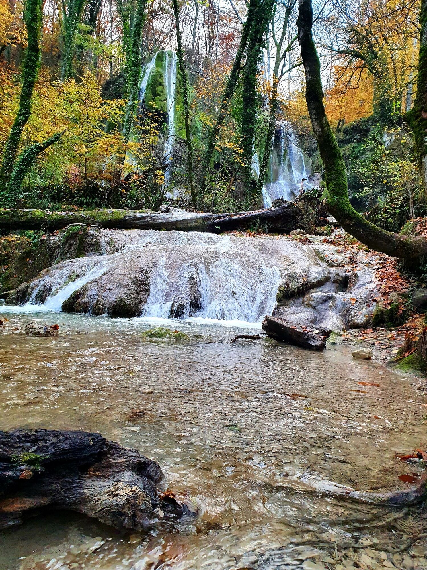
Wandern: Schaltung des Clairefontaine-Wasserfalls

Schwierigkeitsgrad: T1
Folgen Sie vom Ort Virieu-le-Grand der Straße nach Hauteville bis zum Weg von Clairefontaine. Sie können die Serpentinen, die sich bis zum Fuß des Wasserfalls schlängeln, schneiden. Die Strecke nimmt dann...
Folgen Sie vom Ort Virieu-le-Grand der Straße nach Hauteville bis zum Weg von Clairefontaine. Sie können die Serpentinen, die sich bis zum Fuß des Wasserfalls schlängeln, schneiden. Die Strecke nimmt dann die Chanille-Brücke, bevor sie sich in zwei mehr oder weniger direkte Rückwege aufteilt.






Start: follow the main street passing the statue of Honoré d'Urfé.
Ja
Ja
Good shoes are necessary.
The surroundings of the waterfall can be slippery and the access path is steep in places.
Defective signage, incidents / security, conflicts of use, illegal dumping? : locate and share the problem encountered on the national alert system from the SURICATE app or via the website https://sentinelles.sportsdenature.fr/
Access by car is via the D1504 then the D904 through Ambérieu-en-Bugey or Belley.
The Virieu-le-Grand Belley train station is located on the Lyon-Geneva railway line and is less than an hour from Lyon and Ambérieu-en-Bugey.
It is possible to park at Place d'Honoré d'Urfé.
T1
APIDAE Tourism data updated on 24/10/2022 by "Office de Tourisme Bugey Sud Grand Colombier".
An error on this sheet? Write to the owner mentioning these references:
Sheet name: Hiking: Clairefontaine waterfall circuit | Sheet ID: 5366559 | URL (link) of this Outdooractive page.
The Office of Tourism's good tips.
This pleasant hike allows you to discover the charming village of Virieu-le-Grand and will take you along the course of the Arène up to its two waterfalls.
The Clairefontaine waterfall, unlike its neighbours in Cerveyrieu and the Pain de sucre, flows continuously all year round.
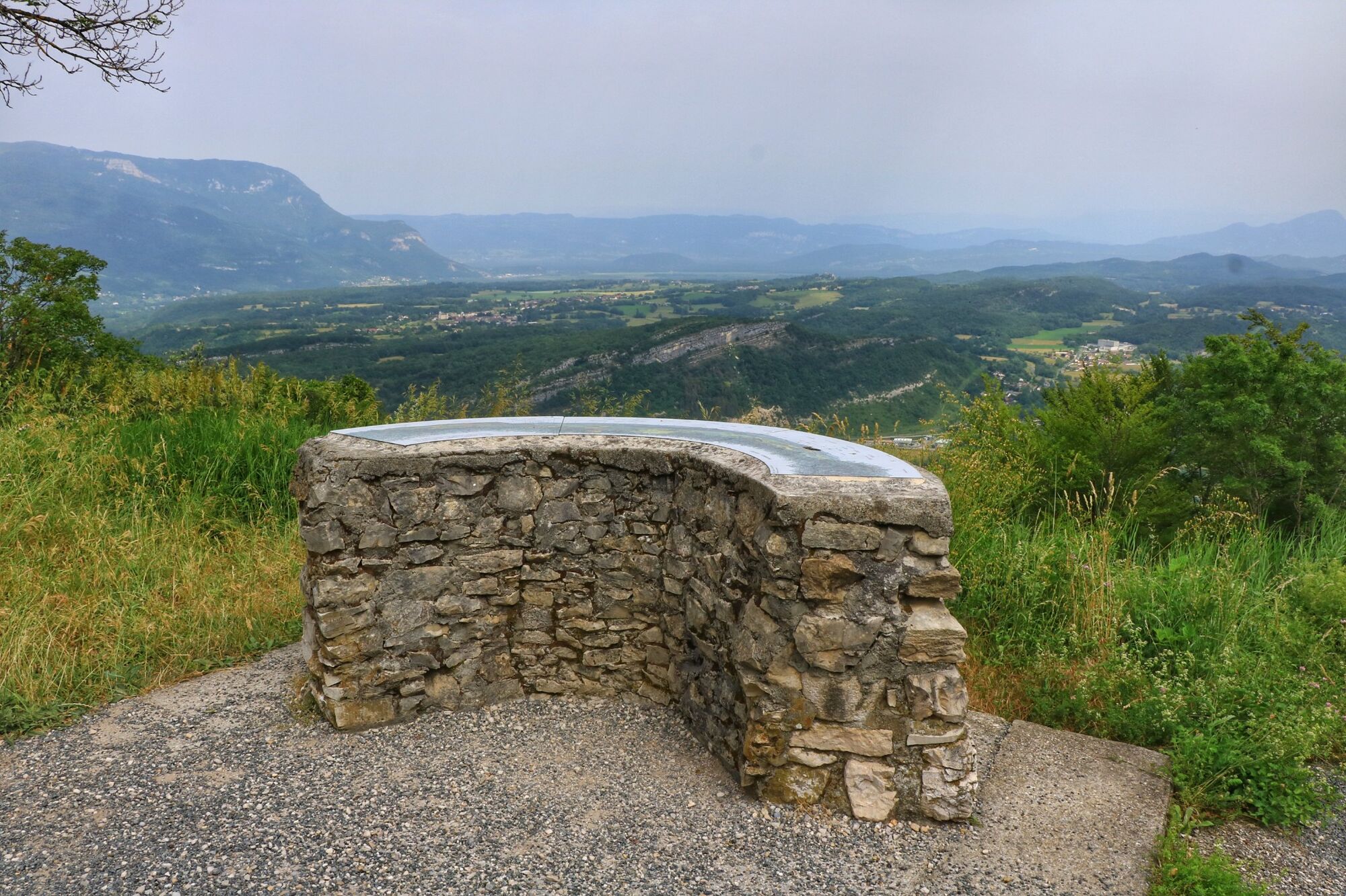
On clear days, the orientation table located a little higher offers a very beautiful view of the Alps.
It is possible to shorten the hike by parking in the bends of the D53 towards the Hauteville Plateau.
After the hike, enjoy the Virieu-le-Grand swimming lake located nearby.
You can dine in the centre of Virieu-le-Grand as well as at the lake during the summer period.
We recommend nearby Auberge de Contrevoz and the restaurants le Séran and les Caudalies in Artemare.
This itinerary is part of the "Ain Outdoor" selection.

Beliebte Touren in der Nähe
- 3,0
Wanderung: Kammstrecke Grand Colombier
mittelWanderung 11,3 km - 5,0
Wanderung: Lac de Barterand
leichtWanderung 7,23 km Fahrradrunde: Marais de Lavours und Weingüter des Bugey
leichtRennrad 33,1 kmFußwanderroute: Das Leben des Wolfes
leichtWanderung 7,22 kmWanderroute: Der Armaille-See
leichtWanderung 9,42 kmRandonnée pédestre : le circuit du Sorbier
leichtWanderung 11,4 kmWanderung: Schleife der Almen des Grand Colombier
mittelWanderung 5,23 kmRandonnée du Grand Colombier depuis Munet
schwerWanderung 16,0 kmWanderroute: See und Weinberge
leichtWanderung 9,76 kmWanderung: Der Grand Colombier von Culoz aus
schwerWanderung 26,1 km
Wandern & Tracking


Verpasse keine Angebote und Inspirationen für deinen nächsten Urlaub
Deine E-Mail-Adresse wurde in den Verteiler eingetragen.





