


GTC Stage 2: Basilica of Superga - Chivasso


Departing from the square in front of the Basilica, descend until you turn onto the road leading to the arrival station of the Sassi - Superga tramway (where it is possible to stop and enter the park's...
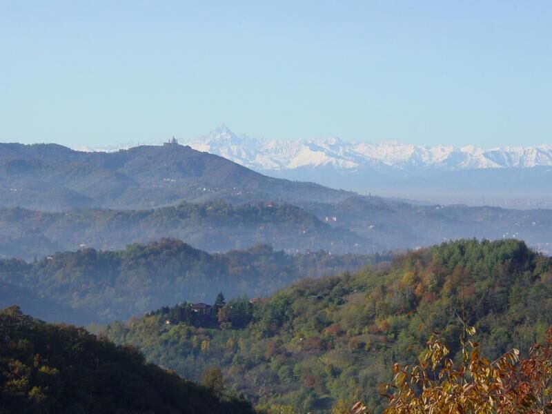
Departing from the square in front of the Basilica, descend until you turn onto the road leading to the arrival station of the Sassi - Superga tramway (where it is possible to stop and enter the park's visitor centre). Follow the asphalt stretch, keeping the tracks on the right, reaching the subway that allows you to cross the ballast; the path continues to the left for a few metres and turns sharply right, ending in an abandoned clearing. In the distance, you get a glimpse of a building, once the Provincial Institute for Children; near the entrance to the institute, descend a few steps and start walking along a path that is flat at first and then descends steeply. When you reach a junction, keep to the right at two small boulders then cross a stream on a small wooden bridge. Continuing on the flat and keeping to the right until you come to a clearing, which you cross by staying on flat ground across the hillside, you will come to an asphalt road (Strada Moncanino) near Villa Trinelli. Go downhill along the road and reach the hamlet of Tetti Coggiola, where, between the houses, turn left onto a dirt road; at the end of the road, take the path that leads to Via Montenero near a group of houses. Follow Via Montenero downhill for about a kilometre until you reach number 25, where you turn right onto a gravel road, skirting the wall of Villa Viale. The road continues downhill and leads to the bridge over Rio Dora and to Piazza di Rivodora. From Piazza di Rivodora, follow the provincial road towards S. Mauro for a few dozen metres and turn right uphill into Strada Tetti Spinello. After a few hairpin bends you will reach a complex of small villas (number 52), beyond which you have to turn left downhill to reach cascina Siccardi at number 57 of Strada S. Martino. Shortly before the hamlet of S. Martino, follow a cart track to the right that leads into the woods; this is the start of a stretch with no clear points of reference. Coming to three forks in succession, the first on the left, the second straight ahead, the third just after a small landslide, on the left you reach a small valley. Following the main track and crossing a brook, you skirt a long meadow on the right, at the end of which you come to a dirt road that leads to a farmstead on the right. Turning left, after a few hundred metres you reach the Castiglione-Crdova-Baldissero road near the ruins of a chapel hidden by vegetation. Turning left, you reach the village of Crdova after a few minutes, which you cross as far as the church. Turning your back to the church, cross the road; on the right, after the bocce facility (Bar Bagianni), follow a small asphalt road (Tetti Bianco) downhill, which ends with the access to a private house; take a grassy lane on the left shortly before it. A little further on you pass through the middle of a group of houses (Cascina Gobetto); going downhill you follow an asphalt road and, after leaving Tetti Bianco on the right, you come to a gravel stretch of the Val Peirone road which must be followed until the end, when it joins the Castiglione - Chieri provincial road. Continue to the right along the provincial road for a short stretch and at the first junction leave it to continue right towards Pavarolo (S.P. 224). Go up as far as the junction for Bardassano, where, turning left into Via Val Villata, you head towards the village. From the war memorial near the cemetery, follow the asphalt road downhill; after passing the connection with the shortcut road indicated above, you reach, and head left on a dirt road next to a beautifully restored house (number 4); the small road leads to a residential village (after a large ENEL cabin keep to the right). In the village you go along Viale Catullo until you reach the Castiglione - Chieri provincial road, where you have to cross it to continue on the Bardassano - Gassino dirt road. Ignore the diversions to Cascina Tonni on the left and continue practically on the flat; at a bend, turn right and go downhill towards an abandoned farmstead (Cascina Ortolanda). You come to a clearing and, keeping to the right, you come to a large meadow with a beautiful view (small lake below) and soon afterwards re-enter the wood. Continue, ignoring a fork to the right near a small villa, until you can see the back of a farmhouse (Polleri di Mezzo). Shortly afterwards you come to a fork where you turn left uphill; two hairpin bends take you to the long, narrow ridge of Colle della Battaina, where there is an ancient boundary stone. Continue right along the ridge downhill, ignoring a path that descends to the right. Towards the end of the ridge, you come to a path that crosses over the hill ridge (wire mesh in front). Continue left downhill; shortly after in the woods, do not continue straight ahead, but go right downhill and, at the next fork, right again where you come to the dirt road. Go past Cascina Canta, continue downhill again and, after crossing the Rio di Valle Maggiore stream, you will reach the Gassino - Cinzano provincial road, near Osteria dell'Antico Pedaggio and Ristorante Defilippi. Here you turn left and, ignoring the fork to the right for Bussolino, carry on to reach the imposing building of Villa Bria; turn right after the villa on the lane that runs along its left side; at the end of the building you continue for about fifty metres on the gravel road, then you leave it to take a path that branches off to the right going steeply uphill. At the top of the climb, turn right onto the road that soon leads to Bussolino. Descend from the parish church towards the junction at the chapel of San Sebastiano, where you turn left into Strada Sant'Antonio. At the end of the climb, the dirt track begins at house numbers 41 and 36. Follow the main road along the crest of the hill, passing the diversions to the right for Agriturismo "La Corte" and, almost a kilometre further on, Cascina Lunga (house numbers 52 and 54), where you return to a paved road; a little further on, ignore the diversion to the right and keep left uphill. This brings you to Regione San Dalmazzo with the homonymous chapel, after which, you go up once more on a paved road; you pass another diversion to the right (Cascina Lamborno) and when you reach the Rivalba - Castagneto road, turn left; go along the provincial road around Bric Martina and, after passing "Tre Termini", where there is a large illustrated panel of the Site of Community Interest, "I Bsc Grand" you come to the junction for Casalborgone at the foot of the chapel of S. Antonio Abate. Continue to the right downhill, coming across a large, abandoned farmstead on the right; at the main gate, leave the road downhill and turn left into Strada dei Soliti. Immediately on the right is a renovated farmstead with an awning: the Bosco del Vaj Nature Reserve begins here. Carrying on, you come to a crossroads, where, going around the ridge of the Bric del Vai on the left, you continue downhill until you reach entrance number 1 of the Reserve, from which you soon reach the parish church and the square of Castagneto Po. Starting from the parish church, climb up the steps that connect Castagneto Po to the hamlet of Ossoli. Turn left and follow the road for 200 metres until you reach the chapel of San Rocco on the right-hand side. Turn right downhill into Strada Giaccona and follow it for about 200 metres as far as the votive shrine, from which you take a downhill lane on the right that leads to the Strada Comunale di Cimenasco (municipal road). After crossing the road at another votive shrine, go down the little road towards Villa Lupo and, after about 400 metres you reach a crossroads - take the central unpaved cart track, which then continues downhill in a hollow section. When you reach a crossroads, continue to the left until you reach a farmstead on the right (number 61); a little further on you will come to the ENEL power station and then the hamlet of Galleani. On road 590 you continue to the right for about a kilometre until you reach the roundabout, where, turning left, you cross the bridge over the Po to reach the centre of Chivasso and the end of the GTC.

Beliebte Touren in der Nähe
GRAND TOUR der Oltre Collina Torinese in 4 Etappen
schwerFernradweg228,0 kmRadfahren zwischen Andezeno und Pino Torinese
mittelRadfahren35,0 kmUNESCO Grand Tour mit dem Fahrrad
schwerFernradweg659,6 kmIn MBTs um Cambiano und Riva presso Chieri (TO)
leichtRadfahren22,8 kmCHIERI - Anello nei dintorni
mittelRadfahren24,4 kmMountainbiken rund um Chieri (TO)
mittelRadfahren32,9 kmCHIERI - Anello verso Riva presso Chieri
Radfahren32,5 kmTORINO - Il giro della collina torinese sulla "strada panoramica"
mittelRennrad36,7 kmCHIERI - Tra vigneti, colline e storia verso l'Abbazia di Vezzolano
mittelRennrad58,6 kmCASALBORGONE - Bosc Grand e Bosco del Vaj in MTB
mittelMountainbike22,6 km
Wandern & Tracking


Verpasse keine Angebote und Inspirationen für deinen nächsten Urlaub
Deine E-Mail-Adresse wurde in den Verteiler eingetragen.