


GTA Variant of the Upper Stura, Maira and Varaita valleys: Stage 53F Rifugio Zanotti - Vinadio Fraz. Strepeis


From Rifugio Zanotti you re-join path P27 at the Bassa di Schiantala plateau. The path then crosses the stream and begins to climb up the detrital slopes on the hydrographic left. Leave the junction to...
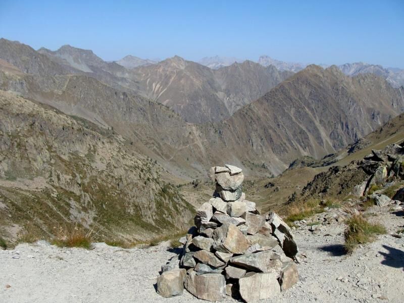
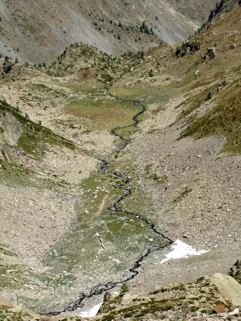
From Rifugio Zanotti you re-join path P27 at the Bassa di Schiantala plateau. The path then crosses the stream and begins to climb up the detrital slopes on the hydrographic left. Leave the junction to the right for path P27B (towards Schiantala - Ischiator) and then start to climb decisively with narrow hairpin bends towards Passo di Rostagno (2550 m). The last stretch is rather steep with a terrain made up of moving detritus material, so you need to be careful. A similar situation can be found on the opposite side, where you descend rapidly in altitude to the Ischiator Valley between rocky cliffs and extensive coverings of coarse detritus material. There are beautiful views of the Lower Lake of the Ischiatr (2064 m) and Rifugio Migliorero. When you reach the refuge, turn right towards the lakes, cross the isthmus that divides the two basins and immediately afterwards take path P24 that climbs to the left, initially on a slope with rhododendron scrub until you cross the confluence of Vallone di Laroussa. You then continue on the slopes of Vallone Superiore dell'Alpette, climbing in a SE direction until you reach the San Bernolfo-Ischiatr watershed with Passo di Laroussa (2471 m). You then descend from the pass into a first basin on the hydrographic left of the Laroussa valley. At an altitude of about 2150 m the path passes on the orographic right and starts to descend more decisively with a dense series of zigzags until it reaches the grassy slopes above the characteristic cottages of San Bernolfo (1663 m). After descending to San Bernolfo, you follow the valley floor of Vallone dei Bagni, descending to Strepeis and re-joining the main route (stage 59).

Beliebte Touren in der Nähe
Gardetta Fahrrad Emotionen
mittelMountainbike13,5 kmLes lacs de vens
mittelWanderung18,9 kmRadtour "La Bonette par la Moutière"
schwerRennrad51,0 km- 5,0
Goldtoni - Alpenbogen A107 Refugio Malinvern-Strepeis
mittelFernwanderweg25,9 km eVélo MNCA étape 1 : Auron - Saint-Dalmas-le-Selvage
mittelMountainbike29,8 km- 5,0
Goldtoni - Alpenbogen A108 Strepeis-Sambuco
mittelFernwanderweg16,1 km Discovering the Natura 2000 site "Site à Chauves-souris de la Haute-Tinée" - from St Etienne de Tinée (sporty level)
mittelWanderung7,43 km- 1,0
Durch das Valle di rio freddo
mittelWanderung15,7 km San Giacomo-Colle Valcavera
mittelRennrad13,2 km- 5,0
Rocca le Meja - Valle Maira
schwerHochtour19,8 km
Wandern & Tracking


Verpasse keine Angebote und Inspirationen für deinen nächsten Urlaub
Deine E-Mail-Adresse wurde in den Verteiler eingetragen.