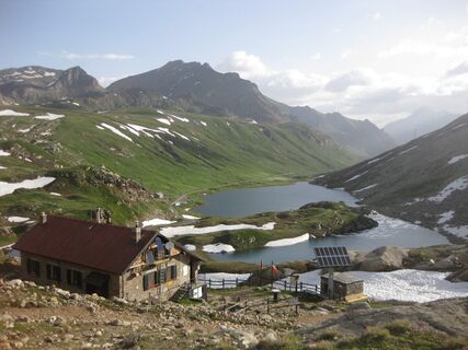
GPR Stage 1A - Chiapili di Sopra crossroads near A. Comba
mittel
Wanderung
Navigieren
Navigieren
Hol diese Tour auf dein Handy
Karte
GPR Stage 1A - Chiapili di Sopra crossroads near A. Comba
mittel
Wanderung
3,60 km
QR-Code scannen und Navigation in der bergfex App beginnen
QR Code
Wandern & Tracking
Wandern & Tracking
Download für iOS
Download für Android

GPR Stage 1A - Chiapili di Sopra crossroads near A. Comba

Distanz
3,60 km
Dauer
02:25 h
Aufstieg
695 hm
Seehöhe
1.768 - 2.495 m
Track-Download
Karte
GPR Stage 1A - Chiapili di Sopra crossroads near A. Comba
mittel
Wanderung
3,60 km

The trail starts next to a stone building (arrowfor "Sentiero Videsott"), on the right - going up - of the road that goes from Ceresole Reale to Colle del Nivolet, a hundred metres before the bridge over...


Beschreibung

The trail starts next to a stone building (arrowfor "Sentiero Videsott"), on the right - going up - of the road that goes from Ceresole Reale to Colle del Nivolet, a hundred metres before the bridge over rio della Percia,which falls on the vast basin of Chiapili di Sopra with a spectacular waterfall. Going up, between green alder shrubs, you pass some ruins (altitude 1858 m). Then,with an upwardcrossingon the left among stony grounds, you reach the pastures of Alpe Pertica, in front of the northern walls of Levanne. You skirt Rio della Percia for a stretch, turn right and head towards alpe Fumetta (2165 m). Turn right and head towards Alpe Pianass (2294 m), at the edges of the stony ground at the foot of punta Rocchetta (2922 m). Turn left towards Alpe Muanda (2350 m) and from this point the path climbs first to the right and then to the left until it comes to the old royal hunting road near Alpe Comba, which connects Nivolet to Noasca acrossthe hills of Terra and Porta http://www.renzovidesott.it/pngp/.

Wegverlauf
Alpe Fumetta
(2.165 m)
Flur/Gelände
1,6 km
Alpe Pianas
(2.294 m)
Flur/Gelände
2,2 km
Wegverlauf
Karte
GPR Stage 1A - Chiapili di Sopra crossroads near A. Comba
mittel
Wanderung
3,60 km
Alpe Fumetta
(2.165 m)
Flur/Gelände
1,6 km
Alpe Pianas
(2.294 m)
Flur/Gelände
2,2 km
Beschreibung
Technik
k.A.
Kondition
4 / 6
Landschaft
5 / 6
Erlebnis
4 / 6
Beste Jahreszeit
Jan
Feb
Mär
Apr
Mai
Jun
Jul
Aug
Sep
Okt
Nov
Dez
Tour teilen
Karte
GPR Stage 1A - Chiapili di Sopra crossroads near A. Comba
mittel
Wanderung
3,60 km
Fehler
Ein Fehler ist aufgetreten. Bitte versuche es erneut.
Noch keine Bewertungen
Bewertung schreiben

Bewertungen helfen anderen Usern bei der Auswahl ihres nächsten Abenteuers. Bewerte bitte nur die Tour, nicht das Wetter oder deine Jause.

Wähle einen der Sterne um die Tour zu bewerten
Schlechte Tour
Schwache Tour
Mittelmäßige Tour
Gute Tour
Ausgezeichnete Tour
bergfex logoHol dir den EinblickImmer live vor Ort mit über 9.500 Webcams. In der Touren App von bergfex siehst du als Pro-User jetzt zu vielen Touren die passenden Webcams. So kannst du dir direkt die aktuellen Bedingungen ansehen.
Wandern & Tracking

Wandern & Tracking

für iOS herunterladenfür Android herunterladen
Wandern & Tracking
Über 550.000 Tourenvorschläge, detailliertes Kartenmaterial und ein intuitiver Routenplaner machen die App zum Must-have für alle Naturbegeisterten.
Wandern & Tracking