Les Suquets de Penne
Castle and village combined:
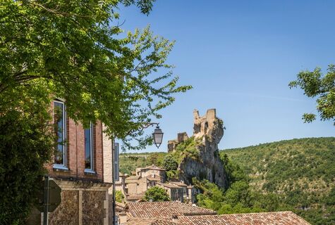
Around 560, the castle of Penne was built at the behest of Frédégonde, wife of Chilpéric I, king of Neustria, a woman who would stop at nothing to hold power. Thus she made...
Castle and village combined:
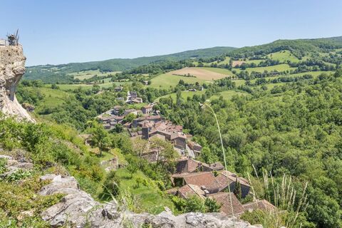
Around 560, the castle of Penne was built at the behest of Frédégonde, wife of Chilpéric I, king of Neustria, a woman who would stop at nothing to hold power. Thus she made Chilperic's first wife and his two sons disappear. Her rivalry with Brunehaut, Queen of Austrasia, is famous. War ravaged their states and Brunehaut died on the orders of Clotaire II, son of Frédégonde. Modernised and enlarged, the castle of Penne sheltered Cathars in the 13th century. One hundred years later, the English occupied it for more than thirty years. Finally, the Protestants dismantled it in 1586... Under Henry IV, the stones were used to rebuild the village, which now merges with the castle. Both enrich a site that has become quite unusual.

1. Opposite the multi-purpose hall car park, turn left up the road. Continue on the tarmac.
2. Leave the GR® de Pays on the right. As you go down, opposite a house, take a path on the left. Cross a stone bridge to join the road. At the intersection after the stream, go up towards Vaour. Opposite the road to Roussel, take a path on the left that climbs into the undergrowth.
3. At the road, turn left onto the tarmac. At Roussergue, go straight up towards the church. Pass in front of it and take the path on your left. At the crow's feet, go down to the left. In Janoye, turn left onto the road, 100 m further on, climb the steep slope to the right. Go up in a zigzag pattern.
4. At the intersection with the GR® de Pays at the top of the hill, turn left. At the Suquets rock, turn right into a hairpin. At the beginning of the descent, pass two successive hairpins.
5. At the crow's feet on the GR® 46, turn left. In the bend, turn right on the same path, then left at the next crow's feet. Go through Amiel. Cross the D115 to a grassy path opposite on the banks of the Aveyron. It runs alongside the road below.
6. Cross the D 115. Take the D9 opposite, towards Vaour; 30 m further on, turn right towards Penne; 50 m further on, also turn right onto the D9 (small bridge) for the same direction. At the crow's feet 50 m further on, follow the road to the right until the intersection opposite the bridge over the Aveyron.
7. Go up the road leading to the village. At the first curve, take a path to the right under the wall. Cross a footbridge, walk along the old wash house before going under the bridge. Climb to reach the road; cross it to pass the Peyrière gate. In front of the church, follow the Rue du Chais. Opposite the Tourist Office square, turn left to reach the starting point.
Vêtements adaptés à la saison et aux conditions (froid, chaud, humide…)
Chaussures de randonnée adaptées au terrain (même pour les enfants !)
Bâtons de randonnée (utiles pour la stabilité et pour soulager les articulations)
Téléphone mobile et batterie de rechange
Avant de partir :
Se renseigner sur la météo générale et locale en s’assurant de l’absence de précipitations S'informer sur la marche d’approche, hauteur de l’itinéraire, temps de parcours, réchappe possible (carte IGN, GPS, topo-guide, etc…) Evaluer les risques possibles en se renseignant auprès de professionnels de montagne, refuge, gîtes S'informer un proche de votre objectif et le recontacter en cas de changement : horaires départ et retour, nombre de participants avec le numéro de téléphone de chacun, véhicule(s), parking Eviter de partir seul, utiliser un matériel conforme à la pratique de l’activité, réglé et en bon état, lampe frontale, trousse de secours complète, couverture de survie, etc
En cas de problème, appelez le 112 (numéro d’urgence européen)
Parking de la salle polyvalente
APIDAE Tourismusdaten aktualisiert am 06/01/2023 von "Tarn Tourisme".
Haben Sie einen Fehler entdeckt? Schreiben Sie an den Besitzer mit folgenden Hinweisen:
Dateiname: Les Suquets de Penne | Identifikationsnummer dieser Seite: 852334 | URL (Link) für diese Outdooractive-Seite.
Forte montée de Janoye avant l'étape 4
Beliebte Touren in der Nähe
Verpasse keine Angebote und Inspirationen für deinen nächsten Urlaub
Deine E-Mail-Adresse wurde in den Verteiler eingetragen.


