


Thematic Path of Military History


Na stičišču notranjskega, kraškega in primorskega sveta vabi radovednega popotnika v svojo neokrnjeno naravo razgibana Pivška kotlina. V njenih prostranih gozdovih so prepletene številne pohodniške poti,...
Na stiÄišÄu notranjskega, kraškega in primorskega sveta vabi radovednega popotnika v svojo neokrnjeno naravo razgibana Pivška kotlina. V njenih prostranih gozdovih so prepletene številne pohodniške poti, ki vodijo skozi idiliÄno pokrajino do skritih lokalnih znamenitosti.
V zadnjih letih se Krožna pot vojaške zgodovine zaradi raznolikih vsebin, privlaÄne pokrajine in urejene infrastrukture s smerokazi, markacijami in informativnimi tablami uveljavlja kot priljubljena pohodniška destinacija ne samo med domaÄini, ampak tudi širše.
S slikovitimi prizori in zanimivimi zgodbami iz okolice predstavlja za pohodnike od blizu in daleÄ še posebej priljubljeno doživetje pohod po Krožni poti vojaške zgodovine, katere gozdne steze sledijo stopinjam tisoÄletne vojaškozgodovinske dedišÄine teh koncev. Tematska uÄna pot se z izhodišÄa v Parku vojaške zgodovine, vzpne do kaverne iz prve svetovne vojne, naprej do vrha Primoža, vzpon do Šilentabra, ki osupne s panoramskim razgledom nad Pivko. Pot se v sklepnem delu spusti do turistiÄne vasi Narin.
.


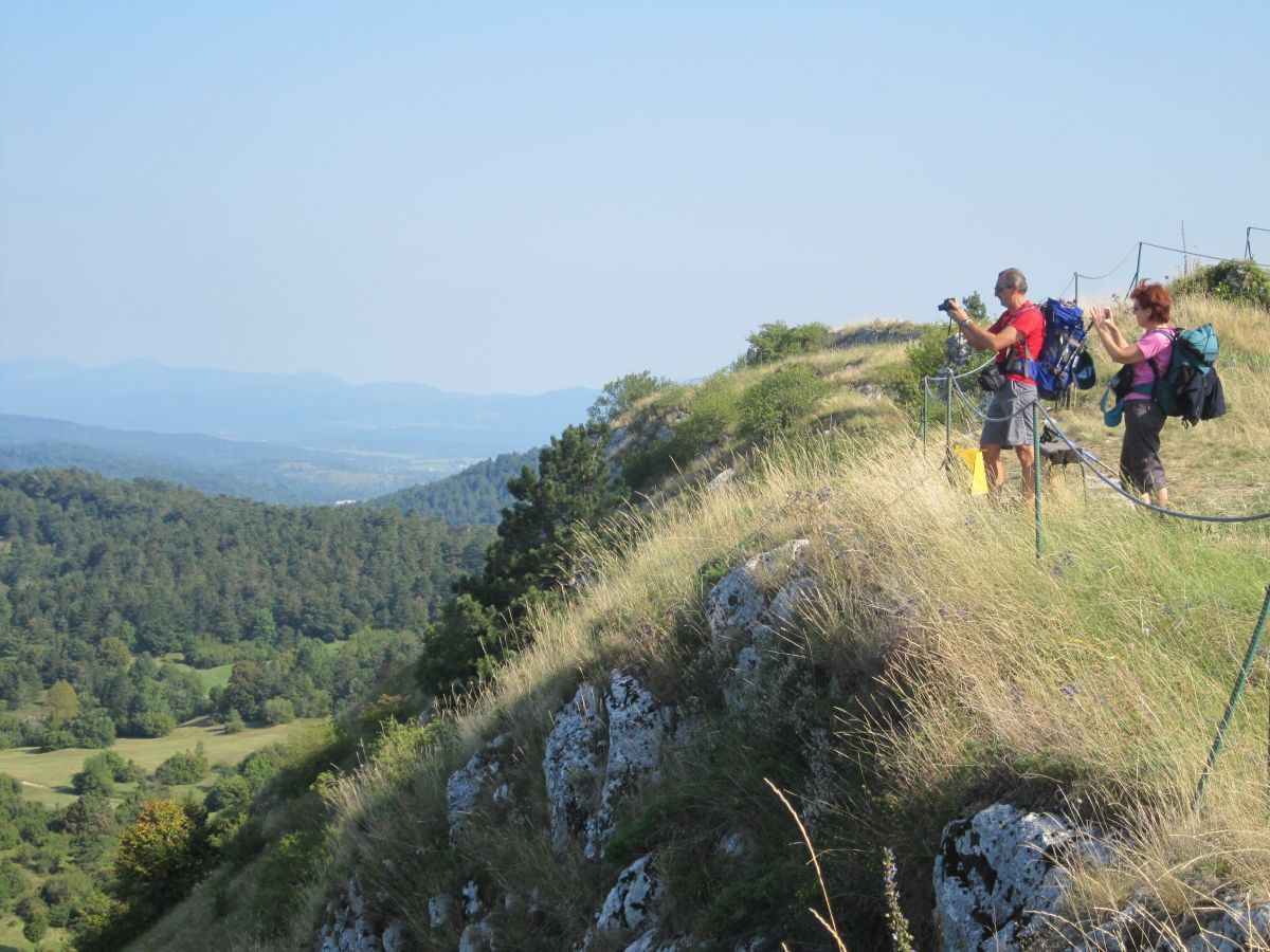
Thematic Path of Military History connects the Military History Park, the underground fortification of the Alpine Wall at Primož, Šilentabor above Zagorje and the village of Narin.
The journey begins at the Military History Park, a museum tourist center that offers visitors a unique insight into Slovenia's rich military history, with a particular focus on the 1991 War of Independence.
After a short climb, the trail leads you to the former military training ground at Kota 110 (613 m), where a system of shooting trenches was built during the First World War and a cavern was dug to train units preparing to fight on the Isonzo battlefield. From Kota 110 an old military road leads to the top of the nearby Primož hill (718 m), on which lies the mighty underground artillery fort of the Alpine Wall. Inside, approximately 500 m of underground tunnels are preserved along with fighting postions, ammunition depots and living quarters.
You can walk inside the fort with a guide by appointment.The hill has always had an important strategic position, as the entire Pivka basin is clearly visible from the top. An important fortified settlement stood on it in the pre-ancient times, and until the second half of the 18th century there was also the church of St. Primož and Felician. In recent years, Primož has been well visited especially because of the energy points located at the very top and right next to it.
From Primož, the path descends to the Dule valley, where, according to tradition, the old Roman road is supposed to be followed by a gentle ascent to Šilentabor (751 m). From the summit, where once stood the largest fortified complex in Slovenia, there is a wonderful view of the surroundings. Šilentabor was inhabited in prehistoric and Roman times, and the mighty fort was built during the Turkish invasions. There is also an old church of Sv. Martin with the remains of a late antique apse and 15th century frescoes.
From here, the path descends towards the tourist village of Narin, where closed groups can take a look at some of the local farmers traditions and customs and taste the various local delicacies before continueing on to the Military History Park.
Ja
Proper hiking equipment
The trail will take you 4h, and includes ascend to a few hills, as well as underground tunnels, so the proper hiking equipment is essential.
Take highway Ljubljana -Koper, exit Postojna and head towards Ilirska Bistrica. The museum is located next to the main road, about 1km from Pivka.
Pivka is accessible by local bus or with train. But you will have to walk or take a taxi to the museum, since it is located a bit out of the city itself.
Free parking available, also payable places for mobile homes.
You can visit just some of the parts of the trail, take a look at the brochure on the link bellow:
https://www.parkvojaskezgodovine.si/wp-content/uploads/2019/04/zlozenka_KROZNA-pot_A4_2017_PRESS-2.pdf
Twice a year, the Thematic Path of Military History Walk is organized along the route
Beliebte Touren in der Nähe
Podbrdo- Šinentabor nad Zagorjem -Gradišče- Podbrdo krožna pot
leichtWanderung11,6 kmVremščica
leichtWanderung6,45 kmSlovenian section of Via Dinarica
mittelFernwanderweg140,1 kmHerzweg Ilirska Bistrica
leichtThemenweg4,81 kmThe Krpan Trail
schwerWanderung109,3 kmThe Great Krpan Trail
schwerFernwanderweg109,0 kmNovokračine - Veliki Snežnik - Suhi vrh - Oltar
mittelFernwanderweg225,3 kmPivka - Cerkvica sv. Urbana na Vremščici - Velika Vremščica - Divača
mittelWanderung9,14 km- 5,0
Sveta Trojica - Vrh Serivnika - Postojna
Wanderung22,7 km Postojna - Sveta Trojica - Avio Pub
Radfahren41,5 km

Wandern & Tracking


Verpasse keine Angebote und Inspirationen für deinen nächsten Urlaub
Deine E-Mail-Adresse wurde in den Verteiler eingetragen.