The Great Krpan Trail
The Green Karst is the land of Martin Krpan, one of the most famous Slovenian literary heroes. A rebel at his own right, he was involved in the business of transporting of salt, which was at the time forbidden....
The Green Karst is the land of Martin Krpan, one of the most famous Slovenian literary heroes. A rebel at his own right, he was involved in the business of transporting of salt, which was at the time forbidden. He astounded the Emperor and the Empress with his cleverness and resourcefulness, using his physical strength to defeat the mighty Brdavs and save the empire from Turkish invasion.
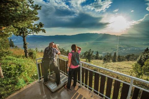
It is an adventure that lasts multiple days, perfect for everyone who loves outdoor activities in unspoiled nature, among natural and cultural sights. It takes you past the intermittent lakes, karst caves, castle ruins and preserved mansions. You can admire the colorful flora on the trail through the woods, across meadows and pastures. You might spot a deer or a fox, and if you are really lucky, even a bear.
The trail is, in principle, a hiking trail and is also marked as one in nature. With the exception of four parts where short detours are needed, it is also suitable for cycling. Hikers and cyclists can use the map of the Great Krpan Trail, where the hiking and the biking trail, as well as QR code for accessing GPS tracks and two suggested extensions of the trail are marked.

We suggest you start in Pivka, from where the trail leads across the Pivka Valley, over the forest massif of the Javornik Hills, and through the Lož Valley onto the Bloke plateau. It then continues at the foot of Mount Slivnica and at Lake Cerknica, all the way to the Rakov Škocjan Valley. What follows is an ascend across KaliÄ to Postojna, and then the return through the valley to Pivka.
Ja
Normal, all weather hiking gear
No special issues
Available
Available
You can get a map of the Great Krpan Trail in the tourist info center.
There are 7 checkpoints on Krpanova pot, where hikers can get a stamp on their card, and the points are marked on the map with a blue number on a yellow background. Hikers and route information are also available to hikers. The numbers especially mark the larger sights along the way that we can see.
Webcams der Tour
Beliebte Touren in der Nähe
Verpasse keine Angebote und Inspirationen für deinen nächsten Urlaub
Deine E-Mail-Adresse wurde in den Verteiler eingetragen.


