


Sur les coteaux de Savennières
Schwierigkeitsgrad: T1


Savennières is also part of the vast Val de Loire, a UNESCO World Heritage site since 2000.
Tourist attractions :
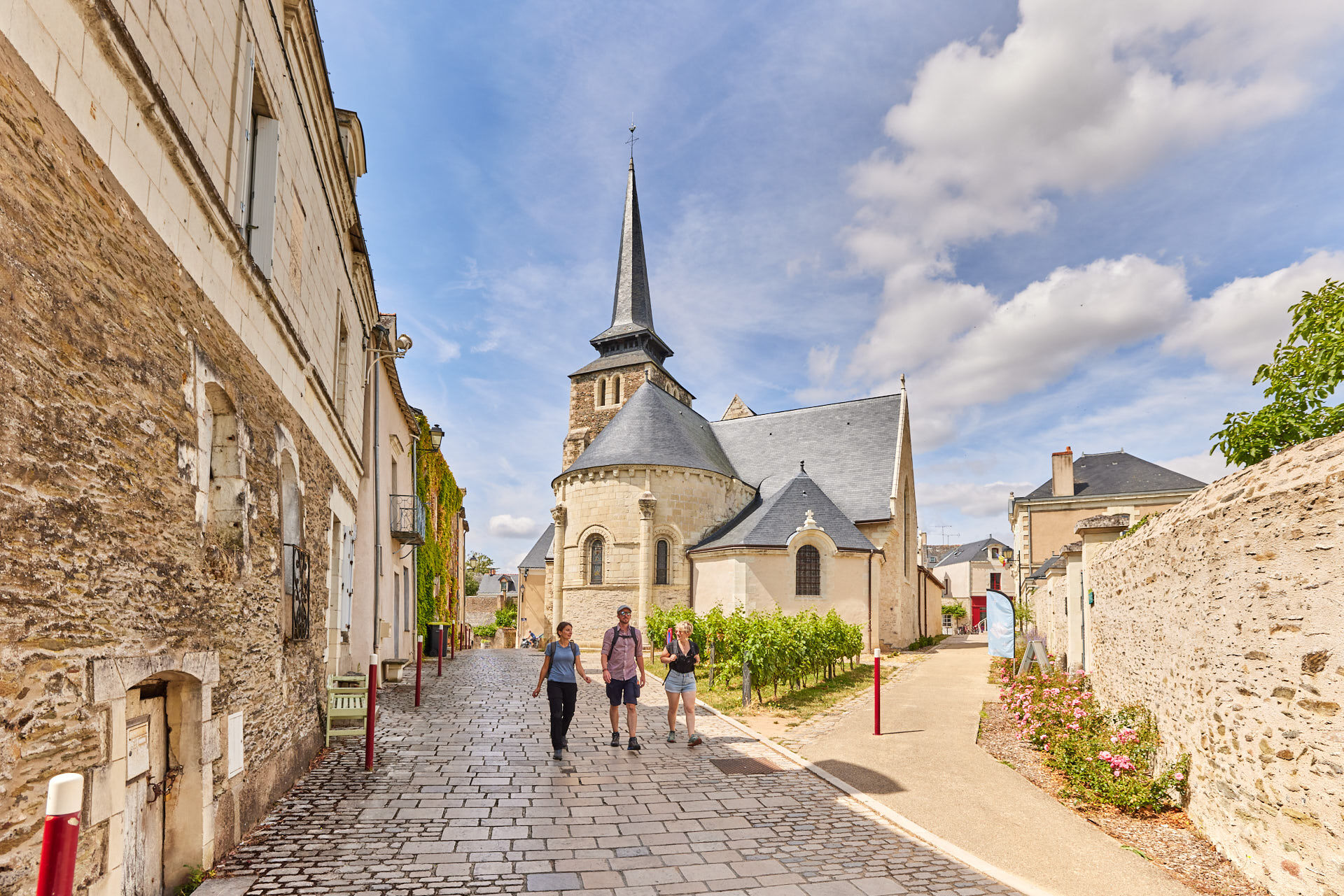
- The town of Savennières is built around the church of Saint-Pierre et Saint-Romain, considered...
Savennières is also part of the vast Val de Loire, a UNESCO World Heritage site since 2000.
Tourist attractions :
- The town of Savennières is built around the church of Saint-Pierre et Saint-Romain, considered to be the oldest standing Christian building in Anjou.
- The Bécherelle stone, located downstream from the confluence of the Loire and Maine rivers and facing the northern tip of the Ile de Béhuard, is a huge, ancient natural monolith that has become a rock-climbing site.
- The picturesque little village of Épiré lies halfway between Savennières and Bouchemaine. Its former church is now privately owned and houses the winery of the Château d'Épiré wine estate.
- This is a very pleasant walk to take in spring and late summer, as you can see the various stages of vineyard work among the rows of vines.
Facilities available:
- Toilets near the town hall
- Picnic tables in Place du Mail and Parc du Fresnes
Starting point :
- Place du Mail, Savennières
Practical information :
- Bicycle trail
- Trail not passable during flood periods
Route marked in mauve.


Circuit marked out in mauve.
Ja
Ja
In an emergency, dial 112.
Think about carpooling.
Parking close to the starting point.
T1
APIDAE Tourismusdaten aktualisiert am 15/03/2023 von "Destination Angers".
Haben Sie einen Fehler entdeckt? Schreiben Sie an den Besitzer mit folgenden Hinweisen:
Dateiname: Sur les coteaux de Savennières | Identifikationsnummer dieser Seite: 6036248 | URL (Link) für diese Outdooractive-Seite.
This circuit and the associated GPX track may not, under any circumstances, be shared without mentioning Destination Angers.
Beliebte Touren in der Nähe
To the confluence of the Loire and the Maine
leichtWanderung18,0 km- 5,0
Angers Historische Centrum
leichtWanderung5,88 km La Vélo Francette - von Longuenée-en-Anjou nach Loire Authion
mittelRadfahren55,8 km- 4,0
La Loire à Vélo - Frische Luft gemeinsam mit der Familie oder Freunden genießen
leichtRadfahren39,2 km La boucle champêtre liniéroise
leichtWanderung8,11 kmMayenne-Schleife
leichtRadfahren23,3 kmLoire à Vélo - von Loire-Authion nach Savennières
leichtRadfahren34,8 kmLa Roche de Mûrs
leichtWanderung5,50 kmCircuit du Fouilloux
leichtWanderung10,7 kmFlânerie autour de l'île
leichtWanderung9,26 km
Wandern & Tracking


Verpasse keine Angebote und Inspirationen für deinen nächsten Urlaub
Deine E-Mail-Adresse wurde in den Verteiler eingetragen.