


Cycling trail Novo Mesto - Žbure


From the main square in Novo Mesto, you can cross the city streets, mostly along a well-maintained cycle path, along the Krka River. A pleasant and well-maintained cycle trail will then lead you along...
From the main square in Novo Mesto, you can cross the city streets, mostly along a well-maintained cycle path, along the Krka River. A pleasant and well-maintained cycle trail will then lead you along it towards Šmarješke Toplice. On the way you will cycle past the famous OtoÄec castle, where you can just stop and walk through the castle park. Opposite, you will find a specialized cycling hotel Šport OtoÄec, where you can also find an adrenaline park, service workshops and an excellent restaurant, as well as rooms and other facilitie specialy suited for cyclists.
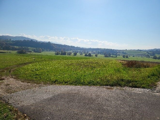
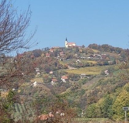
This is the basic trail the first part of which, almost to Šmarješke Toplice, is common with the path that then leads to Škocjan (after the underpass, turn right). But here you continue towards Šmarješke Toplice, which is known for its thermal water and wooden pool from the end of the 18th century. You will cycle along a forest trail to avoid the main road, then continue past the village along the main road, but on the bike trail. Through the village of Šmarjeta, continue slightly upwards towards the village of Žbure, across the typical Dolenjska hilly landscape.
The trail ends in the village of Žbure, but you will probably continue left towards GriÄ near Klevevž, to visit the biggest local attraction - the hot spring Klevevž, where you will find a small pool where the water has a temperature between 21 and 25 degrees Celsius throughout the year.

From Glavni trg, the center of Novo Mesto, cycle to the main connecting street - Seidlova, where at the crossroads turn right onto a red-painted cycle path. You cycle partly on a separate bike path along the road, partly on a marked bike path within the road. After about three kilometers, the marked bike path ends. Continue cycling either along the road or along a sidewalk wide enough to the intersection for the direction of the highway At the intersection, cycle left up the cycle path next to the Krka factory.
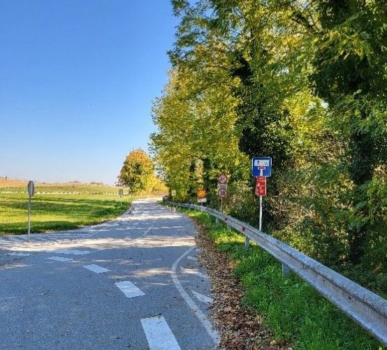
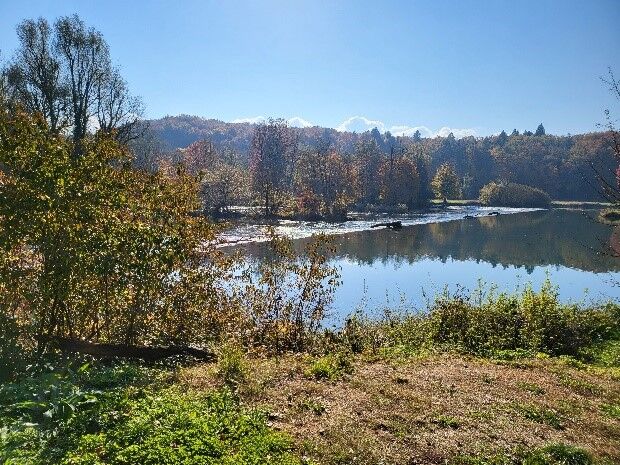
At the roundabout, continue right along the marked bike path separated from the road by a fence. At the second roundabout, continue to the right along the marked cycle path, which ascends slightly. Continue along the bike path past the next roundabout straight on. From here on, the path is marked with red signs in the direction of Šmarješke Toplice. At the crossroads, turn right onto the local road along the Krka. The end of the bike path awaits you as you turn from the regional road to the local one. You continue cycling along the traffic-free local asphalt road above the river Krka.
Continue along the local road to and through the village of OtoÄec. At the end of the village, near the cemetery, the local road turns into a two-way bike path above Krka in the direction of OtoÄec Castle. Then cycle straight towards Šmarješke Toplice. In Dolenje Kronovo, turn left onto the regional road OtoÄec - Šmarješke Toplice and after 100 m turn right onto the road, without a cycle path, through Družinska vas towards Šmarješke Toplice. At the crossroads, turn left under the motorway past the Domen inn towards Šmarješke Toplice and Šmarjeta. From the inn, cycle along the main road and turn left over the bridge, onto a macadam promenade and bike path. Immediately after the bridge, turn right onto the tourist path towards Šmarješke Toplice.
At the second bridge, turn right over the wooden bridge, then immediately left along the path past the Prinovec inn. After the inn, turn right onto the paved parking lot, cycle from the parking lot in the direction of the crossroads, where the right direction leads to the Šmarješke Toplice thermal baths, and you turn right across the crossroads in the direction of the village of Šmarjeta straight along the bike path.
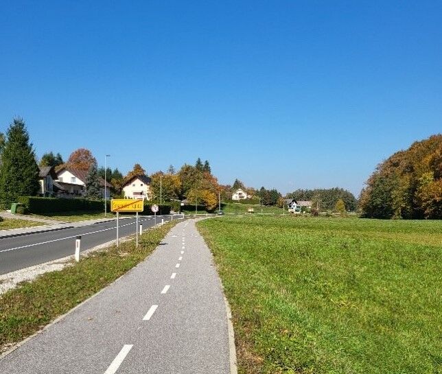
You continue cycling in a slight ascent along the bike path towards Šmarjeta past the settlement of Brezovica. Behind the roundabout, the bike path ends. You cycle to the center of the village of Šmarjeta along the road past the church and on the other side of the GregorÄiÄ inn. In the center of Šmarjeta turn right in the direction of the cemetery and the chapel behind the cemetery. At the chapel, turn left past the Plastoform plastic products factory towards the regional road.
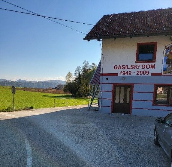
Cycle right onto the regional road without a cycle path towards Žbure. So be careful because the road is relatively busy. Cycle along the main road through the village of Zaboršt, then past the turnoff for Klevevž (here you can turn for a hot spring). The parking lot at the fire station in Žbure is the goal of this route. You can continue past the inn opposite the fire station on the regional road about 5 km towards Škocjan and along the route Škocjan (back) to Šmarješke Toplice.
Ja
Ja
Helmet, swimsuit and a towel
Novo Mesto is located along the highway Ljubljana-Zagreb. Follow the signs for Center, to get to the main square.
Novo Mesto is accessible by bus or train
Payable in the city
Beliebte Touren in der Nähe
Andrijaniceva Herzweg Šmarješke Toplice- Otočec
leichtThemenweg4,62 km- 2,0
Trdinova Herzweg Gorjanci
mittelThemenweg10,5 km Rudolf trail
mittelMountainbike38,4 km- 5,0
Cycling trail from Novo Mesto to Dolenjske Toplice
leichtRadfahren14,9 km Cycling trail from Šmarješke Toplice to Škocjan
mittelRadfahren10,4 kmDer Bären-Radweg
schwerMountainbike50,5 kmMountainbiketour rund um Novo Mesto
mittelMountainbike34,8 kmFrom Novo Mesto to the warm spring of Klevevž
mittelMountainbike41,4 kmRefreshing cycling along the Radulja stream
mittelMountainbike43,1 km- 5,0
Mach heritage trail
mittelWanderung9,99 km
Wandern & Tracking


Verpasse keine Angebote und Inspirationen für deinen nächsten Urlaub
Deine E-Mail-Adresse wurde in den Verteiler eingetragen.