


Slovenian section of Via Dinarica


𝐒𝐥𝐨𝐯𝐞𝐧𝐢𝐚𝐧 𝐬𝐞𝐜𝐭𝐢𝐨𝐧 𝐨𝐟 𝐕𝐢𝐚 𝐃𝐢𝐧𝐚𝐫𝐢𝐜𝐚 Hi! I noticed there aren’t many descriptions for the Slovenian section, and some people don’t know what to see. So as Slovenian, I’ve created this guide for it. There...
𝐒𝐥𝐨𝐯𝐞𝐧𝐢𝐚𝐧 𝐬𝐞𝐜𝐭𝐢𝐨𝐧 𝐨𝐟 𝐕𝐢𝐚 𝐃𝐢𝐧𝐚𝐫𝐢𝐜𝐚
Hi!
I noticed there aren’t many descriptions for the Slovenian section, and some people don’t know what to see. So as Slovenian, I’ve created this guide for it. There are some small differences from the original, with some small adjustments. I’ve included things worth seeing to help you get the most out of it while keeping it short (I reduced it by about half a day). I hope you find it useful!
𝗦𝗲𝗰𝘁𝗶𝗼𝗻 𝟭: 𝗥𝗮𝘇𝗱𝗿𝘁𝗼 – 𝗡𝗮𝗻𝗼𝘀 – 𝗣𝗿𝗲𝗱𝗷𝗮𝗺𝗮 𝗖𝗮𝘀𝘁𝗹𝗲 (𝗢𝗽𝘁𝗶𝗼𝗻𝗮𝗹: 𝗣𝗼𝘀𝘁𝗼𝗷𝗻𝗮 𝗖𝗮𝘃𝗲)
Distance: 16 km
Profile: Some hills with flat areas, forests
Water: Available
Accommodation:
- Camping Mirjam
- Vojkova koča na Nanosu (Mountain Cabin Nanos: food, water, accommodation) – probably open daily from May to the end of September.
Sights:
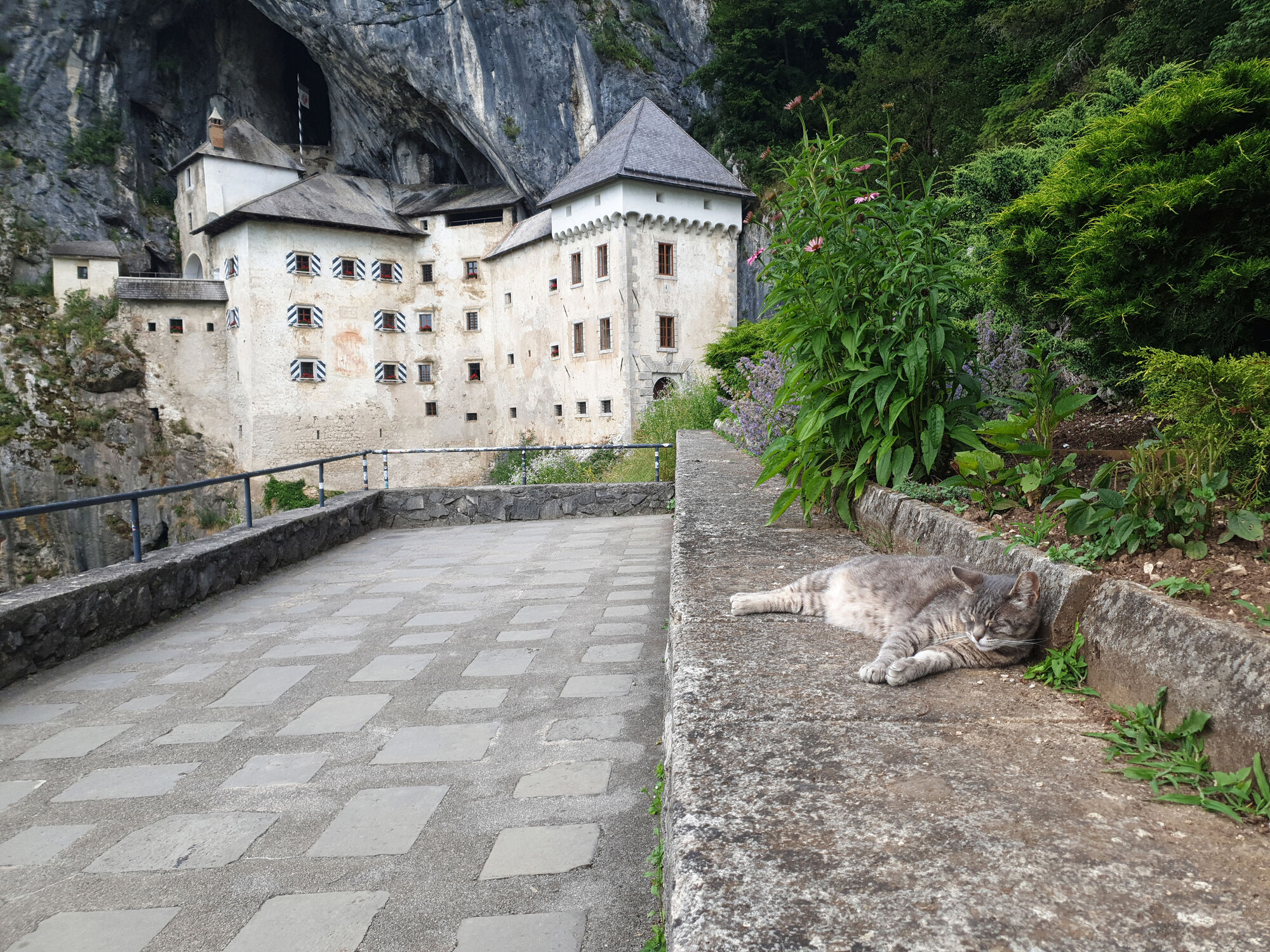
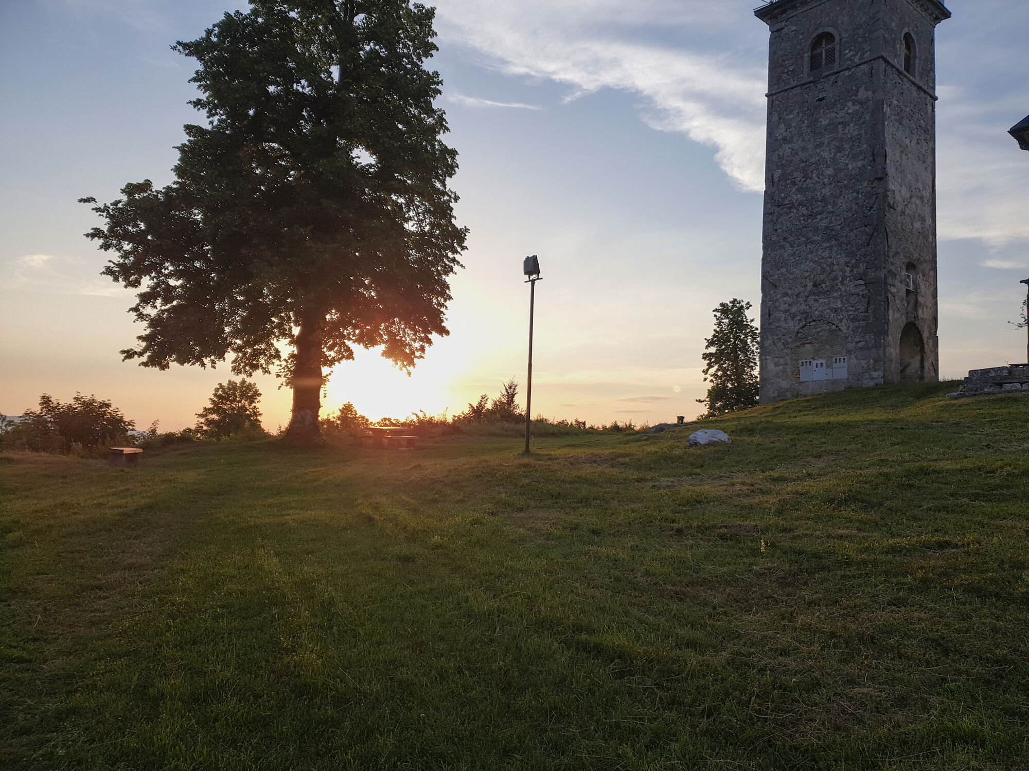
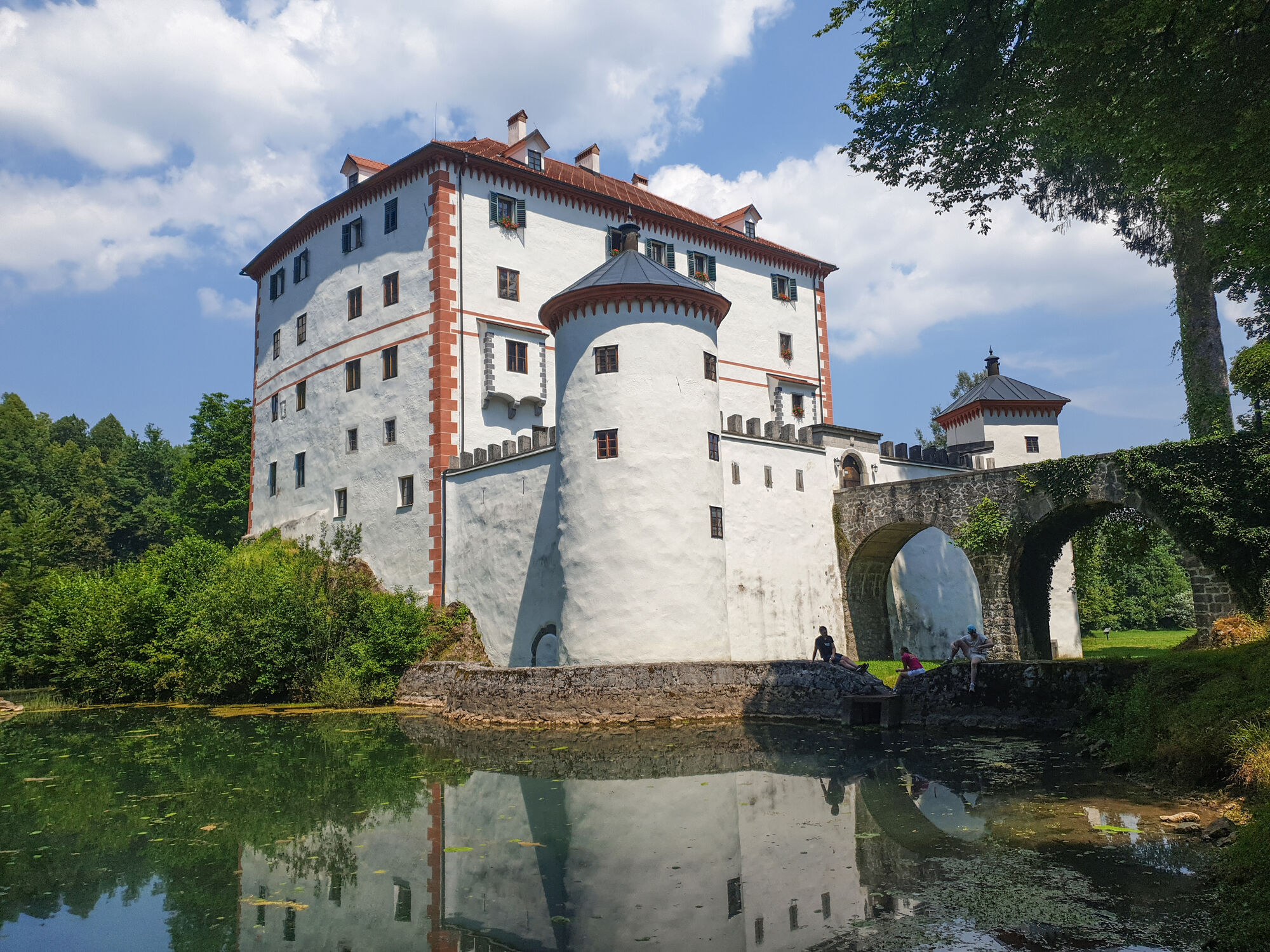
- Predjama Castle
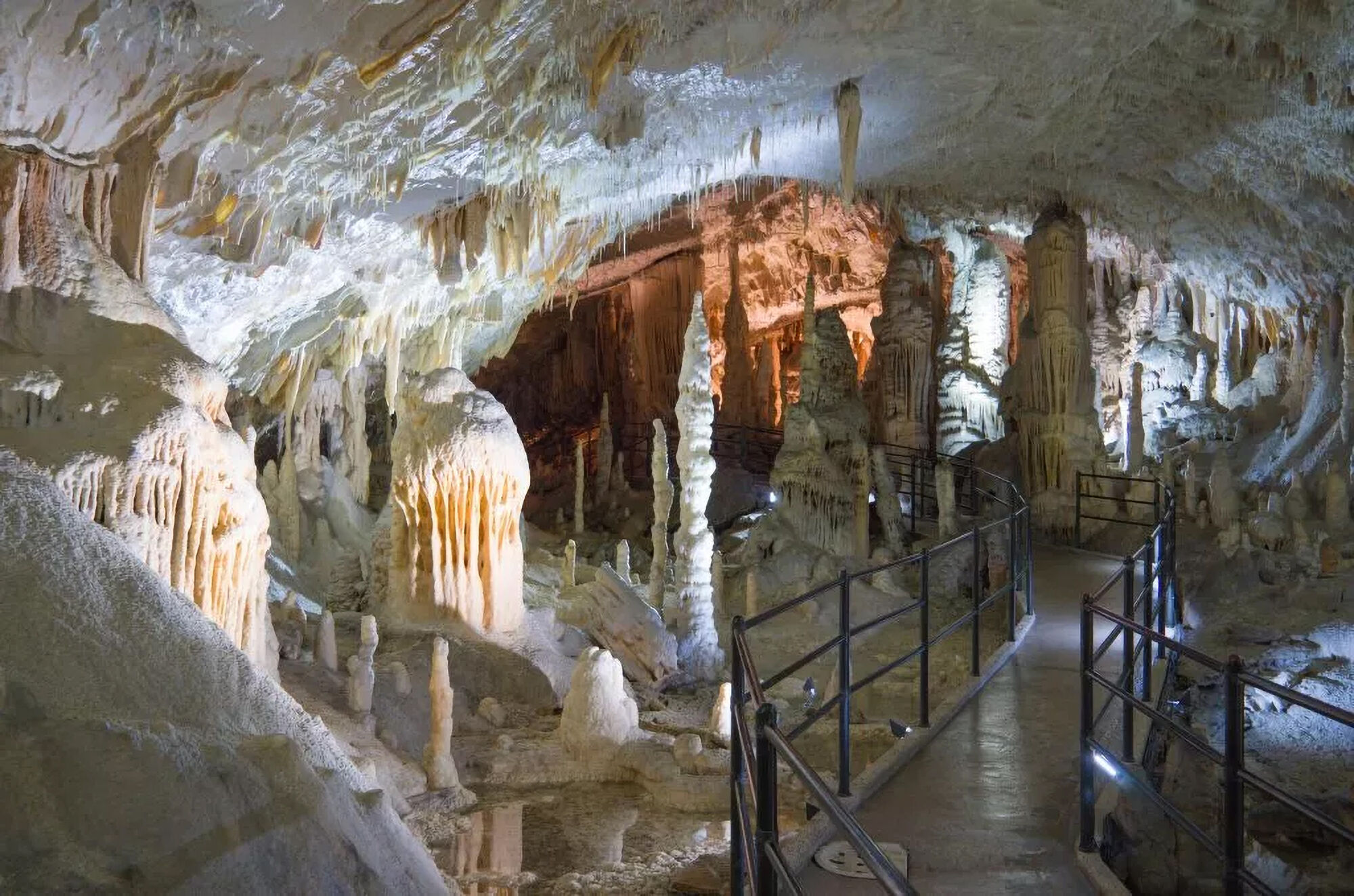
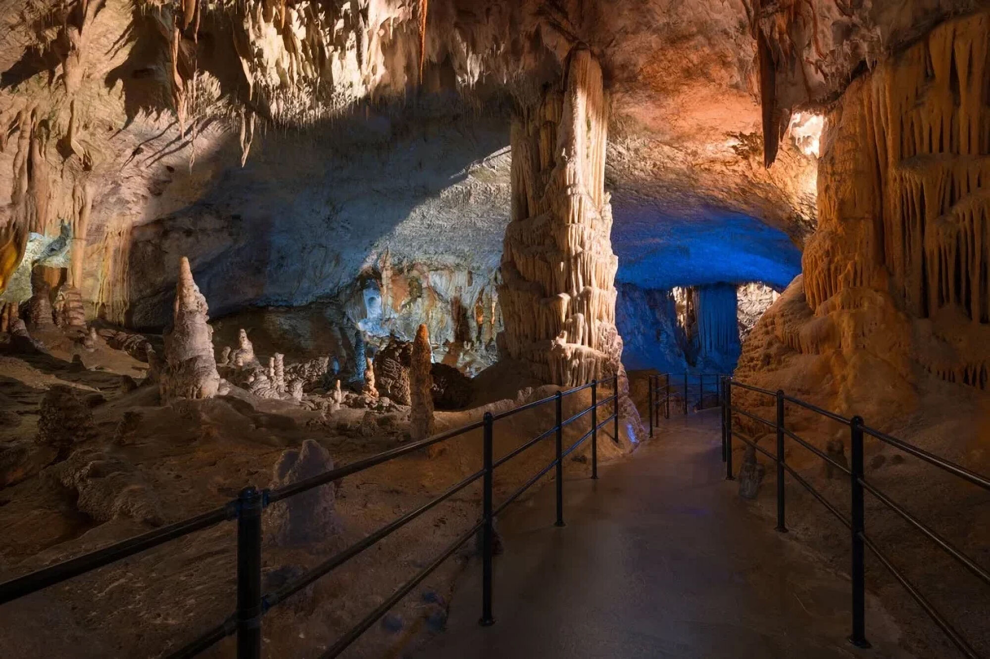
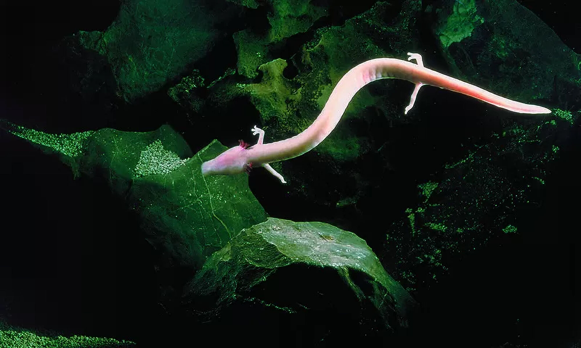
- Postojna Cave: Definitely worth it. There’s a cheap 1 euro bus from Predjama Castle to the cave and back; it’s off the official .gpx trail.
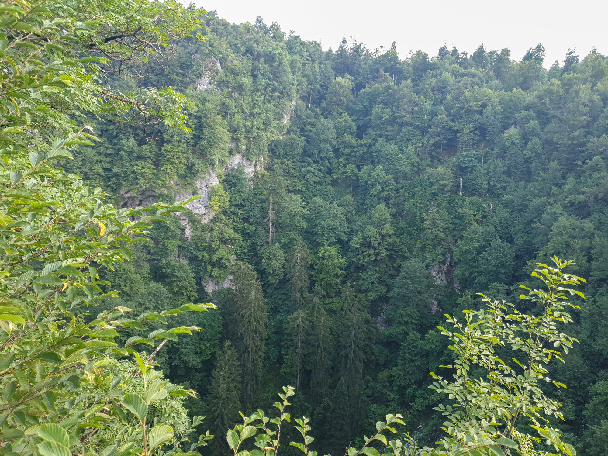
𝐒𝐞𝐜𝐭𝐢𝐨𝐧 𝟐: 𝐏𝐫𝐞𝐝𝐣𝐚𝐦𝐚 𝐂𝐚𝐬𝐭𝐥𝐞 – 𝐒𝐭. 𝐋𝐨𝐯𝐫𝐞𝐧𝐜 (𝐇𝐢𝐥𝐥) – 𝐆𝐫𝐦𝐚𝐝𝐚 (𝐇𝐢𝐥𝐥) – 𝐂𝐚𝐯𝐞 𝐧𝐞𝐚𝐫 𝐑𝐚𝐯𝐛𝐚𝐫𝐣𝐞𝐯 𝐒𝐭𝐨𝐥𝐩 – 𝐃𝐯𝐨𝐫𝐞𝐜 𝐇𝐚𝐬𝐛𝐞𝐫𝐠 (𝐂𝐚𝐬𝐭𝐥𝐞 𝐑𝐮𝐢𝐧𝐬) – 𝐔𝐧𝐞𝐜 – 𝐑𝐚𝐤𝐨𝐯 𝐒̌𝐤𝐨𝐜𝐣𝐚𝐧 𝐋𝐚𝐧𝐝𝐬𝐜𝐚𝐩𝐞 𝐏𝐚𝐫𝐤
Distance: 30 km
Profile: Some hills, later flat with caves and forests
Water: Available
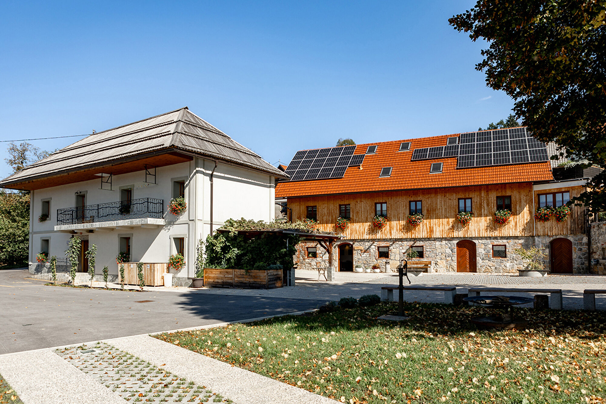
Accommodation: Local apartments,...
Sights:
- Cave near Ravbarjev Stolp
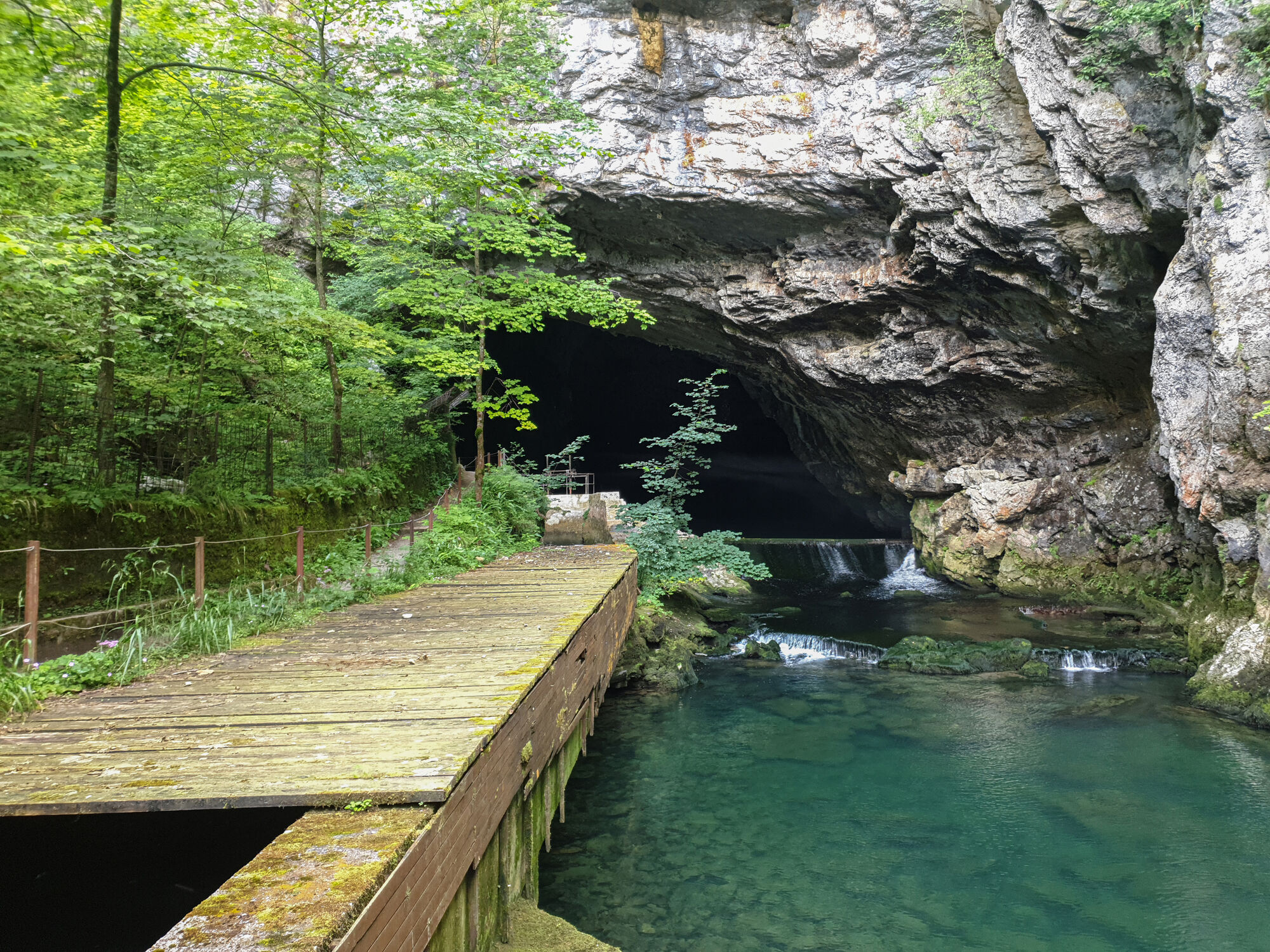
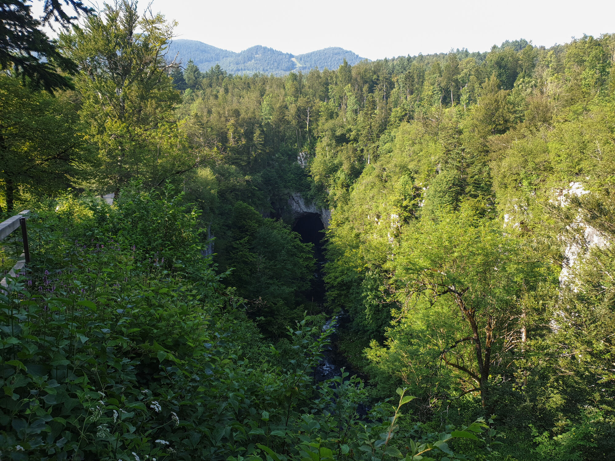
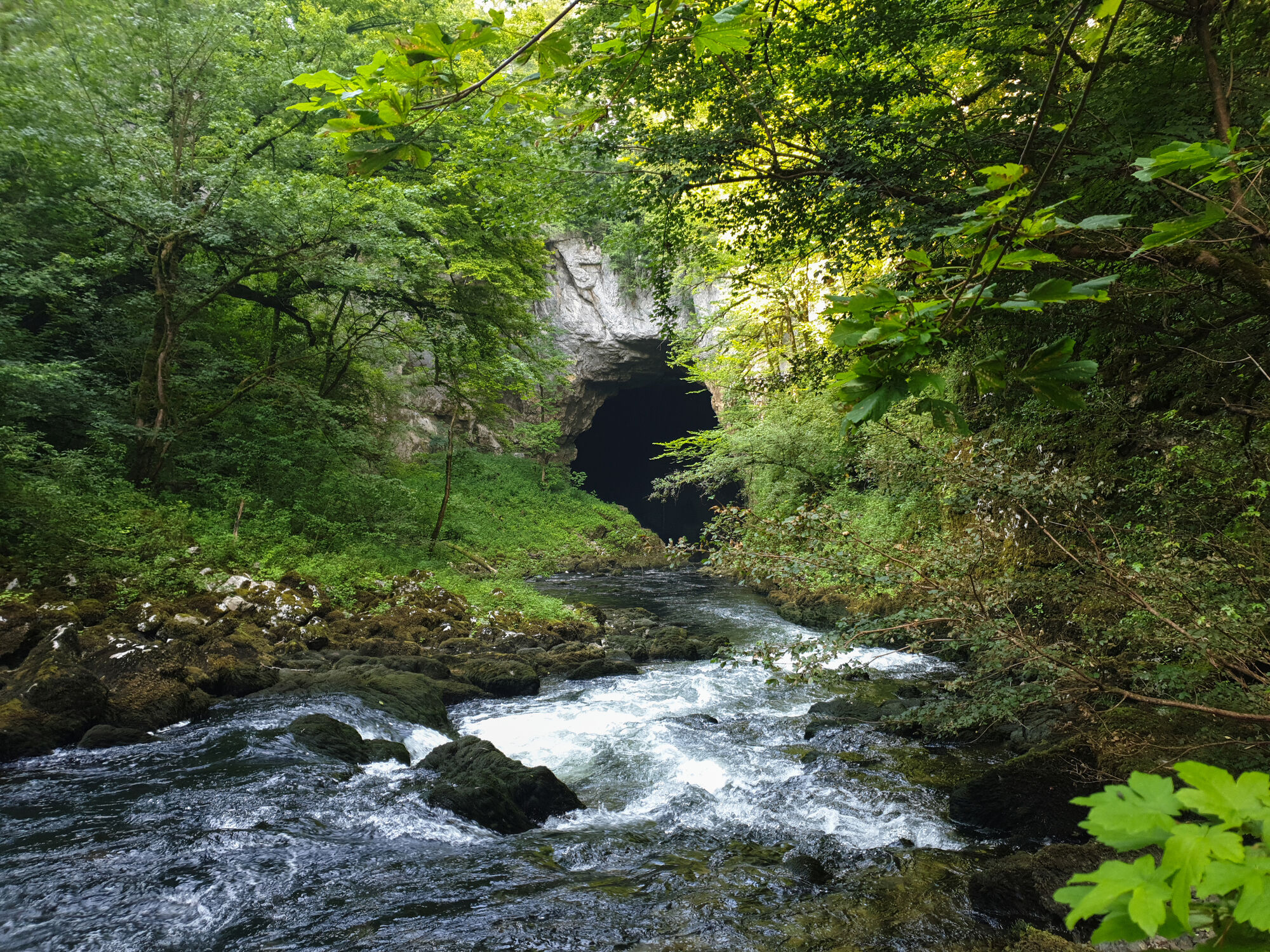
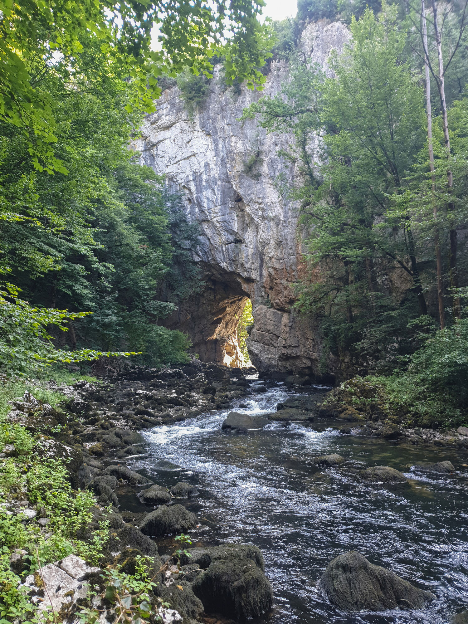
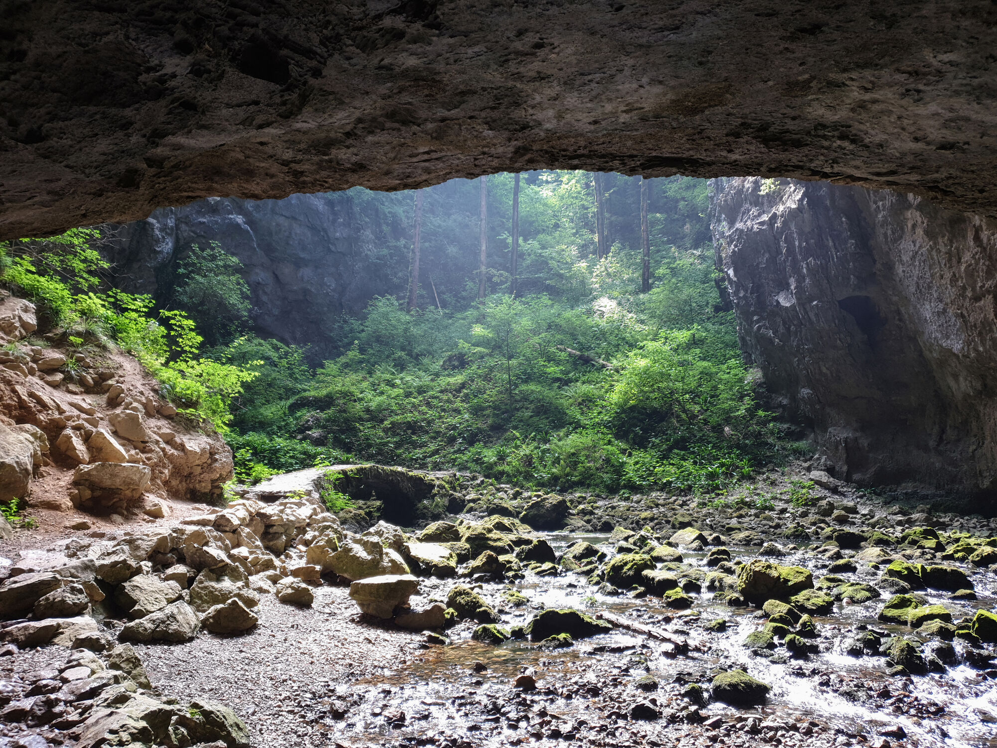
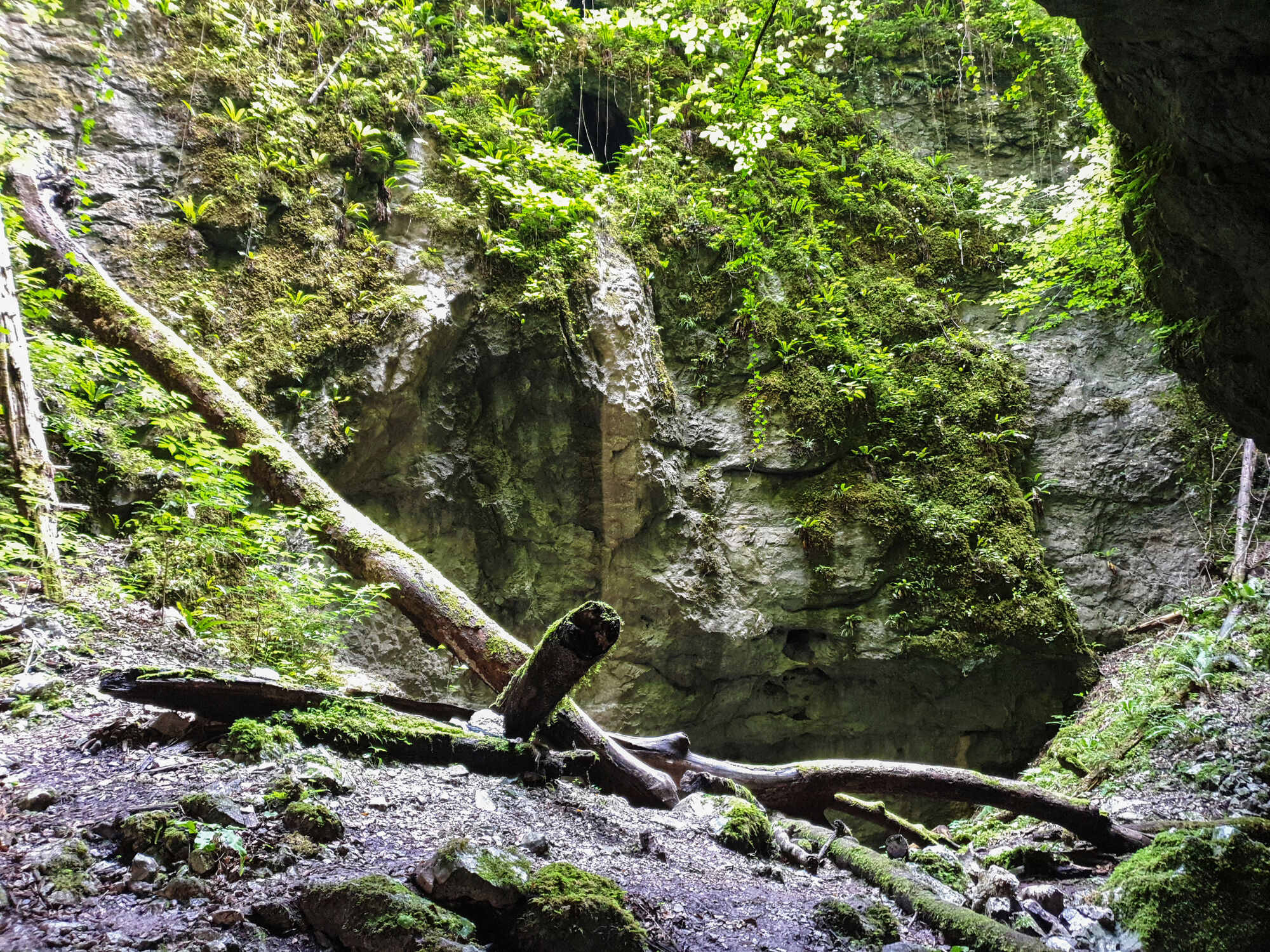
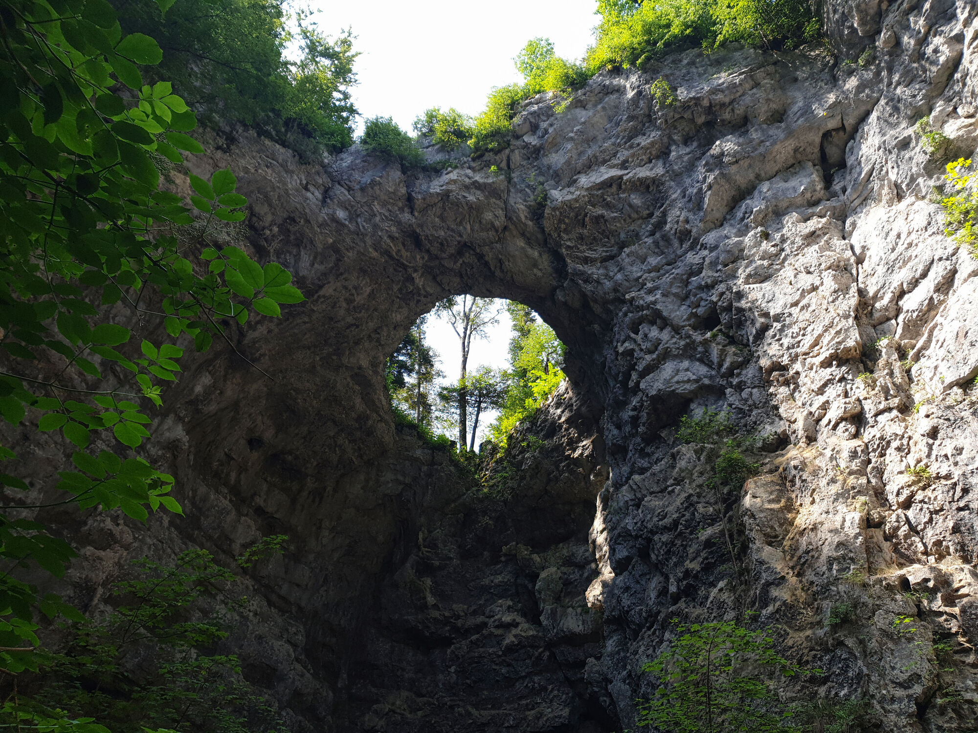
- Rakov Škocjan Landscape Park: It’s worth spending some time here to go down towards cave system and explore a bit.
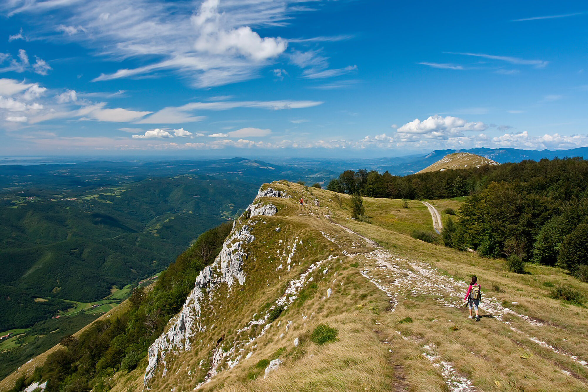
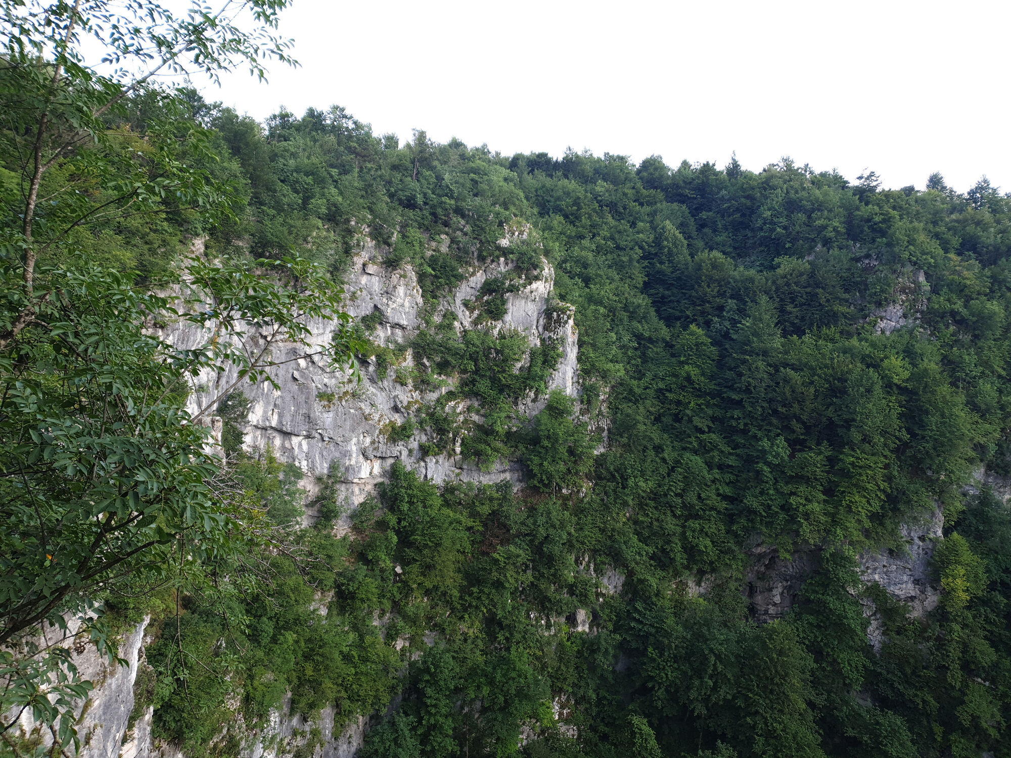
𝐒𝐞𝐜𝐭𝐢𝐨𝐧 𝟑: 𝐑𝐚𝐤𝐨𝐯 𝐒̌𝐤𝐨𝐜𝐣𝐚𝐧 𝐋𝐚𝐧𝐝𝐬𝐜𝐚𝐩𝐞 𝐏𝐚𝐫𝐤 – 𝐂𝐞𝐫𝐤𝐧𝐢𝐜𝐚 – 𝐕𝐞𝐥𝐢𝐤𝐚 𝐒𝐥𝐢𝐯𝐧𝐚 (𝐏𝐞𝐚𝐤)
Distance: 20 km
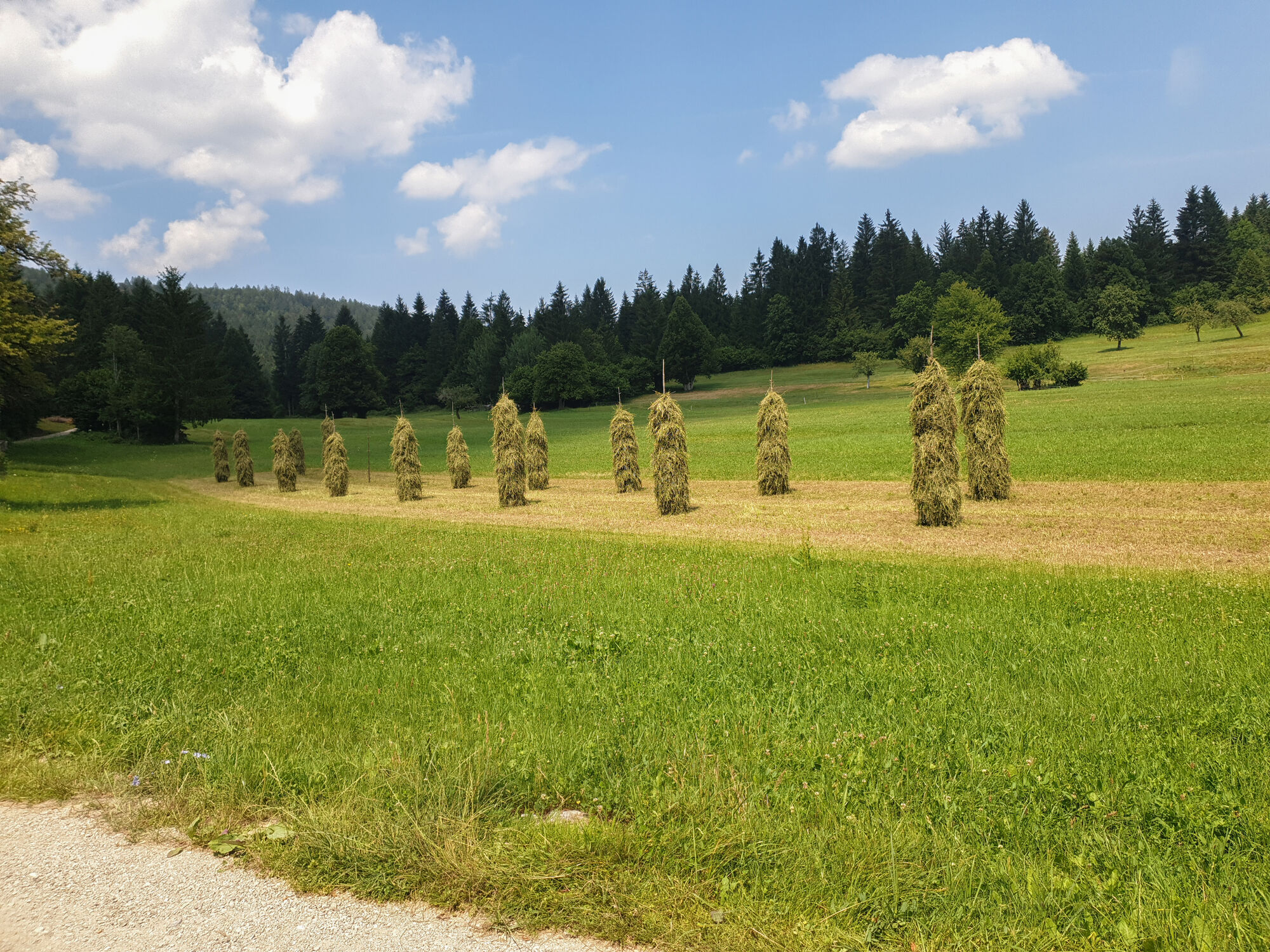
Profile: Mostly flat, forests, hill at the end
Water: Available
Food: Cerknica has large supermarkets (Hofer), but later on, they are much smaller for about a week. This is the last resupply point with a wider variety of items to choose from. Supermarkets later on are smaller.
Accommodation:
- Local lodging
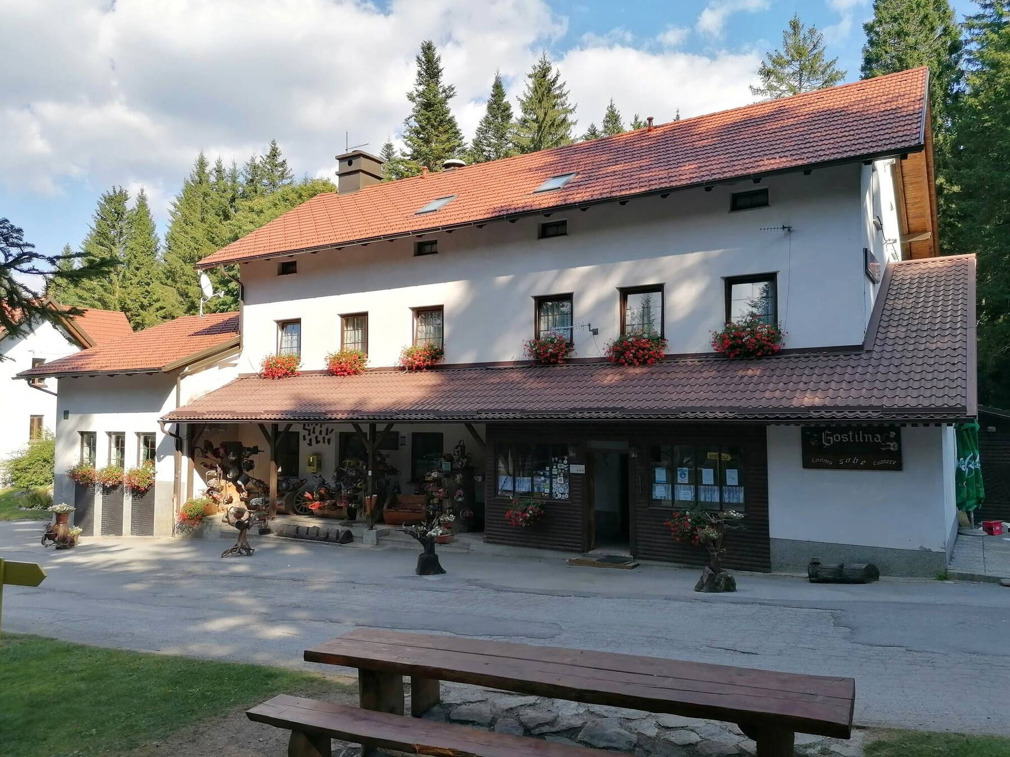
- Planinski dom na Slivnici (Slivna Mountain Hut) – may be closed on weekdays (not sure). Offers food, drinks, and accommodation.
Sights:
- Rakov Škocjan Landscape Park: Definitely worth checking out. Go down to see the caves and natural bridges.
𝐒𝐞𝐜𝐭𝐢𝐨𝐧 𝟒: 𝐕𝐞𝐥𝐢𝐤𝐚 𝐒𝐥𝐢𝐯𝐧𝐚 (𝐏𝐞𝐚𝐤) – 𝐊𝐫𝐢𝐳̌𝐧𝐚 𝐆𝐨𝐫𝐚 (𝐇𝐢𝐥𝐥 𝐰𝐢𝐭𝐡 𝐂𝐡𝐮𝐫𝐜𝐡, 𝐍𝐢𝐜𝐞 𝐅𝐥𝐚𝐭 𝐀𝐫𝐞𝐚 𝐨𝐧 𝐓𝐨𝐩, v𝐢𝐞𝐰𝐬) – 𝐒𝐭𝐚𝐫𝐢 𝐓𝐫𝐠 𝐩𝐫𝐢 𝐋𝐨𝐳̌𝐮 – 𝐕𝐢𝐥𝐥𝐚𝐠𝐞 𝐏𝐨𝐝𝐜𝐞𝐫𝐤𝐞𝐯 (𝐘𝐨𝐮𝐭𝐡 𝐇𝐨𝐬𝐭𝐞𝐥 𝐀𝐫𝐬 𝐕𝐢𝐯𝐚) – 𝐆𝐫𝐚𝐝 𝐒𝐧𝐞𝐳̌𝐧𝐢𝐤
Distance: 22 km
Profile: Hills, forests, some flat areas, countryside
Water: Available
Accommodation:
- Local lodging
- Youth Hostel Ars Viva in Podcerkev (looks nice for sleeping).
Sights:
- Snežnik Castle: Beautiful castle with moat, pond to take some time off.
𝐒𝐞𝐜𝐭𝐢𝐨𝐧 𝟓: 𝐆𝐫𝐚𝐝 𝐒𝐧𝐞𝐳̌𝐧𝐢𝐤 (𝐂𝐚𝐬𝐭𝐥𝐞 𝐒𝐧𝐞𝐳̌𝐧𝐢𝐤) – 𝐌𝐚𝐬̌𝐮𝐧 – 𝐏𝐞𝐚𝐤 𝐒𝐧𝐞𝐳̌𝐧𝐢𝐤 (𝟏𝟕𝟗𝟔 𝐦)
Distance: 26 km
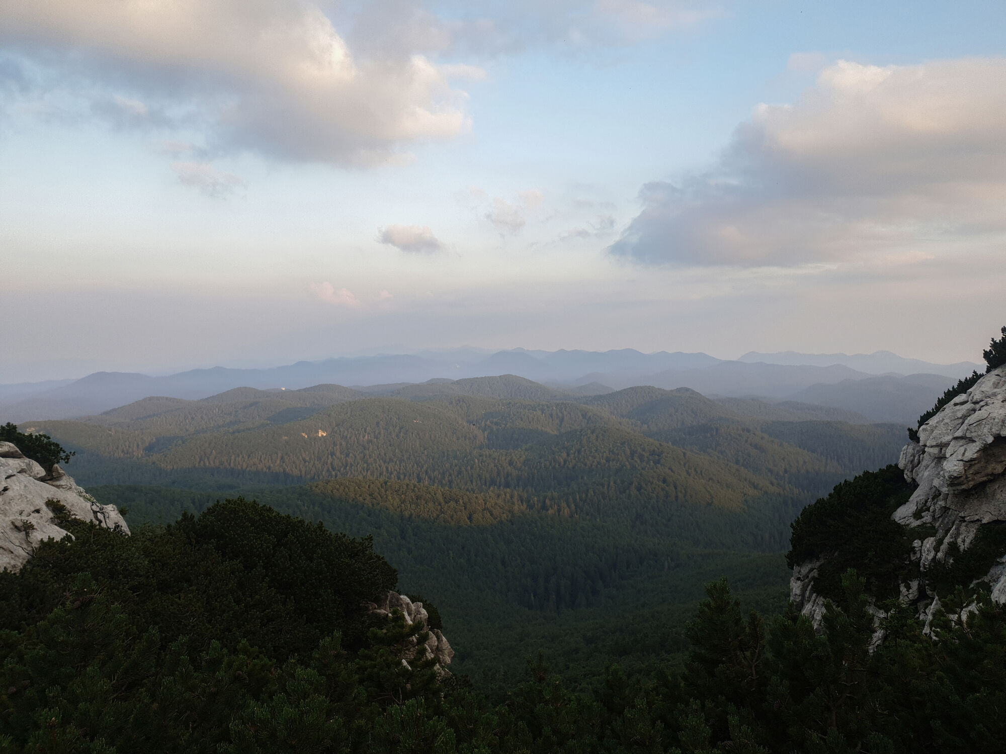
Profile: Hills, forests. Mount Snežnik is the highest mountain in a large area (80+ km) with great views.
Water: Be careful to take enough water, especially from Mašun (refill) to Snežnik and then to the Mercator store or Toni Bar near the border to refill.
Accommodation:
- Mašun Guesthouse and restaurant (very good, even serves bear meat)
- Planinski dom Snežnik (Mountain Hut Snežnik)
Important Notes:
- Mašun Restaurant is probably open every day except Tuesday. Great place for water and food (standard + wild animal meat, including bear).
- Mountain Hut Snežnik (staffed) may only be open on weekends during the low season and likely all the time in summer. If closed, there’s no cistern for water. If open, get water at the hut. Be mindful of water in this section!
- If the mountain hut is closed, there’s a very basic bivouac shelter for 2-3 people where you can sleep inside. The views from the top are amazing (highest mountain in an 80+ km radius), so it’s worth it!
Sights:
- Village of Mašun with a very good restaurant (standard + deer, wild boar, even bear meat)
- Views from Mount Snežnik
𝐒𝐞𝐜𝐭𝐢𝐨𝐧 𝟔: 𝐏𝐞𝐚𝐤 𝐒𝐧𝐞𝐳̌𝐧𝐢𝐤 (𝟏𝟕𝟗𝟔 𝐦) – 𝐕𝐢𝐥𝐥𝐚𝐠𝐞 𝐁𝐚𝐛𝐧𝐨 𝐏𝐨𝐥𝐣𝐞 (𝐄𝐧𝐝 𝐨𝐟 𝐒𝐥𝐨𝐯𝐞𝐧𝐢𝐚𝐧 𝐒𝐞𝐜𝐭𝐢𝐨𝐧) – 𝐏𝐫𝐞𝐳𝐢𝐝 (𝐒𝐭𝐚𝐫𝐭 𝐨𝐟 𝐂𝐫𝐨𝐚𝐭𝐢𝐚𝐧 𝐒𝐞𝐜𝐭𝐢𝐨𝐧)
Distance: 25 km
Profile: Hills, forests
Water: Be careful with water; the mountain hut at the top may be closed. You can get water later in the village (Babno Polje) at Toni Bar or the supermarket. There’s also a bar just at the start of the Croatian section.
𝐆𝐞𝐧𝐞𝐫𝐚𝐥 𝐈𝐧𝐟𝐨𝐫𝐦𝐚𝐭𝐢𝐨𝐧
- Total Distance for My Version of the Slovenian Section: About 139 km
- If passing through Ljubljana, it’s definitely worth seeing before starting the Via Dinarica. The fastest way to the starting point is via direct bus: Ljubljana AP – Razdrto.
- Water: In the Slovenian section, water is generally not a problem. While there aren’t many streams, you can still find good public water, buy it in supermarkets, or get it at mountain huts. It’s still good to carry 1.5–2 liters with you. The only section where there can be a problem with water is the last one – Mount Snežnik (1796 m). For that, you need more water. It’s possible to get it at Mašun along with something good to eat. You can also buy water at Mount Snežnik, but only if the mountain hut is open. If it’s not a weekend, it can be closed, so the next refill is near the border.
- Food: Not a problem; there are enough mountain huts, villages with restaurants, and supermarkets. In the Slovenian section, most supermarkets are open all day, except the last one in Stari Trg pri Ložu. But after the Slovenian section, in the first few days of the Croatian section, smaller supermarkets may only be open early for half a day, so plan accordingly. Restaurant Mašun offers deer, boar and bear meat.
- Ticks: If you walk through high grass or very dense vegetation then it is good ocasionaly to check out if something is crawling up. But this is rare in Slovenian section, because paths are well walked, marked. If you need place to stop, relax, then do not sit at grass, but sit in picnic place or bench (many of them). Generally not a lot of ticks, but still take some simple precautions and it is fine. It is not such a big deal or danger. In my experience some ticks in Slovenia and first week of Croatia until Senj and 1 day later. Then it is fine.
- Advice: I’d advise against taking shortcuts directly to Snežnik because you’ll miss some nice things, and the shortcut isn’t so nice. The .gpx trail I made should be good to get the most out of it. Postojna Cave (off the trail with a bus from Predjama castle) is worth visiting. The sections are more general, and it’s not necessary to sleep at the end of each one. Youth Hostel Ars Viva is probably a good choice before starting the ascent to Snežnik.
GPX trails, points
Useful Links
Bus Timetables
arriva.si/en/
Slovenian Railways Timetables
potniski.sz.si/en/timetable-finder/
Weather Forecast for Slovenia
vreme.arso.gov.si/napoved/Postojna/graf
Hiking Map for Slovenia (needs internet)
mapzs.pzs.si/home/trails
Gpx trails
Slovenian section via Dinarica .gpx trail:
drive.google.com/file/d/1LBVdA82kiz9e...
Slovenian section via Dinarica .gpx info poins, places of interests:
drive.google.com/file/d/1ux4BBlr3RdJe...
Enjoy your via Dinarica!
Alexander

Beliebte Touren in der Nähe
- 5,0
Slivnica
leichtWanderung7,25 km Herzweg Postojna
leichtThemenweg4,58 kmVia Dinarica Slowenien
schwerFernwanderweg159,9 kmDrvošec-Pfad
mittelWanderung4,57 kmThematic Path of Military History
mittelThemenweg12,6 kmThe Krpan Trail
schwerWanderung109,3 kmThe Great Krpan Trail
schwerFernwanderweg109,0 kmVia Dinarica
schwerFernwanderweg159,9 kmRazdrto - Velika Slivnica - Veliki Snežnik - Bukovica
mittelFernwanderweg174,1 kmNovokračine - Veliki Snežnik - Suhi vrh - Oltar
mittelFernwanderweg225,3 km

Wandern & Tracking


Verpasse keine Angebote und Inspirationen für deinen nächsten Urlaub
Deine E-Mail-Adresse wurde in den Verteiler eingetragen.