


Cammino delle Pievi della Carnia Stage 10 from Forni di Sopra to Sauris di Sotto


The walk starts from the main square of the village, crossing the bridge and following CAI trail marker 209 on a road and path inside a forest. After about two hours you reach the Malga dell'Aip hut and...
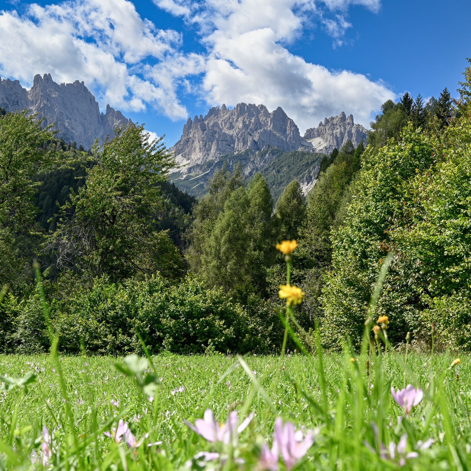
The walk starts from the main square of the village, crossing the bridge and following CAI trail marker 209 on a road and path inside a forest. After about two hours you reach the Malga dell'Aip hut and then Casera Tragonia, where you can eat and sleep in summer. From here you can enjoy a beautiful view of the Forni Dolomites.
The path with CAI marker 209 leads to Forcella della Croce di Tragonia, then down to Casera Mediana. Continue on a road that descends to the bridge over the Lumiei Stream and then climb up to Sauris di Sopra. You descend along a small road to the small church of San Lorenzo and continue on a road to Sauris di Sotto.
The stage can be divided into two days, with an overnight stay at Casera Tragonia. Or you can reduce the elevation gain by going up by chairlift from Forni di Sopra to Casera Varmost and then following the CAI 211 trail to Casera Tartoi. From here continue on cartroad, climbing left at the crossroads, to Casera Tragonia.

Ja
Ja
Beliebte Touren in der Nähe
- 4,5
Naturalistischer Spaziergang Tiziana Weiss
mittelWanderung9,23 km - 1,0
26 OLBE-SEEN von der Schutzhütte Monte Ferro - Sappada
schwerFernwanderweg3,41 km 25 OLBE-SEEN auf der Skipiste und Weg 135 - Sappada
schwerFernwanderweg4,70 kmDie vielfarbigen Glockentürme von M. Zauf
mittelWanderung14,2 kmRing der Colmajer-Kämme
mittelWanderung7,51 kmDie Berge Bivera und Clap Savon von Casera Razzo aus, alpine Fahrt
schwerWanderung20,5 kmUrtisiel und Canpuros, Wunder der Dolomiten
mittelWanderung13,5 km- 5,0
Monte Tuglia
mittelWanderung12,8 km Gnomendorf - blauer Pfad
leichtWanderung5,71 kmGnomendorf - Grüner Pfad
leichtWanderung4,46 km

Wandern & Tracking


Verpasse keine Angebote und Inspirationen für deinen nächsten Urlaub
Deine E-Mail-Adresse wurde in den Verteiler eingetragen.