Kanal Slovenia
mittel
Navigieren
Navigieren
Hol diese Tour auf dein Handy
Kanal Slovenia
mittel
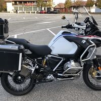
Motorrad
174,10
km
QR-Code scannen und Navigation in der bergfex App beginnen

Wandern & Tracking


Kanal Slovenia
mittel
Distanz
174,10
km
Dauer
03:39
h
Aufstieg
2.703
hm
Seehöhe
67 -
963
m
Track-Download
Kanal Slovenia
mittel
Motorrad
174,10
km


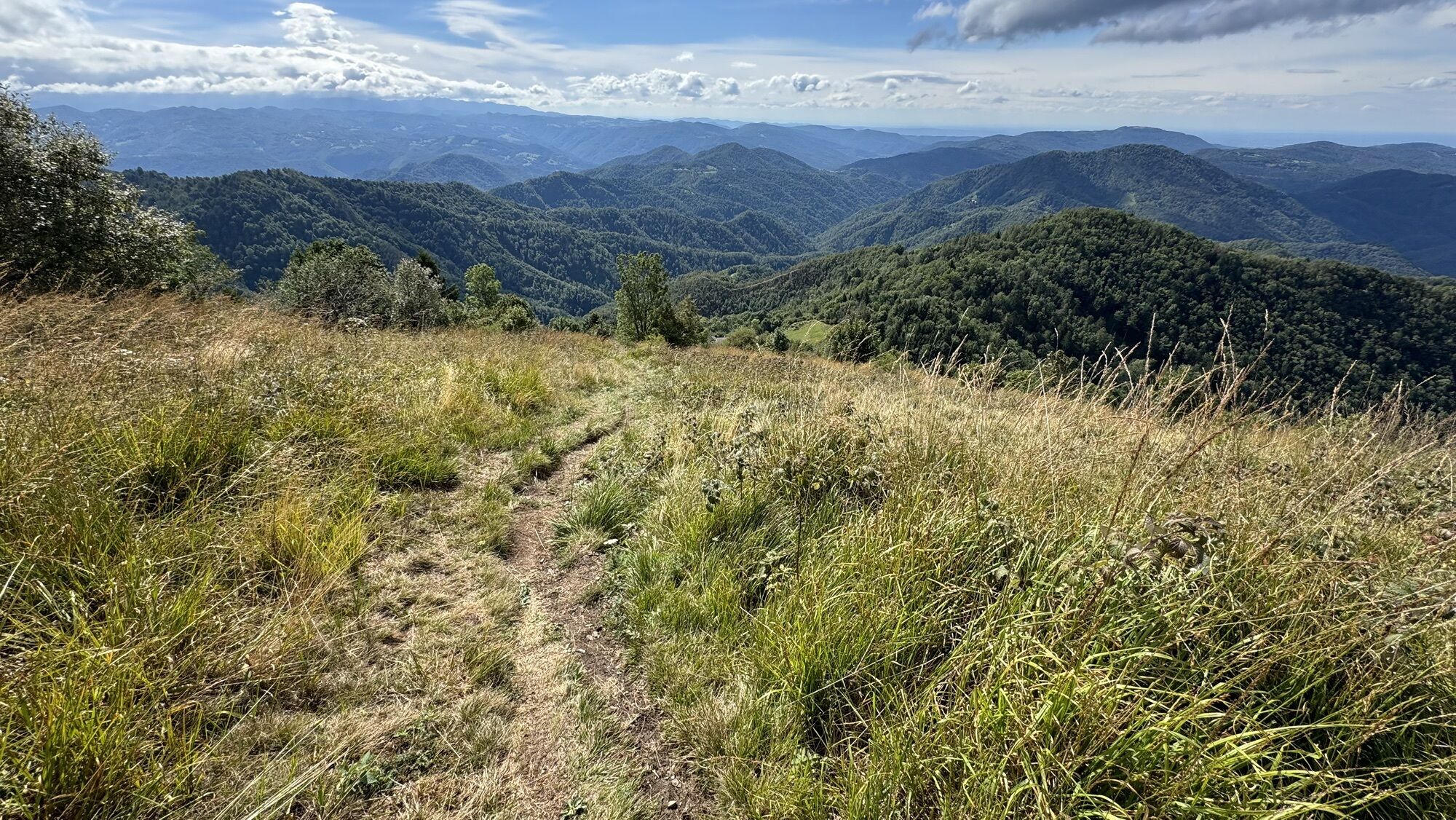
Wegverlauf
Chiesa di San Pietro
(142 m)
Andachtsstätte
12,2 km
Sv. Kancijan
(269 m)
Andachtsstätte
47,1 km
Sv. Ana
(105 m)
Andachtsstätte
60,3 km
Cerkev sv. Trojice
(703 m)
Andachtsstätte
93,3 km
Senica
(576 m)
Gipfel
104,9 km
Chiesa di San Giorgio Martire
(145 m)
Andachtsstätte
150,0 km
Chiesa di San Nicolò
(135 m)
Andachtsstätte
156,3 km
Wegverlauf
Kanal Slovenia
mittel
Motorrad
174,10
km
Nimis
(209 m)
Dorf
0,7 km
Qualso Nuovo
(186 m)
Flur/Gelände
4,0 km
Qualso
(190 m)
Dorf
4,7 km
Vergnacco
(168 m)
Dorf
6,3 km
Zompitta
(171 m)
Dorf
7,2 km
Cjase Minisìn
(167 m)
Siedlung
7,3 km
Savorgnano del Torre
(167 m)
Dorf
8,0 km
Ravosa
(148 m)
Dorf
11,2 km
Magredis
(142 m)
Dorf
12,2 km
Chiesa di San Pietro
(142 m)
Andachtsstätte
12,2 km
Bellazoia
(137 m)
Siedlung
13,6 km
Ronchis
(131 m)
Siedlung
15,3 km
Ziracco
(119 m)
Dorf
17,4 km
Case Marcolini
(116 m)
Stadtviertel
18,2 km
Case del Bivio
(117 m)
Stadtviertel
18,5 km
Moimacco
(117 m)
Dorf
21,9 km
Trattoria ai Colli di Spessa
(110 m)
Restaurant
30,1 km
Spessa Alta
(110 m)
Siedlung
30,2 km
Castagneto
(102 m)
Flur/Gelände
33,8 km
Prepotto / Prapotno
(107 m)
Dorf
35,2 km
Golo Brdo
(115 m)
Dorf
36,9 km
Cras / Kràs
(139 m)
Siedlung
38,8 km
Bodigoi / Búdgoji
(126 m)
Siedlung
39,2 km
Cosson / Košoni
(142 m)
Siedlung
41,4 km
Podresca / Podarskije
(215 m)
Siedlung
44,4 km
Valico Molino Vecchio
(211 m)
Flur/Gelände
46,6 km
Britof
(269 m)
Siedlung
47,1 km
Sv. Kancijan
(269 m)
Andachtsstätte
47,1 km
Malčina
(271 m)
Flur/Gelände
47,5 km
Filej
(340 m)
Siedlung
47,9 km
Strmec
(348 m)
Siedlung
48,2 km
Lig
(624 m)
Dorf
51,6 km
Čolnica
(485 m)
Dorf
54,4 km
Ravenca
(443 m)
Siedlung
55,3 km
Pečno
(156 m)
Siedlung
58,7 km
Gorenja vas
(247 m)
Dorf
59,4 km
Marija Vnebovzeta
(104 m)
Andachtsstätte
59,5 km
Kriznic
(105 m)
Restaurant
59,6 km
Kanalburg
(106 m)
Dorf
59,6 km
Sv. Ana
(105 m)
Andachtsstätte
60,3 km
Morsko
(151 m)
Dorf
60,7 km
Rodež
(131 m)
Siedlung
63,0 km
Anhovo
(103 m)
Dorf
63,7 km
Deskle
(98 m)
Dorf
64,9 km
Picerija Špik
(93 m)
Restaurant
65,0 km
Ložice
(103 m)
Dorf
65,8 km
Plave
(85 m)
Dorf
67,6 km
Gostilna pri Mostu
(88 m)
Restaurant
68,2 km
Ložice
(103 m)
Dorf
70,1 km
Deskle
(98 m)
Dorf
71,0 km
Anhovo
(103 m)
Dorf
71,8 km
Anhovo
(104 m)
Bahnhof
73,5 km
Robidni Breg
(129 m)
Siedlung
73,6 km
Krstenica
(127 m)
Siedlung
75,5 km
Morsko
(151 m)
Dorf
75,9 km
Gorenja vas
(247 m)
Dorf
76,8 km
Kanalburg
(106 m)
Dorf
77,5 km
Okrepčevalnica Pirih
(99 m)
Restaurant
77,8 km
Pečno
(156 m)
Siedlung
79,0 km
Ravenca
(443 m)
Siedlung
82,5 km
Čolnica
(485 m)
Dorf
83,5 km
Lig
(624 m)
Dorf
84,0 km
Kambreško
(535 m)
Dorf
90,2 km
Srednje
(703 m)
Siedlung
93,2 km
Cerkev sv. Trojice
(703 m)
Andachtsstätte
93,3 km
Pušno
(649 m)
Siedlung
94,3 km
Vogrinki
(648 m)
Siedlung
96,2 km
Kuščarji
(706 m)
Flur/Gelände
97,1 km
Sleme
(865 m)
Bergsattel
99,2 km
Solarji
(952 m)
Bergsattel
100,7 km
Senica
(576 m)
Gipfel
104,9 km
Volče
(199 m)
Dorf
109,1 km
Gostilna Jazbec
(211 m)
Restaurant
121,4 km
Karfreit
(236 m)
Dorf
122,7 km
Kaisersmühlen
(217 m)
Dorf
123,4 km
Gostilna Jazbec
(211 m)
Restaurant
123,8 km
Hidersch
(210 m)
Dorf
123,9 km
Libegg
(689 m)
Dorf
129,2 km
Valico di Polava
(588 m)
Flur/Gelände
131,1 km
Polava
(546 m)
Siedlung
132,2 km
Cepletischis / Čeplešišče
(566 m)
Dorf
132,9 km
Gabrovizza / Gabruca
(497 m)
Siedlung
133,6 km
Crisnaro / Kranjac
(217 m)
Siedlung
138,0 km
Savogna / Sauodnja
(243 m)
Dorf
138,5 km
Cedron
(193 m)
Siedlung
139,2 km
Cocevaro / Kočebar
(189 m)
Siedlung
140,4 km
Tarpezzo / Tarpeč
(168 m)
Siedlung
141,4 km
Clenia / Klenje
(167 m)
Siedlung
142,5 km
Azzida / Ažla
(165 m)
Dorf
144,1 km
Trattoria Pizzeria Le Valli
(149 m)
Restaurant
145,5 km
Ponte San Quirino / Muost
(131 m)
Siedlung
145,5 km
Trattoria al Giro di Boa
(139 m)
Restaurant
145,8 km
Vernasso / Barnas
(164 m)
Siedlung
147,0 km
Trattoria al Giro di Boa
(139 m)
Restaurant
148,4 km
Chiesa di San Giorgio Martire
(145 m)
Andachtsstätte
150,0 km
Birreria Pizzeria da Vincenzo
(144 m)
Restaurant
150,0 km
Frasca da Gianni
(144 m)
Restaurant
150,0 km
Sanguarzo
(145 m)
Dorf
150,0 km
Barbetta
(131 m)
Stadtviertel
152,0 km
Borgo San Domenico
(134 m)
Stadtviertel
152,3 km
Östrich
(134 m)
Stadt
152,3 km
Trattoria San Marco
(134 m)
Restaurant
153,7 km
Rubignacco
(132 m)
Siedlung
153,7 km
Chiesa di San Nicolò
(135 m)
Andachtsstätte
156,3 km
Trattoria al Passeggio
(134 m)
Restaurant
156,4 km
Togliano
(134 m)
Dorf
156,4 km
Borgo Pont'Ellero
(125 m)
Stadtviertel
158,9 km
Campeglio
(145 m)
Siedlung
159,4 km
Faedis
(164 m)
Dorf
162,6 km
Prosciutteria Martinuzzi
(176 m)
Restaurant
165,3 km
Racchiuso
(174 m)
Dorf
165,3 km
Trattoria La Baita
(175 m)
Restaurant
165,4 km
Attimis
(196 m)
Dorf
168,5 km
La Valanghe
(207 m)
Restaurant
172,0 km
Antica Osteria San Gervasio
(209 m)
Restaurant
172,0 km
Nimis
(209 m)
Dorf
172,7 km


Noch keine Bewertungen
Beliebte Touren in der Nähe
- 4,2
Kozjak Wasserfall und Soča
leichtWanderung5,18 km - 3,2
Slap Kozjak (Wasserfall)
leichtWanderung3,40 km - 4,0
Matajur
mittelMountainbike24,8 km - 4,0
Kolovrat
mittelMountainbike33,0 km - 5,0
JULIANA TRAIL: etappe 12 Tolmin – Kobarid
mittelWanderung17,3 km - 4,3
Wanderung zum Kozjak Wasserfall in Kobarid (Slowenien)
leichtWanderung4,90 km Ring des Berges Kolovrat
leichtWanderung7,51 km- 4,0
Matajur (1642 m) da Mersino
mittelWanderung10,2 km JULIANA TRAIL Etappe 18: Berghütte Pod Ježo – Korada
mittelWanderung20,7 kmJULIANA TRAIL Etappe 19: Korada – Šmartno
mittelWanderung11,4 km
Wandern & Tracking

Über 550.000 Tourenvorschläge, detailliertes Kartenmaterial und ein intuitiver Routenplaner machen die App zum Must-have für alle Naturbegeisterten.

Verpasse keine Angebote und Inspirationen für deinen nächsten Urlaub
Zum Newsletter anmelden
Fehler
Ein Fehler ist aufgetreten. Bitte versuche es erneut.Vielen Dank für deine Anmeldung
Deine E-Mail-Adresse wurde in den Verteiler eingetragen.
Touren in ganz Europa
Österreich Schweiz Deutschland Italien Slowenien Frankreich Niederlande Belgien Polen Liechtenstein Tschechien Slowakei Spanien Kroatien Bosnien und Herzegowina Luxemburg Andorra Portugal Island Vereinigtes Königreich Irland Griechenland Albanien Nordmazedonien Malta Norwegen Montenegro Moldau Kosovo Ungarn San Marino Rumänien Estland Lettland Belarus Zypern Litauen Serbien Bulgarien Monaco Dänemark Schweden Finnland