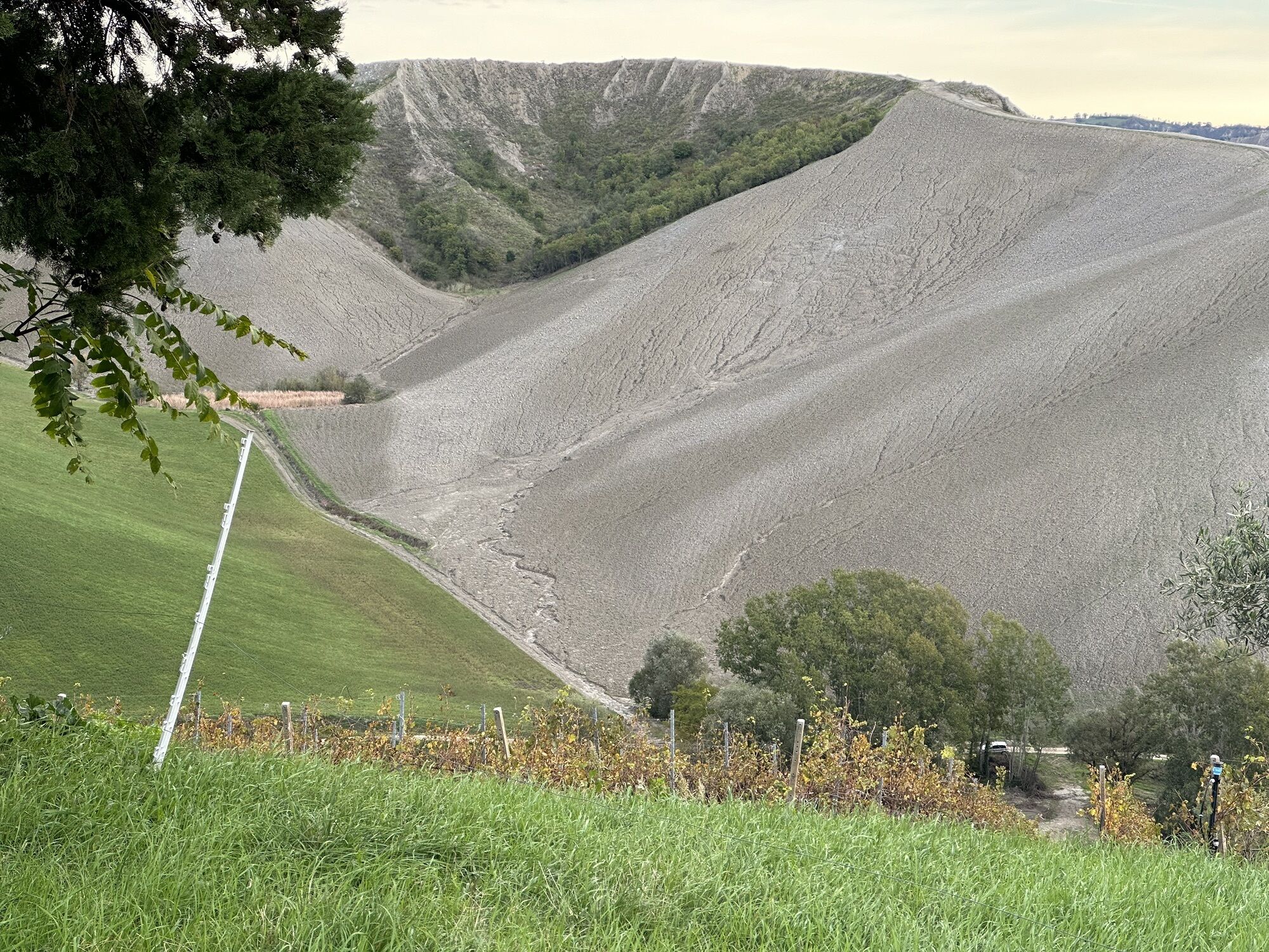
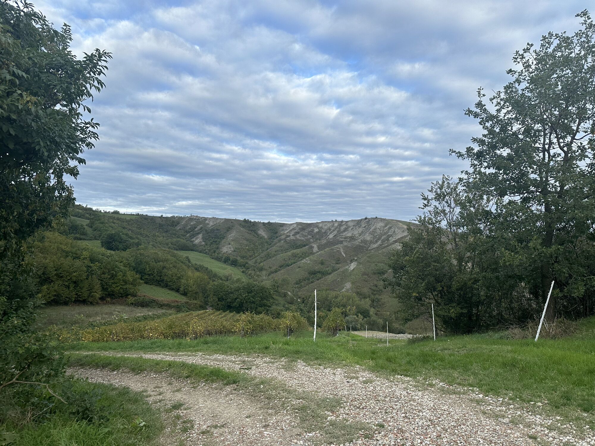
Castel Bolognese-Riolo Terme - Monte Querzola - Monte Ghebbio - Monte Mauro
schwer
Navigieren
Navigieren
Hol diese Tour auf dein Handy
Castel Bolognese-Riolo Terme - Monte Querzola - Monte Ghebbio - Monte Mauro
schwer
Mountainbike
47,97
km
QR-Code scannen und Navigation in der bergfex App beginnen

Wandern & Tracking


Castel Bolognese-Riolo Terme - Monte Querzola - Monte Ghebbio - Monte Mauro
schwer
Distanz
47,97
km
Dauer
04:50
h
Aufstieg
1.430
hm
Seehöhe
37 -
465
m
Track-Download
Castel Bolognese-Riolo Terme - Monte Querzola - Monte Ghebbio - Monte Mauro
schwer
Mountainbike
47,97
km


Wegverlauf
Chiesa della Nativita' Della Beata Vergine In Serra
(155 m)
Andachtsstätte
6,5 km
Col Pineta
(193 m)
Gipfel
6,8 km
Monte Querzola
(239 m)
Gipfel
8,2 km
Monte Ghebbio
(241 m)
Gipfel
9,8 km
Monte Mauro
(517 m)
Gipfel
22,0 km
Monte Ghebbio
(241 m)
Gipfel
38,2 km
Monte Querzola
(239 m)
Gipfel
39,7 km
Col Pineta
(193 m)
Gipfel
41,1 km
Wegverlauf
Castel Bolognese-Riolo Terme - Monte Querzola - Monte Ghebbio - Monte Mauro
schwer
Mountainbike
47,97
km
Castel Bolognese-Riolo Terme
(37 m)
Bahnhof
0,0 km
Castel Bolognese
(41 m)
Dorf
0,5 km
Chiesa di San Sebastiano
(43 m)
Andachtsstätte
1,3 km
Alberazzo - Canalvecchio
(46 m)
Siedlung
2,6 km
Imola
(47 m)
Stadt
4,9 km
Chiesa della Nativita' Della Beata Vergine In Serra
(155 m)
Andachtsstätte
6,5 km
La Serra
(157 m)
Siedlung
6,6 km
Monticino Serra
(154 m)
Restaurant
6,7 km
Col Pineta
(193 m)
Gipfel
6,8 km
Monte Querzola
(239 m)
Gipfel
8,2 km
Agriturismo La Querciola
(213 m)
Restaurant
8,5 km
Ossano
(201 m)
Siedlung
9,6 km
Monte Ghebbio
(241 m)
Gipfel
9,8 km
Riolo Terme
(97 m)
Dorf
14,1 km
La Villa
(275 m)
Siedlung
19,8 km
Abisso Ravenna
(321 m)
Höhleneingang
20,8 km
Ca' Castellina di Sopra
(338 m)
Flur/Gelände
20,8 km
Monte Mauro
(517 m)
Gipfel
22,0 km
Buca del Rampicante
(407 m)
Höhleneingang
22,4 km
Capanno Lucio Cavara
(414 m)
Schutzhütte (unbewirtschaftet)
22,6 km
Buco I a sud-ovest di Ca' Co' di Sasso
(202 m)
Höhleneingang
26,1 km
La Villa
(275 m)
Siedlung
30,2 km
Riolo Terme
(97 m)
Dorf
36,0 km
Da Mario Pizzeria
(108 m)
Restaurant
36,0 km
Monte Ghebbio
(241 m)
Gipfel
38,2 km
Ossano
(201 m)
Siedlung
38,4 km
Agriturismo La Querciola
(213 m)
Restaurant
39,4 km
Monte Querzola
(239 m)
Gipfel
39,7 km
Col Pineta
(193 m)
Gipfel
41,1 km
Monticino Serra
(154 m)
Restaurant
41,2 km
La Serra
(157 m)
Siedlung
41,3 km
Chiesa della Nativita' Della Beata Vergine In Serra
(155 m)
Andachtsstätte
41,3 km
Imola
(47 m)
Stadt
42,9 km
Alberazzo - Canalvecchio
(46 m)
Siedlung
45,2 km
Chiesa di San Sebastiano
(43 m)
Andachtsstätte
46,6 km
Castel Bolognese
(41 m)
Dorf
47,4 km
Castel Bolognese-Riolo Terme
(37 m)
Bahnhof
47,8 km
Noch keine Bewertungen
Beliebte Touren in der Nähe
Monte Battaglia Trails
mittelMountainbike21,1 kmTarvis
Pilgerweg1.067 kmMonte Incisa - Monte Mauro - Monte della Volpe - Brisighella
Wanderung11,2 kmMiren-Kostanjevica
Pilgerweg1.077 kmBrisighella - Monte Incisa - Monte Mauro - Abisso Ravenna
mittelWanderung12,0 kmCasola Valsenio - Monte Albano - Monte Frassineto - Locanda Cardello
schwerMountainbike43,0 kmChiesa di San Giovanni Battista - La Villa - Monte Mauro - Riolo Terme
mittelMountainbike22,3 kmRiolo Terme - La Villa - Monte Giornetto - Monte Albano
schwerMountainbike42,5 kmZattaglia - Monte della Volpe - Monte Casazza - Monte Besdone
schwerWanderung16,6 kmBrisighella - Monte Mauro - Monte Besdone - Monte di Rontana
schwerWanderung27,4 km

Wandern & Tracking

Über 550.000 Tourenvorschläge, detailliertes Kartenmaterial und ein intuitiver Routenplaner machen die App zum Must-have für alle Naturbegeisterten.

Verpasse keine Angebote und Inspirationen für deinen nächsten Urlaub
Zum Newsletter anmelden
Fehler
Ein Fehler ist aufgetreten. Bitte versuche es erneut.Vielen Dank für deine Anmeldung
Deine E-Mail-Adresse wurde in den Verteiler eingetragen.
Touren in ganz Europa
Österreich Schweiz Deutschland Italien Slowenien Frankreich Niederlande Belgien Polen Liechtenstein Tschechien Slowakei Spanien Kroatien Bosnien und Herzegowina Luxemburg Andorra Portugal Island Vereinigtes Königreich Irland Griechenland Albanien Nordmazedonien Malta Norwegen Montenegro Moldau Kosovo Ungarn San Marino Rumänien Estland Lettland Belarus Zypern Litauen Serbien Bulgarien Monaco Dänemark Schweden Finnland