


Traces of the salmon and the beaver - across borders


Get to know the Rhine in all its facets! Experience his tributaries Wiese and Kander, the charming cities of Basel, Huningue and Weil as well as several natural reserves like the Rhine Island on your round...
Get to know the Rhine in all its facets! Experience his tributaries Wiese and Kander, the charming cities of Basel, Huningue and Weil as well as several natural reserves like the Rhine Island on your round trip across the “Dreiländereck”. On your way you’ll meet a plethora of fascinating species in diverse habitats. Come along and discover true gems of nature in places you never expected!
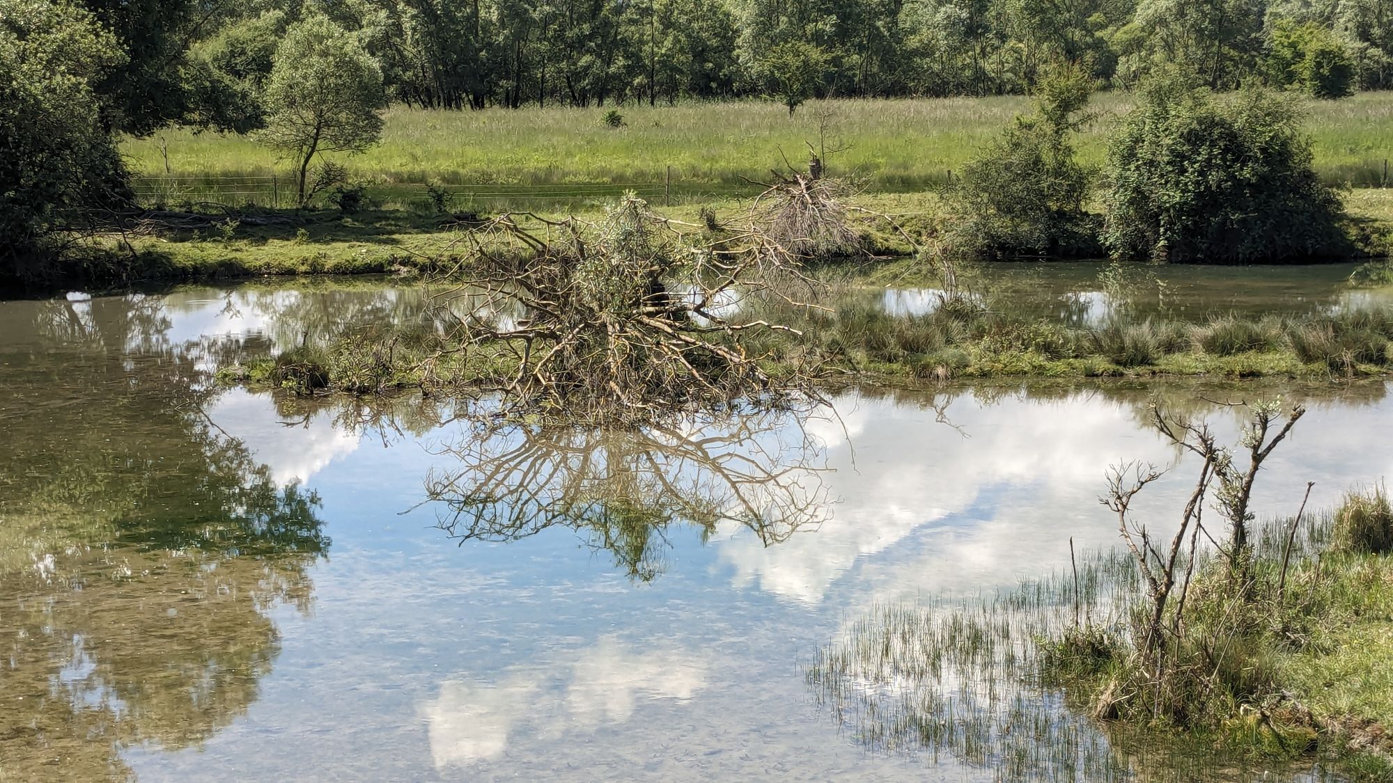
A total of eleven stops are set up alongside the route to teach you everything there is to know about the big river and two of his native inhabitants the beaver and the salmon. The extensive floodplains of the Rhine in its original state used to be an ideal home for the busy dam building beaver and the swift swimming salmon. This changed dramatically throughout the 19th Century due to the regulation of the stream and intensive hunting done by humans. For the longest time both beaver and salmon were considered to be extinct in the Upper Rhine region. However recent efforts like the installation of fish passes as well as widespread restauration and reintroduction programs pathed the way for a comeback of our little furry and scaly friends. Witness at first hand the attempts to enable the return of the once vanished beaver and salmon to the Rhine and learn how coexistence of humans and animals can be made possible. An exciting and memorable tour for all lovers of cycling, nature and animals!
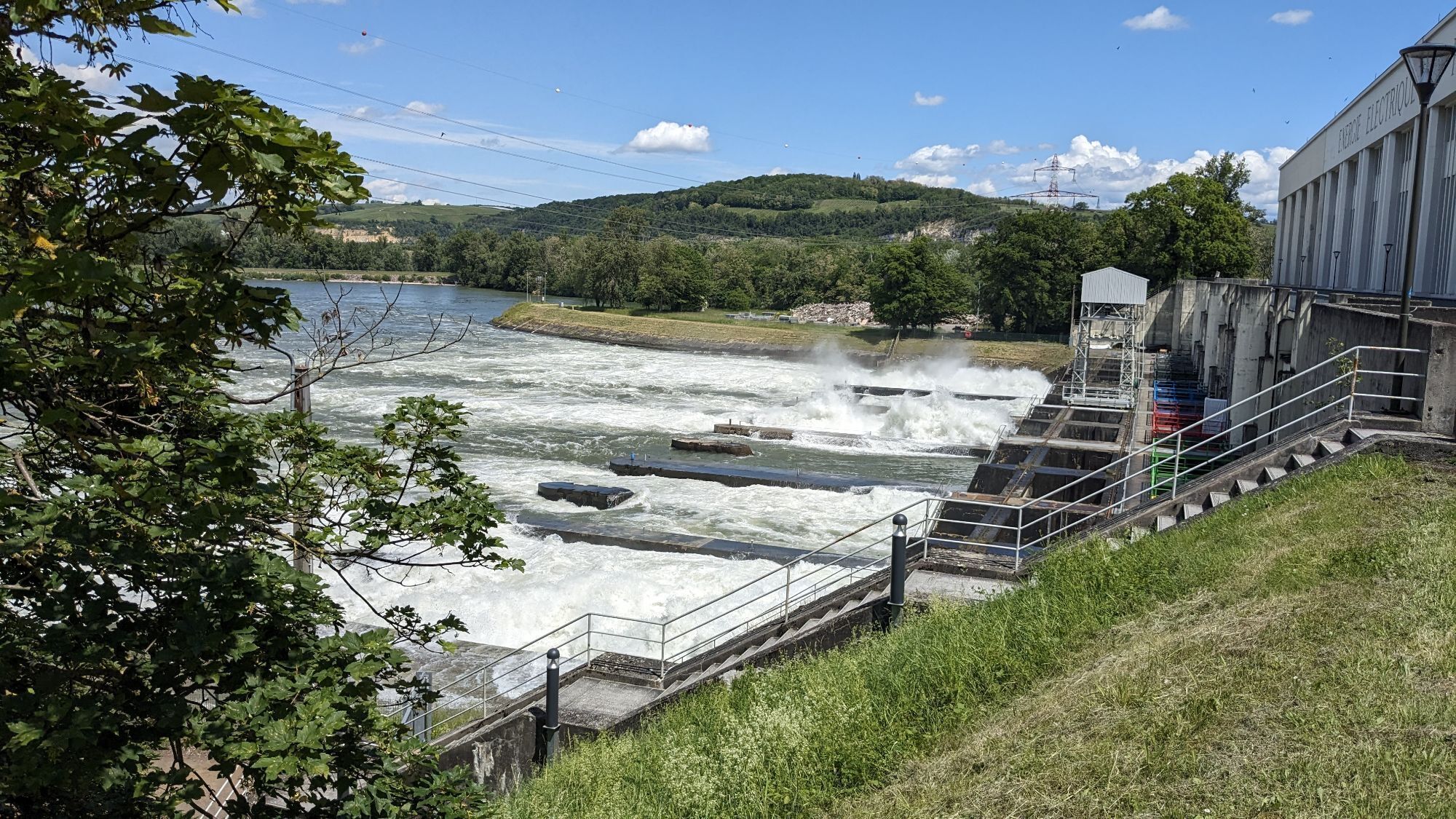
You can start at any point of the tour and go in either direction. The tour takes you along the Rhine through the city of Basel. It passes the mouth of the river Birs and crosses the dam of the hydraulic plant of Birsfelden. Continue through the landscape park Wiese and across the border into Weil am Rhein in Germany. After leaving Weil the tour goes alongside the border of the nature reserve Krebsbachtal and through the towns Haltingen and Eimeldingen. After following the small river Kander for a little bit, you’ll once again arrive at the Rhine and the dam of Märkt. Cross the dam to reach the Rhine Island. Here simply follow the cycling tracks until you get to the hydraulic plant of Kembs which allows you to go across the Grand Canal d'Alsace and into France. While continuing alongside the Canal de Huningue, you’ll pass the old Lock House which marks the entrance to the nature reserve Petit Carmague Alsacienne. At the end of the canal the tour reaches the Rhine for its third and last time in Huningue. From here just follow the river for a short while to get back to Basel.
There are plenty ofplaces to take a rest and get something to eat and drink alongside the route. For example at the dam of Märkt and in the cities of Basel, Weil, Huningue and Saint Louis. Besides that you’ll find several spots with benches for breaks during the tour.
The tour can easily be reached by car and by train. Possible starting points include:
Thetrain stations on the German side “Weil am Rhein“ and „Haltingen“ are recommended.
From “Weil am Rhein” cross the bridge and turn right into “Lustgartenstraße” to reach the route.
The station “Haltingen” is directly located on the route The Swiss stations “Basel SBB” and “Basel Badischer Bahnhof” aren’t far from the track either. They also provide access to long-distance trains.
From “Basel SBB” head north across the station square and through “De-Wette Park” into “Elisabethenstraße”. At the junction take a right into “St Alban-Graben” and continue until you reach the bridge “Wettsteinbrücke” at the Rhine and can start your tour from there.
On the eastside of the tracks at “Basel Badischer Bahnhof” head towards the junction “Egliseestraße”/”Im Surinam” which is part of the route and start your tour from there.
– The parking lot at the dam of “Märkt”:
leave the freeway A5 at the exit “Weil/Hüningen” and follow “Alte Straße” to the parking lot and start your tour from there.
– The parking lot at the lock hosue “Maison éclusière” at “Rue de Canal” on the french side of the border right next to the stop “Petit Camargue Alsacienne”.
The “beaver and salmon company without borders! “Is a tri-national bike tour supported by the European Regional Development Fund (ERDF) and the Swiss Regional Development Fund (NRP) within the framework of the INTERREG Upper Rhine program.
The project is at home here: www.natur-erlebnis.org
Responsible: Trinational environmental center TRUZ / CTE e.V.Cross-border nature conservation department
Mattrain 1
D-79576 Weil am Rhein
Phone: +49 7621/1614971
eMail: nature@truz.org
Website: www.truz-naturschutz.org
There are two local associations of the Black Forest Association that are members of the TRUZ and we carry out nature conservation campaigns together.
Beliebte Touren in der Nähe
- 4,7
Wolfsschlucht
leichtWanderung6,19 km - 1,0
Isteiner Klotz - Huttlingen
mittelWanderung8,67 km Fernsehturm Chrischona Riehen, Basel-Stadt
leichtWanderung13,5 kmDreiland Radregion - Zwischen Natur und Kultur
schwerFernradweg209,5 kmEntlang des Schlipf
leichtWanderung4,89 kmDer Interregio-Weg: Drei Länder, ein Weg
schwerFernwanderweg215,9 km- 1,0
Grenzüberschreitend Altweil - Riehen Weil am Rhein, Deutschland
leichtWanderung7,47 km Kleiner Dreiland-Radweg - Ein Ragweg am Wasser für die ganze Familie
leichtRadfahren40,5 kmAltweil - Bettingen , Deutschland / Schweiz
leichtWanderung9,40 kmLange Erlen
leichtNordic Walking9,66 km

Wandern & Tracking


Verpasse keine Angebote und Inspirationen für deinen nächsten Urlaub
Deine E-Mail-Adresse wurde in den Verteiler eingetragen.