


Balade à pied dans la plaine de Bessans


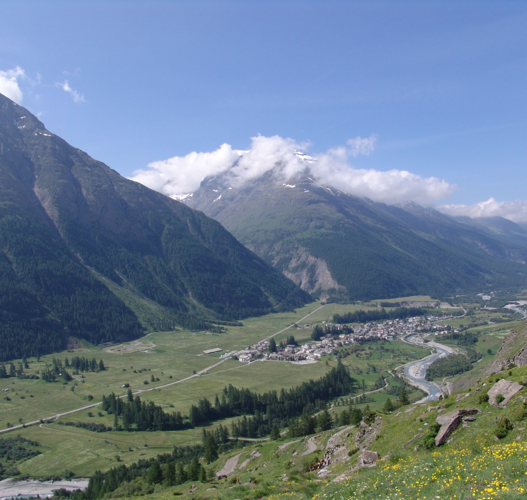
Are you ready to faithfully follow the Arc river?
On your way along the Chemin du Petit Bonheur, you're sure to want to stop
for a family picnic. Get yourself comfortably settled at a banquet table... It...
Are you ready to faithfully follow the Arc river?
On your way along the Chemin du Petit Bonheur, you're sure to want to stop
for a family picnic. Get yourself comfortably settled at a banquet table... It
seems to have been waiting for your "gnia"* to stop here for a feast.
Under the watchful eye of the imposing Tierce peak, you continue your
journey through the heart of the meadows. Can you see its chapel, perched
at 2,973 meters?
And, with your gaze forever glued to the landscape, it takes just a few seconds
before you spot the breathtaking waterfalls on the south side. Unrestrained,
they cascade down from the glaciers of Vallonbrun and Gefret at the heart
of the Vanoise National Park. In early summer, you won't be able to take
your eyes away from the sight.
Then, in the forest of Chantelouve, you might come across some squirrels,
fearful at the passage of adventurous mountain bikers.
Before you get to the village, Le Ribon invites you to new hikes. Next time,
that's a promise…

To guide you in the field, consult the "step-by-step" directional diagram provided in pdf.
APIDAE Tourismusdaten aktualisiert am 27/07/2022 von "Communauté de communes Haute Maurienne Vanoise".
Haben Sie einen Fehler entdeckt? Schreiben Sie an den Besitzer mit folgenden Hinweisen:
Dateiname: La Plaine de Bessans | Identifikationsnummer dieser Seite: 5048470 | URL (Link) für diese Outdooractive-Seite.
Beliebte Touren in der Nähe
Le Lac Blanc
leichtWanderung4,42 kmRadfahren auf den Col du Mont-Cenis von Lanslebourg aus
schwerRennrad9,84 kmCol du Mont-Cenis von Modane aus
schwerRennrad34,8 kmCol de l'Iseran depuis Termignon
schwerRennrad38,3 km- 5,0
Goldtoni - Alpenbogen A068 Refuge de la Leisse-Termignon Val Cenis
mittelFernwanderweg28,7 km - 5,0
Arnas - Pian della Mussa Ring
schwerWanderung13,6 km Col du Petit Mont-Cenis
schwerRennrad18,0 km- 5,0
Le Lac du Grand Méan en passant par le cirque des Evettes
schwerWanderung13,6 km Bessans Jadis et Aujourd'hui
leichtThemenweg1,74 kmPetite Haute Mauriennaise
schwerRennrad32,0 km
Wandern & Tracking


Verpasse keine Angebote und Inspirationen für deinen nächsten Urlaub
Deine E-Mail-Adresse wurde in den Verteiler eingetragen.