Randonnée sur la Voie du Tacot
schwer
Navigieren
Navigieren
Hol diese Tour auf dein Handy
Randonnée sur la Voie du Tacot
schwer
Themenweg
76,95
km
QR-Code scannen und Navigation in der bergfex App beginnen

Wandern & Tracking


Randonnée sur la Voie du Tacot
schwer
Distanz
76,95
km
Dauer
07:30
h
Aufstieg
624
hm
Seehöhe
175 -
436
m
Track-Download
Randonnée sur la Voie du Tacot
schwer
Themenweg
76,95
km


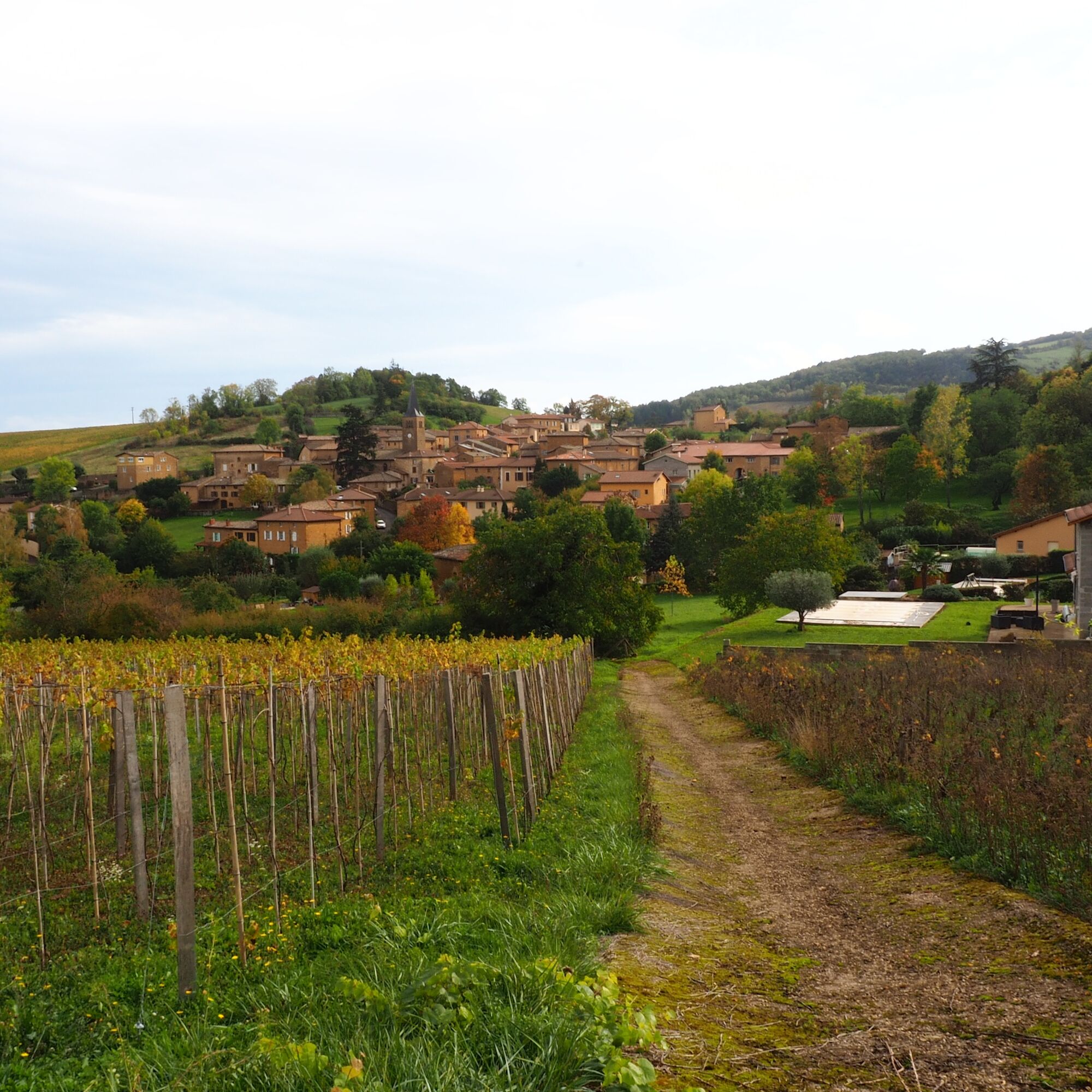
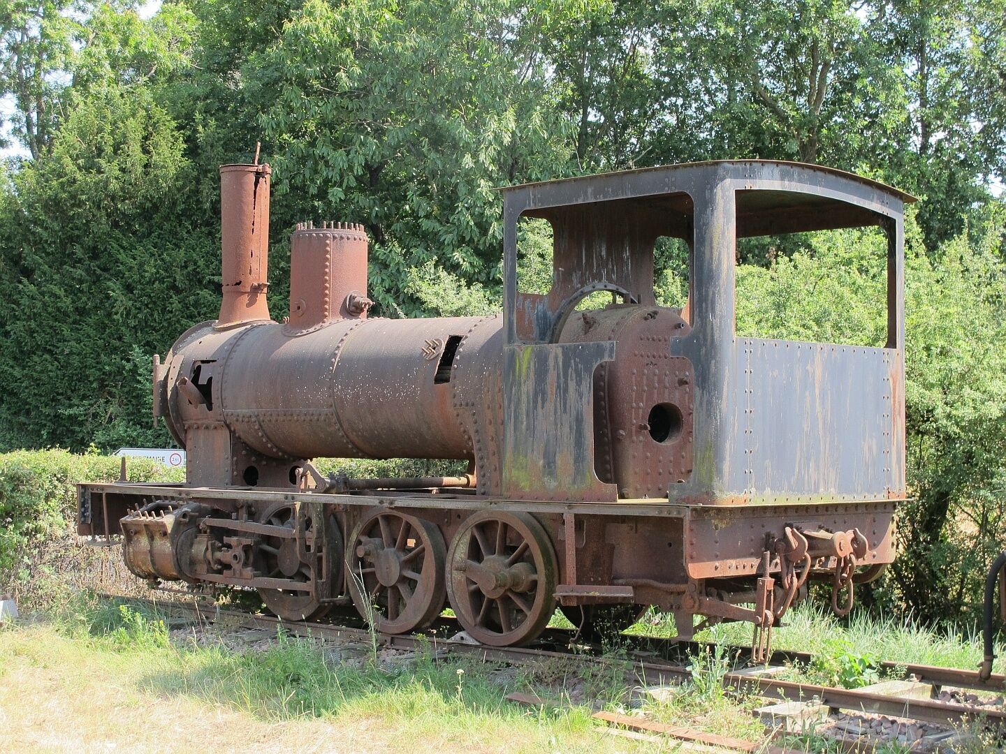
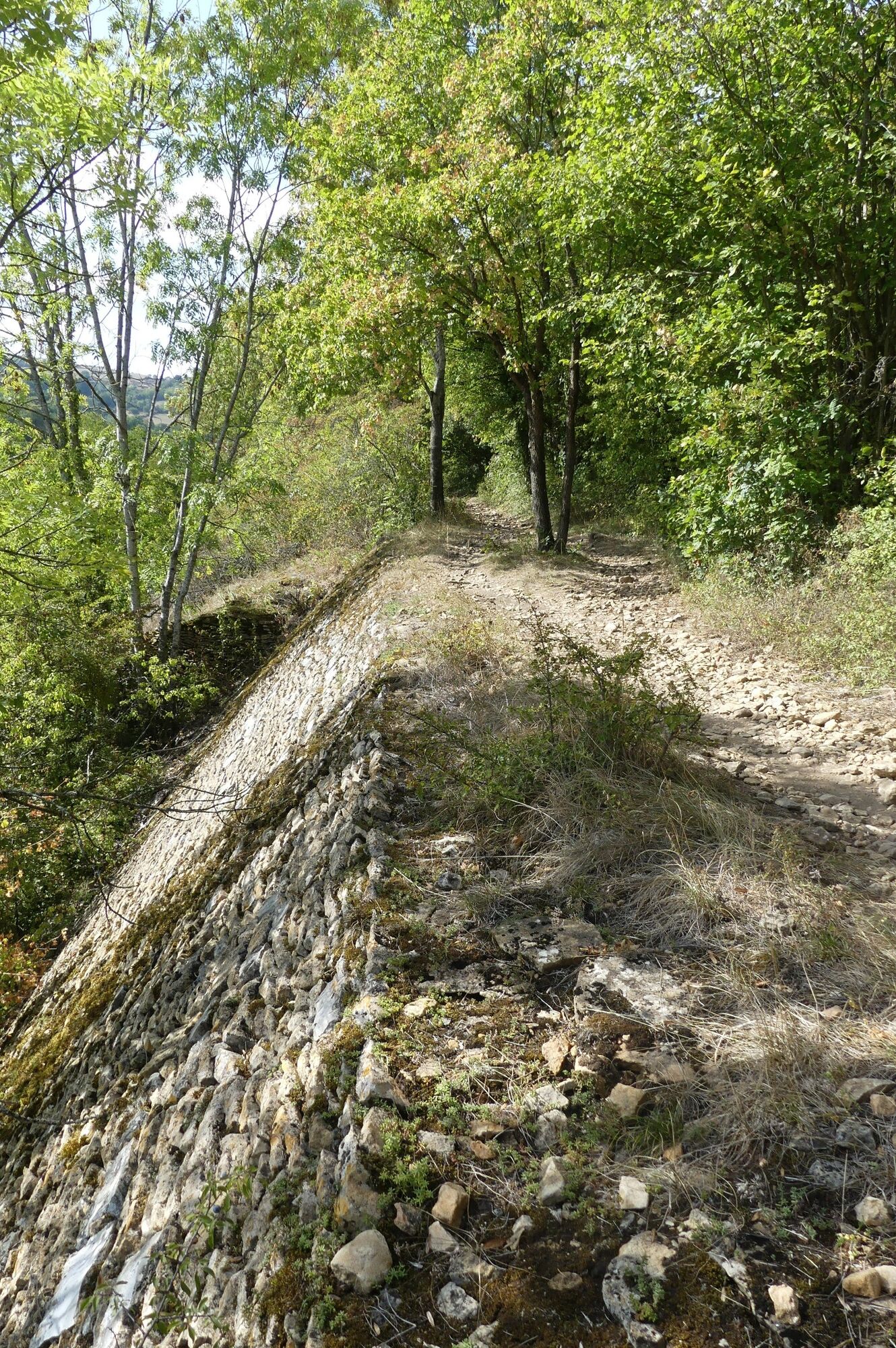
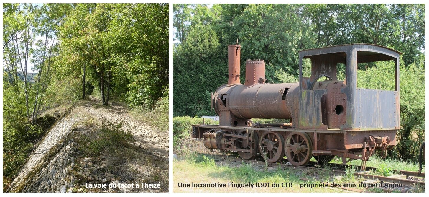
The Beaujolais Railway operated from 1901 to 1935 and connected Villefranche to Tarare. This section of the Voie du Tacot has been restructured into a 24 km route starting from Liergues. It passes through...
Beschreibung
The Beaujolais Railway operated from 1901 to 1935 and connected Villefranche to Tarare. This section of the Voie du Tacot has been restructured into a 24 km route starting from Liergues. It passes through the villages of Pouilly le Monial, Jarnioux (remarkable viaduct), Ville sur Jarnioux, Theizé, Le Bois d'Oingt, Légny to finally reach Liergues. It is possible to travel in both directions from the different villages it passes through.
Wegverlauf
Belleville-en-Beaujolais
(174 m)
Stadt
0,0 km
Montmay
(269 m)
Siedlung
16,4 km
Chapelle Sainte-Agathe
(197 m)
Andachtsstätte
40,9 km
Villefranche-sur-Saône
(182 m)
Stadt
43,1 km
Pouilly-le-Monial
(277 m)
Dorf
50,3 km
La Croix de Mission
(403 m)
Siedlung
58,1 km
Saint-Paul
(300 m)
Siedlung
64,9 km
Wegverlauf
Randonnée sur la Voie du Tacot
schwer
Themenweg
76,95
km
Belleville-en-Beaujolais
(174 m)
Stadt
0,0 km
Balmont
(179 m)
Stadtviertel
0,5 km
Saint-Jean-d'Ardières
(183 m)
Dorf
1,4 km
Point Vélo Saint-Jean d’Ardières
(194 m)
Flur/Gelände
3,0 km
Les Granges
(199 m)
Siedlung
3,5 km
Bergeron
(217 m)
Flur/Gelände
6,1 km
Bergeron
(224 m)
Siedlung
6,4 km
Cercié
(226 m)
Dorf
6,7 km
La Glacière
(242 m)
Siedlung
7,4 km
Saint-Vincent
(257 m)
Siedlung
9,9 km
La Chevalière
(297 m)
Stadtviertel
14,1 km
Revolon
(285 m)
Siedlung
14,5 km
Montmay
(269 m)
Siedlung
16,4 km
Les Samsons
(259 m)
Siedlung
19,4 km
Les Balloquets
(302 m)
Siedlung
20,9 km
Odenas
(296 m)
Dorf
23,8 km
La Jonchère
(288 m)
Stadtviertel
24,8 km
Le Fourque
(298 m)
Siedlung
25,3 km
Maisons Neuves
(276 m)
Stadtviertel
26,2 km
Esprit Beaujolais
(269 m)
Restaurant
26,6 km
Saint-Étienne-des-Oullières
(270 m)
Dorf
26,7 km
Les Oullières
(271 m)
Stadtviertel
26,9 km
La Cristale
(281 m)
Stadtviertel
27,5 km
Milly
(267 m)
Siedlung
27,8 km
Le Fond d'Arbuissonnas
(263 m)
Flur/Gelände
30,1 km
Arbuissonnas
(285 m)
Dorf
30,3 km
Salles
(311 m)
Dorf
31,6 km
Berne
(303 m)
Siedlung
33,0 km
Blacé
(303 m)
Dorf
33,7 km
Saint-Julien
(245 m)
Dorf
34,8 km
Église Saint-Julien
(244 m)
Andachtsstätte
35,0 km
La Croix Marpaux
(251 m)
Stadtviertel
35,4 km
Chambély
(225 m)
Siedlung
36,6 km
Grange Perret
(212 m)
Siedlung
38,7 km
Joutecrot
(206 m)
Siedlung
39,3 km
Chapelle Sainte-Agathe
(197 m)
Andachtsstätte
40,9 km
Villefranche-sur-Saône
(182 m)
Stadt
43,1 km
La Claire
(186 m)
Stadtviertel
44,4 km
Le Grand Moulin
(188 m)
Stadtviertel
44,4 km
Belleroche
(218 m)
Stadtviertel
45,1 km
Sotizon
(192 m)
Stadtviertel
45,2 km
Chervinges
(228 m)
Dorf
46,7 km
Ronzière
(219 m)
Siedlung
47,1 km
La Combe
(212 m)
Siedlung
47,5 km
Chalier
(232 m)
Siedlung
47,9 km
Le Moulin
(229 m)
Siedlung
48,7 km
Liergues
(247 m)
Dorf
48,8 km
Au-Delà de l'Eau
(247 m)
Stadtviertel
50,0 km
Pouilly-le-Monial
(277 m)
Dorf
50,3 km
Givrais
(270 m)
Siedlung
50,7 km
Graveton
(293 m)
Stadtviertel
51,0 km
Jarnioux
(292 m)
Dorf
51,6 km
La Creuse
(341 m)
Stadtviertel
51,8 km
La Chanal
(317 m)
Siedlung
52,3 km
La Penière
(347 m)
Siedlung
52,9 km
Cosset
(409 m)
Siedlung
53,0 km
Le Vivier
(421 m)
Stadtviertel
55,2 km
La Croix Chervet
(423 m)
Siedlung
55,5 km
Ville-sur-Jarnioux
(407 m)
Dorf
55,5 km
Bonave
(426 m)
Siedlung
56,1 km
La Croix de Mission
(403 m)
Siedlung
58,1 km
Theizé
(458 m)
Dorf
58,5 km
Le Laurent
(386 m)
Siedlung
58,7 km
Le Guéret
(388 m)
Stadtviertel
59,2 km
Frontenas
(368 m)
Dorf
60,5 km
Rongefert
(417 m)
Flur/Gelände
60,7 km
Moiré
(452 m)
Dorf
61,2 km
Lanfert
(419 m)
Siedlung
61,5 km
Thalebard
(417 m)
Siedlung
61,6 km
Boucairon
(371 m)
Siedlung
62,5 km
Les Tourrières
(351 m)
Stadtviertel
64,0 km
Le Bois-d'Oingt
(354 m)
Dorf
64,3 km
Saint-Paul
(300 m)
Siedlung
64,9 km
Saint-Paul
(298 m)
Siedlung
65,4 km
Légny
(320 m)
Dorf
65,8 km
Margand
(289 m)
Siedlung
66,1 km
Pont-Nizy
(244 m)
Siedlung
66,4 km
Varina
(264 m)
Stadtviertel
66,6 km
Les Ponts Tarrets
(242 m)
Siedlung
67,3 km
Les Landes
(306 m)
Siedlung
69,7 km
Les Roches
(341 m)
Siedlung
71,2 km
Sarcey
(366 m)
Dorf
72,0 km
Le Marais
(336 m)
Stadtviertel
74,4 km
Autor
Bereitgestellt von Rhône Tourisme
Die Tour Randonnée sur la Voie du Tacot wird von outdooractive.com bereitgestellt.

Noch keine Bewertungen
Beliebte Touren in der Nähe
La forêt de la Cantinière - Beaujolais - Saint-Cyr-le-Châtoux
leichtWanderung11,3 kmDe l’Aze à l’Ergues - Beaujolais Vert - Claveisolles
leichtWanderung13,0 kmDer Wald von Flachère - Beaujolais - Légny
leichtWanderung6,68 kmVon Oingt zum Col du Châtoux - Beaujolais - Oingt - Val d'Oingt
schwerWanderung15,1 kmThe forest of Brou - Beaujolais - Dième
leichtNordic Walking10,5 kmLes pierres dorées - Entre Pierres Dorées et Val d’Azergues - Boucle 7.4
schwerRennrad57,6 kmLes pierres dorées - Le tour des Pierres Dorées - Boucle 7.3
schwerRennrad45,6 kmThe Cantinière forest
leichtThemenweg2,96 kmPorte des Pierres Dorées - Beaujolais - Jarnioux
leichtWanderung14,8 kmDer Mont Brouilly, zwischen Weinbergen und Kultur - Beaujolais - Saint-Lager
leichtWanderung7,47 km
Wandern & Tracking

Über 550.000 Tourenvorschläge, detailliertes Kartenmaterial und ein intuitiver Routenplaner machen die App zum Must-have für alle Naturbegeisterten.

Verpasse keine Angebote und Inspirationen für deinen nächsten Urlaub
Zum Newsletter anmelden
Fehler
Ein Fehler ist aufgetreten. Bitte versuche es erneut.Vielen Dank für deine Anmeldung
Deine E-Mail-Adresse wurde in den Verteiler eingetragen.
Touren in ganz Europa
Österreich Schweiz Deutschland Italien Slowenien Frankreich Niederlande Belgien Polen Liechtenstein Tschechien Slowakei Spanien Kroatien Bosnien und Herzegowina Luxemburg Andorra Portugal Island Vereinigtes Königreich Irland Griechenland Albanien Nordmazedonien Malta Norwegen Montenegro Moldau Kosovo Ungarn San Marino Rumänien Estland Lettland Belarus Zypern Litauen Serbien Bulgarien Monaco Dänemark Schweden Finnland