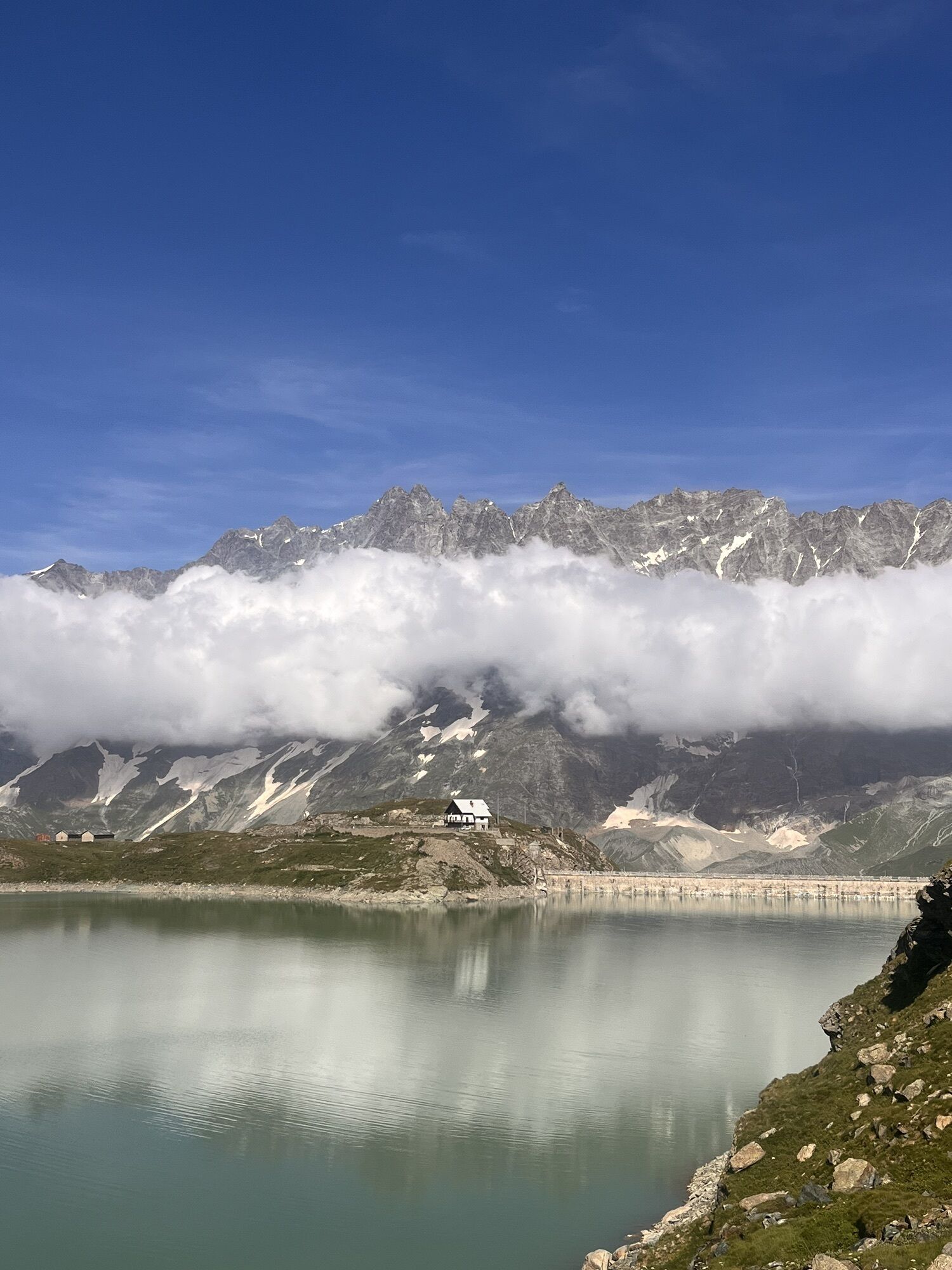
Matterhorn Ultratrail 55 k
schwer
Navigieren
Navigieren
Hol diese Tour auf dein Handy
Matterhorn Ultratrail 55 k
schwer
Wanderung
50,72
km
QR-Code scannen und Navigation in der bergfex App beginnen

Wandern & Tracking


Matterhorn Ultratrail 55 k
schwer
Distanz
50,72
km
Dauer
21:36
h
Aufstieg
2.938
hm
Seehöhe
1.494 -
2.968
m
Track-Download
Matterhorn Ultratrail 55 k
schwer
Wanderung
50,72
km


Wegverlauf
Chiesa della Regina della Valle
(2.004 m)
Andachtsstätte
0,0 km
Bec Pio Merlo
(2.620 m)
Gipfel
7,0 km
San Pietro
(1.847 m)
Andachtsstätte
17,2 km
Rifugio L'Ermitage
(1.922 m)
Schutzhütte
22,1 km
Punta Fontana Fredda
(2.513 m)
Gipfel
25,8 km
Colle Inferiore delle Cime Bianche
(2.896 m)
Bergsattel
39,7 km
Chiesa della Regina della Valle
(2.004 m)
Andachtsstätte
50,7 km
Wegverlauf
Matterhorn Ultratrail 55 k
schwer
Wanderung
50,72
km
Chiesa della Regina della Valle
(2.004 m)
Andachtsstätte
0,0 km
Le Breuil - Cervinia
(2.050 m)
Dorf
0,0 km
Hotel Chalet Valdôtain
(1.977 m)
Restaurant
1,8 km
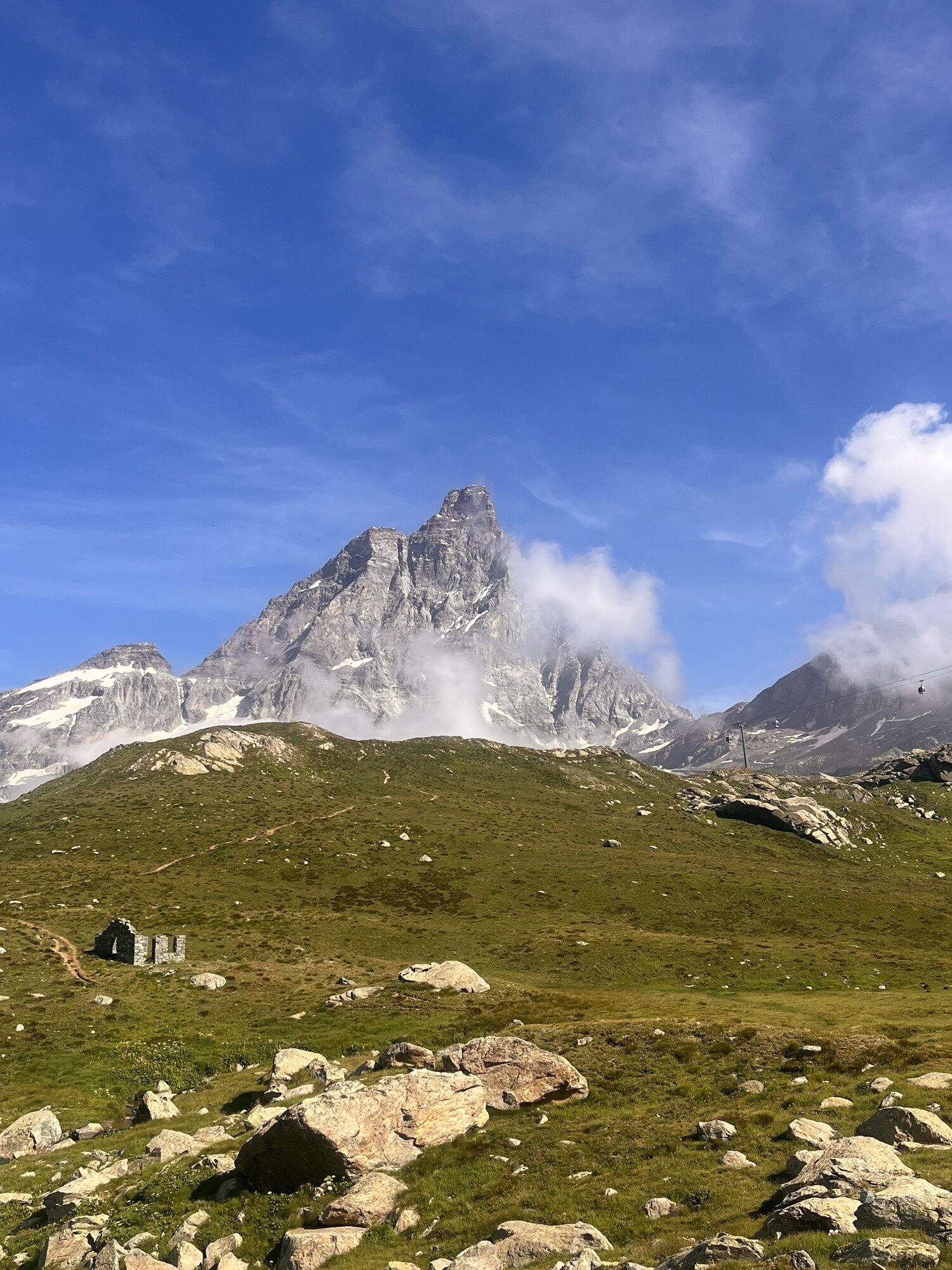
View Cervino/Matterhorn
(1.985 m)
Aussichtspunkt
1,9 km
Cervino e Lago di Layet
(2.012 m)
Aussichtspunkt
2,5 km
Layet
(2.040 m)
Restaurant
2,7 km
Cervino e Grandes Murailles
(2.094 m)
Aussichtspunkt
3,2 km
Belvedere sul Cervino
(2.176 m)
Aussichtspunkt
3,6 km
Belvedere sul fondo valle, Grandes Murailles e Cervino
(2.249 m)
Aussichtspunkt
4,4 km
Bec Pio Merlo
(2.620 m)
Gipfel
7,0 km
Manda Desot
(2.108 m)
Siedlung
12,0 km
Loz
(1.662 m)
Dorf
13,6 km
Pessey Inferiore
(1.750 m)
Siedlung
14,1 km
Pessey Superiore
(1.763 m)
Dorf
14,4 km
Losanche
(1.647 m)
Dorf
14,9 km
Cheperon
(1.651 m)
Dorf
15,4 km
Bringaz
(1.706 m)
Dorf
15,4 km
Le Baraquien
(1.837 m)
Restaurant
15,6 km
Champleve
(1.854 m)
Siedlung
15,9 km
San Pietro
(1.847 m)
Andachtsstätte
17,2 km
Croux
(1.702 m)
Siedlung
17,8 km
Montaz-Dessous
(1.434 m)
Dorf
18,3 km
Montaz-Dessus
(1.461 m)
Dorf
18,3 km
Servaz
(1.486 m)
Siedlung
18,6 km
Maisonnasse
(1.335 m)
Dorf
19,1 km
Belvedere
(1.568 m)
Siedlung
19,6 km
Pessey Inferiore
(1.540 m)
Siedlung
19,7 km
Duerche
(1.308 m)
Dorf
20,6 km
Belvedere
(1.927 m)
Aussichtspunkt
21,6 km
Rifugio L'Ermitage
(1.922 m)
Schutzhütte
22,1 km
Lavoré
(1.912 m)
Siedlung
22,2 km
Lieussel
(1.845 m)
Siedlung
22,4 km
Corgnolaz
(1.821 m)
Siedlung
22,7 km
L'Assetat
(1.922 m)
Siedlung
23,2 km
Le Lod
(2.020 m)
Siedlung
23,6 km
Baita Fontana Freida
(2.020 m)
Restaurant
23,6 km
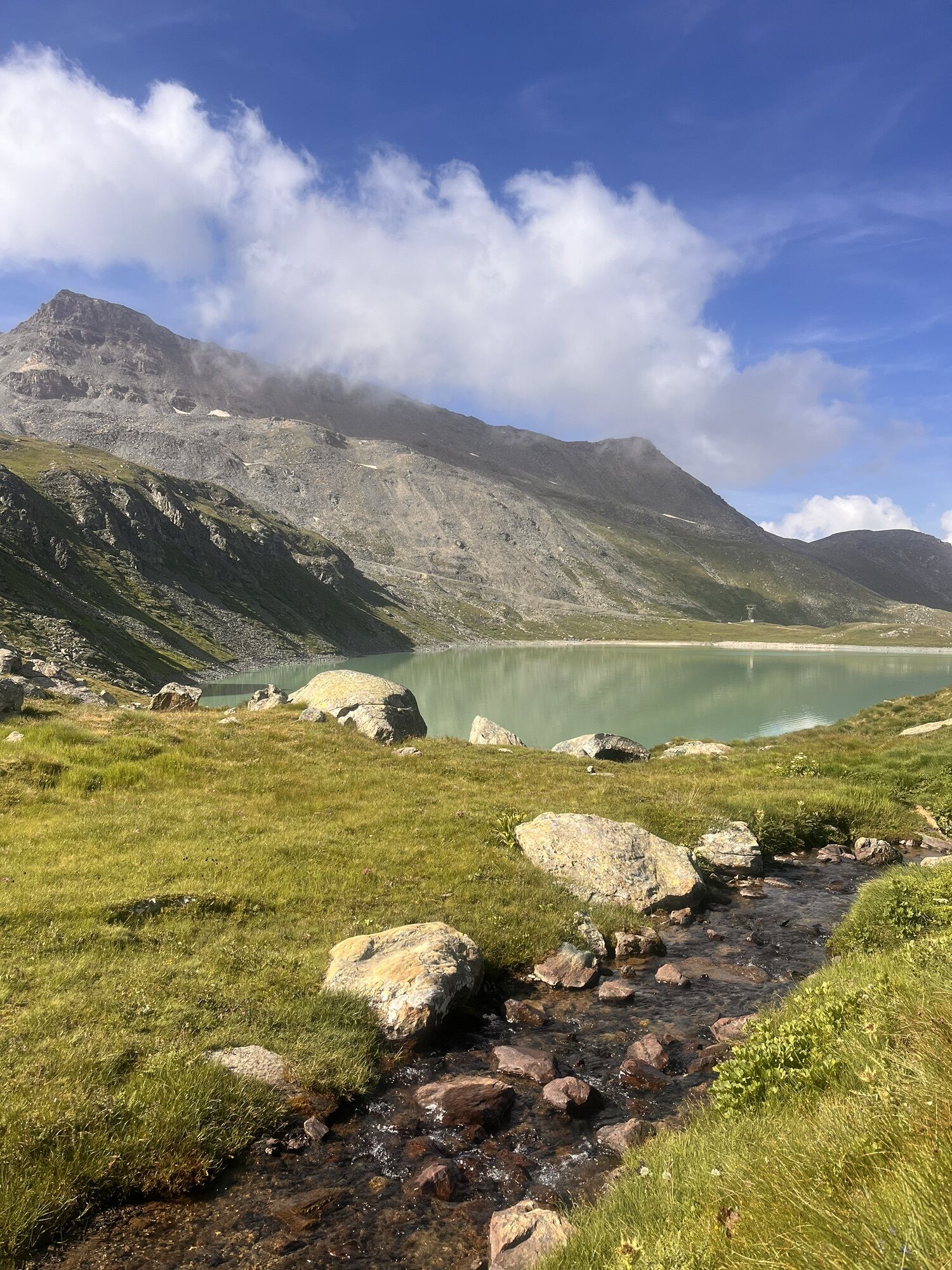
Lago Lod
(2.019 m)
Gondelstation
23,6 km
da Bruna Bar Ristorante
(2.021 m)
Restaurant
23,7 km
Bar del Lago
(2.025 m)
Restaurant
23,7 km
Belvedere Lago Lod e fondo valle
(2.066 m)
Aussichtspunkt
23,8 km
Belvedere Valtournenche
(2.348 m)
Aussichtspunkt
25,0 km
Punta Fontana Fredda
(2.513 m)
Gipfel
25,8 km
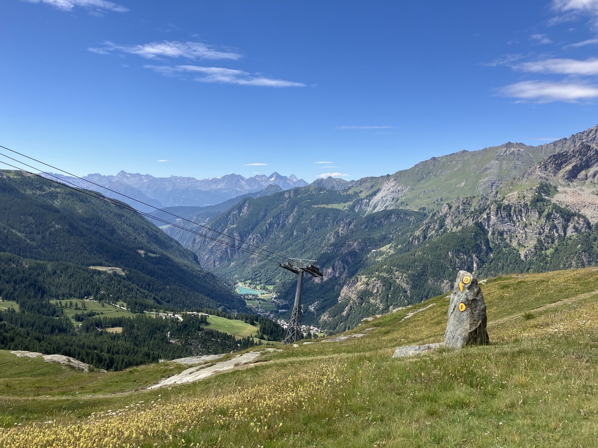
Falinère
(2.494 m)
Gondelstation
26,5 km
Santuario di Clavalité
(2.519 m)
Andachtsstätte
26,6 km
Champ Tsec
(2.336 m)
Siedlung
30,5 km
Cheneil
(2.105 m)
Dorf
32,0 km
Belvedere sulla Conca di Cheneil
(2.269 m)
Aussichtspunkt
33,1 km
Belvedere sul fondo valle, Grandes Murailles e Cervino
(2.359 m)
Aussichtspunkt
34,8 km
Illaz Perron
(2.241 m)
Siedlung
36,3 km
Gran Plan
(2.512 m)
Flur/Gelände
38,1 km
Colle Inferiore delle Cime Bianche
(2.896 m)
Bergsattel
39,7 km
Du Col
(2.893 m)
Gondelstation
39,8 km
Du Col
(2.858 m)
Gondelstation
40,1 km
Laghi Cime Bianche
(2.812 m)
Flur/Gelände
42,8 km
Tuk Tu
(2.540 m)
Restaurant
46,4 km
Plan Maison
(2.555 m)
Gondelstation
46,4 km
Pian Torrette
(2.105 m)
Flur/Gelände
49,0 km
Batse
(2.171 m)
Siedlung
49,5 km
Cappella degli Alpini
(2.131 m)
Andachtsstätte
49,6 km
Cretaz
(2.064 m)
Siedlung
50,0 km
Le Breuil - Cervinia
(2.050 m)
Dorf
50,6 km
Chiesa della Regina della Valle
(2.004 m)
Andachtsstätte
50,7 km

Noch keine Bewertungen
Webcams der Tour
-
Antagnod - Pian Pera
-
Matterhorn Glacier Paradise
-
Antagnod
-
Valtournenche - Veduta da Salette
-
Chamois - La Piazzetta
-
Chamois - Altiporto
-
Plan Maison
-
La Magdeleine - Comune
-
Seggiovia Goillet
-
Seggiovia Goillet
-
Seggiovia Goillet
-
Seggiovia Goillet
-
Seggiovia Goillet
-
Seggiovia Goillet
-
Seggiovia Goillet
-
Cervinia - Bardoney
Beliebte Touren in der Nähe
-
4,8
Zermatt Hörnlihütte
mittelWanderung 4,12 km -
5,0
Trockerner Steg nach Matterhorn (Hornlihütte)
leichtHochtour 12,2 km -
4,6
Schwarzsee - Schwarzsee paradise - Hörnlihütte
schwerWanderung 4,40 km -
4,8
Klein Matterhorn - P3824 - Breithorn Occidentale / Westgipfel
mittelHochtour 5,53 km -
Cervinia Rif. D'Abruzzi und Gletscherseen
mittelE-MTB 32,3 km -
Riffelalp - Gornergrat
mittelWanderung 6,22 km -
4,5
Quintino Sella al Felik 16 08 22
mittelWanderung 4,42 km -
Schwarzsee - Schwarzsee paradise - Hörnlihütte - Matterhorn
schwerHochtour 6,48 km -
5,0
Trail Running sulle 3 vette oltre i 3000m
schwerTrailrunning 16,7 km -
Saint Evence
leichtWanderung 5,70 km

Wandern & Tracking

Über 550.000 Tourenvorschläge, detailliertes Kartenmaterial und ein intuitiver Routenplaner machen die App zum Must-have für alle Naturbegeisterten.

Verpasse keine Angebote und Inspirationen für deinen nächsten Urlaub
Zum Newsletter anmelden
Fehler
Ein Fehler ist aufgetreten. Bitte versuche es erneut.
Vielen Dank für deine Anmeldung
Deine E-Mail-Adresse wurde in den Verteiler eingetragen.
Touren in ganz Europa
Österreich
Schweiz
Deutschland
Italien
Slowenien
Frankreich
Niederlande
Belgien
Polen
Liechtenstein
Tschechien
Slowakei
Spanien
Kroatien
Bosnien und Herzegowina
Luxemburg
Andorra
Portugal
Island
Vereinigtes Königreich
Irland
Griechenland
Albanien
Nordmazedonien
Malta
Norwegen
Montenegro
Moldau
Kosovo
Ungarn
San Marino
Rumänien
Estland
Lettland
Belarus
Zypern
Litauen
Serbien
Bulgarien
Monaco
Dänemark
Schweden
Finnland